Suzanna drove me back out to Unicoi Gap to get back on the trail. There were van loads of hikers unloading when we got there. It took us 5.8 miles to catch up to them since we stayed around at the gap taking pictures of Blue Blaze beer cans. Blue Blaze is an AT themed brewery in west Charlotte, it’s actually where Kelly and I met.
We hiked 2.7 miles, up and over Rocky Mountain to Indian Grave Gap. From there we hiked up Tray Mountain and started back down and stopped at Tray Mountain Shelter, for an additional 3.2 miles and 1,300 feet!
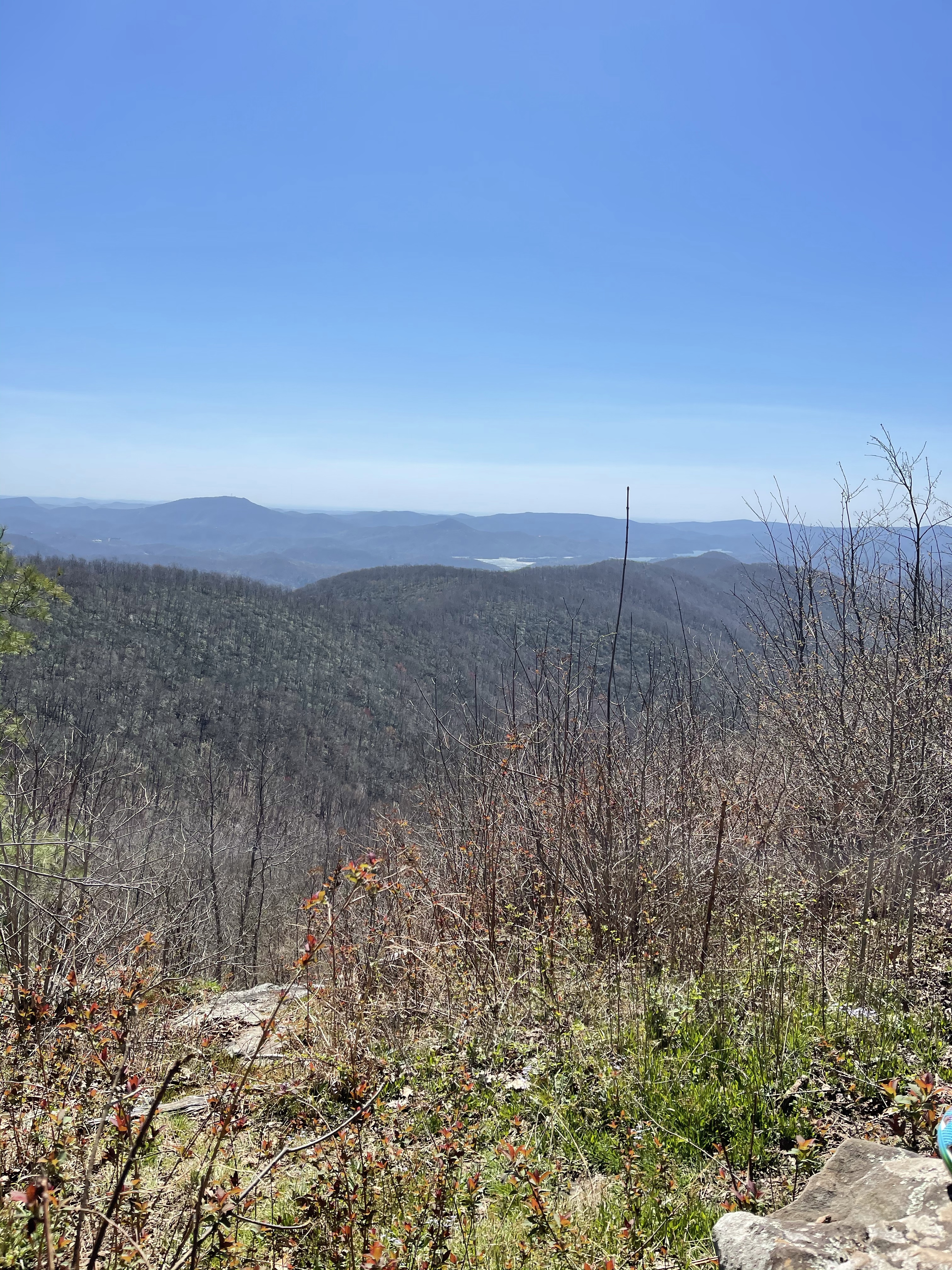
There were several amazing views along the way.
Next we hiked up and over Tray Mountain, a 1.8 mile journey up 600 feet and down 1,200 feet! In hiking, uphills wreck havoc on the thighs, butt, and claves. What the uphills don’t get on the legs, the downhills do! Then we went up and down, up and over for the next three miles to Sassafras Gap! Here we set up camp, ate and waited for the sun to go down before calling it a night.
Life on the Appalachian trail is wonderful, it, for the most part, runs north to south and therefore, every evening and every morning has its sunsets and sunrises!
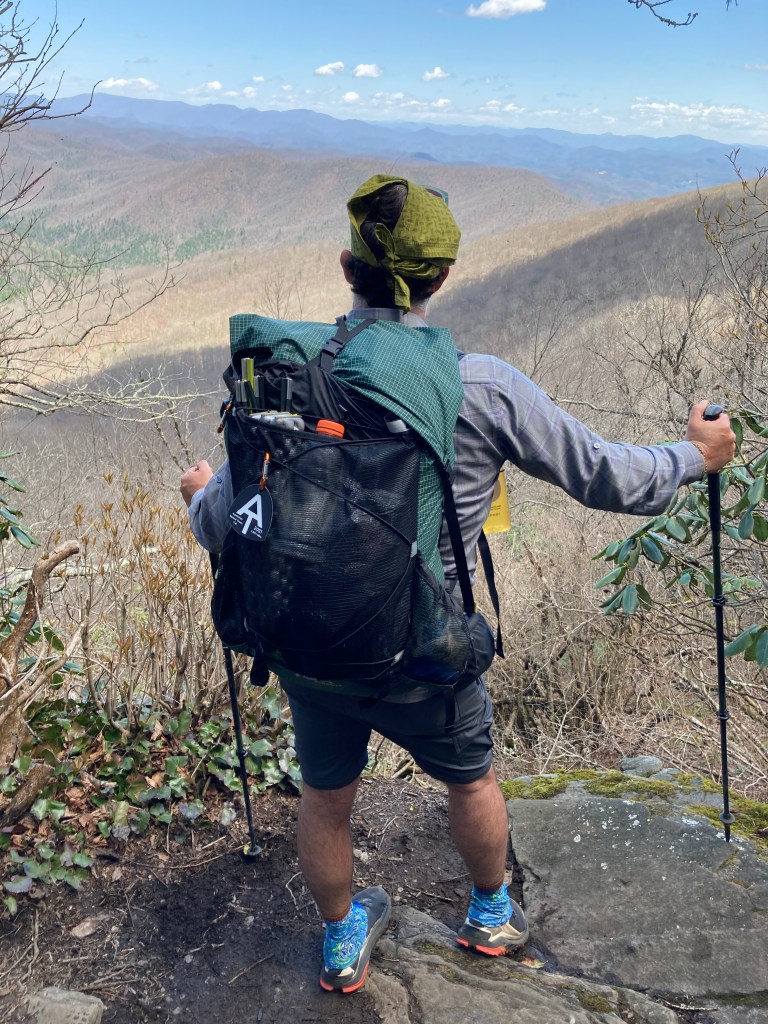
Today as the first time that my feet started hurting. It feels like with ever step I take my feet stretch. Not sure if it’s planter fasciitis or just stress of walking 8-10 miles per day. I have rolled it with my cork ball after diner and will see how the 6.4 miles feels tomorrow.
AT Thru-Hike, Day 8
Slept horrible last night! Not sure if it was because I was in a bed the three nights previous or what!
We left Sassafras Gap headed for Dicks Creek Gap, a 6.3 mile hike for the day, from mile 62.9 to mile 69.2. We ascended 1,577 feet, and descended 2,351 feet, the total grade was 615 feet per mile.
It was not the toughest of days but it was a lot like life, up and down!!
The first climb, basically right after getting out of bed, was up Kelly Knob, (4,144 feet) and it was 800 feet in .9 miles.
One thing I try hard to do when I’m hiking is to not stop mid climb, now obviously if it’s 2 miles of climb, that’s different! I like to make the climb and the enjoy the reward, the view, well, and some water!
From this beautiful view, we headed down the mountain to check out the Deep Gap Shelter (3,454 feet), where we sat for a few minutes and used the privy. 🙂 Way better than digging a 6 inch cat hole! :-0
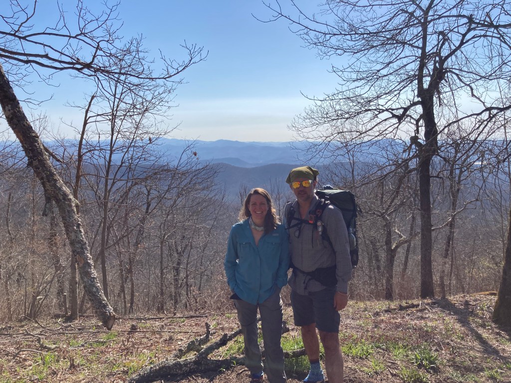
We continued up and down the trail to Powell Mountain Vista (3,886 feet), what an amazing view!!
North we went, for 3 plus miles to Dicks Creek Gap (2,654 feet). Here we waited for George and Sherrie Warren, my stepmoms dad and stepmom to pick us up. We rode into Clayton, Ga. with them to stay at their house, and while there they loaned us Charlie’s (the lab) car, it’s the car he can ride in, hahah and we went into town to Outdoor76 and grab some Mexican food. We went into Walgreens to get some stuff for Kelly and I checked to see if they had any no show COVID-19, and they did, so I got my second vaccine! I’m not a vaccine guy but being out here with all of these people and going into all these towns, I thought it best to go ahead and get it.
AT Thru-Hike Day 9
Dicks Creek Gap (2,654 feet) Mile 69.2 to Mile 81, Muskrat Shelter ( 4,567 feet) we ascended 4,251 feet and descended 2,364 feet!
We had originally planned to only go about 8.5 miles, but when we were almost to that gap, someone told us there was Nora Virus in the water and we wanted nothing to do with that!
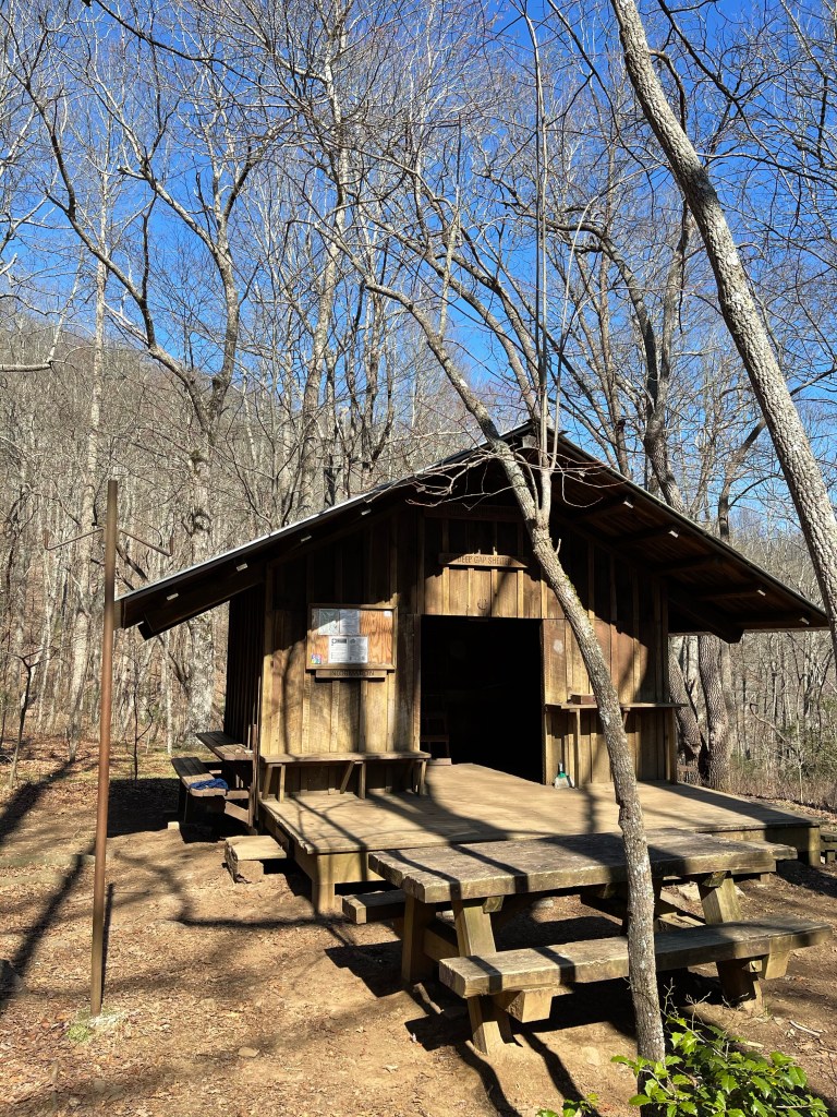
We stopped in after hiking 4.5 miles we stopped at Plumorchard Shelter (3,008 feet). It was a super cool shelter with three levels! There was a sign on the wall that showed a shelter being lowered in by helicopter and we assumed that is how it got there.
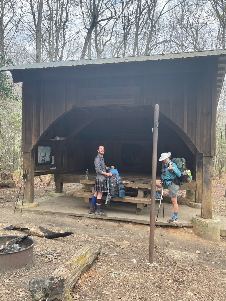
When we walked up to the shelter, we were greeted by the most loving, giant dog!! His name is Diesel, his mom isn’t sure, but I think he is a wolf dog!

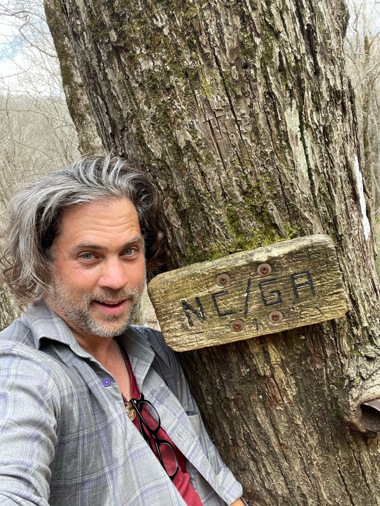
From plumorchard we made our way to the North Carolina/ Georgia border (3,885 feet). We were in need of water, I finished off 5.5 liters, and we were climbing up the side of Sharp Top Mountain and saw some folks standing around, we got excited it was water, but it wasn’t water, it was NC!!
From here, the plan was to hike to Bly Gap Shelter (3,820 feet), and this is where the supposed case of the Nora Virus came from. We changed our plan and hiked on to Muskrat creek Shelter (4,567 feet), mile 81.0. This added 1,443.6 feet to our ascension!!
We hung at the shelter and set up our kitchen, cooked our dinner, ate, and then headed back to the tent to lay down.
Laying down, it was cloudy, waking up it was bright sunny blue skies.
