Locust Grove Gap (3651 feet) mile 147.4 to Cable Gap Shelter (2883 feet) mile 159.2 for a 11.8 mile day. We ascended 2,503 feet and descended 3,280 feet for a total grade of 503 feet per mile.
Today was an up and down day, literally! We went up and then we went down into Stecoah Gap and then started back up again, and this back up again is where the wheels started shaking! Hiked a nice little stroll up hill but it was really not that steep, it was a long gradual climb, roughly 385 feet in .7 miles and then down 111 feet to Sweetwater Gap. The walk down into the gap, I could see the trail, even with my eyeballs, on the other and I knew that that meant trouble was looming ahead.! Got down into the gap and sure enough, straight up, I don’t me horizontal straight up, I mean vertical straight up in front of me lay Jacobs Latter. It is an incline measuring 634 feet in .7 miles, that is a grade of 993 feet per mile!!!!
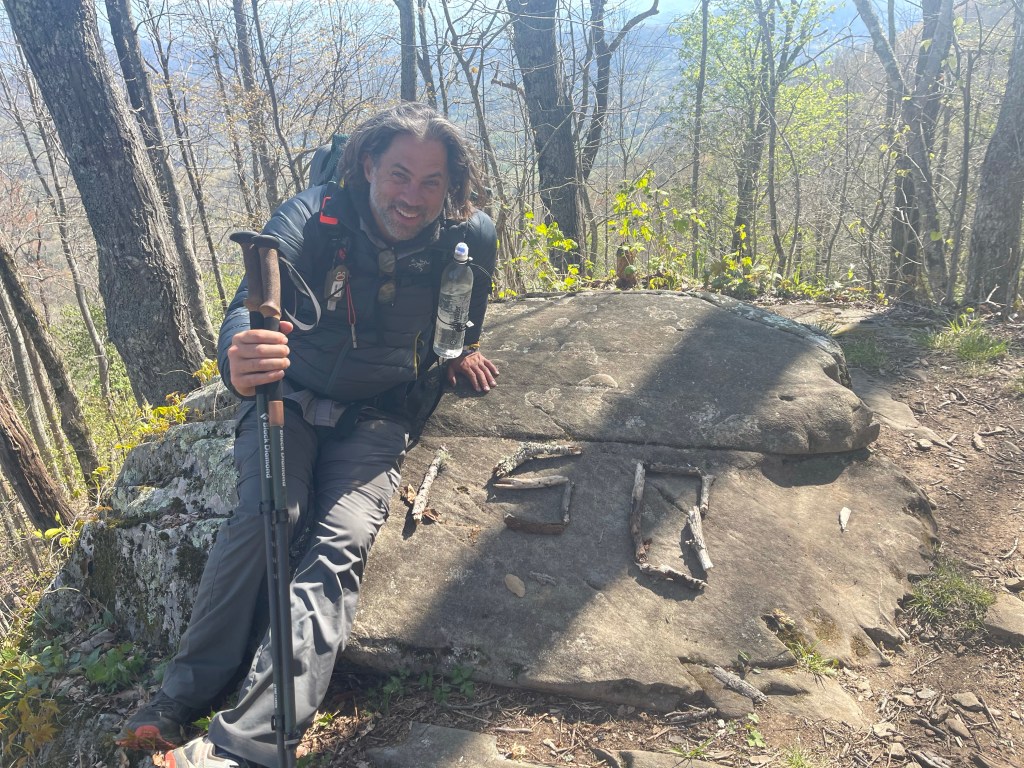
After drinking my liter of water and recovering from that climb, we made our way to Brown Fork Gap Shelter (3,761 feet), mile 152.9, for lunch. First we had to stop at that monumental mark of 150 miles and take a photo.
One of the many things that I was looking forward to on this hike was the chasing of spring time, the blooming flowers, the budding trees, and the bright green new leaves! The trail has not failed to provide the beauty of Gods magnificent hand.

We continued on for 6.3 miles to Cable Gap Shelter where we looked and looked for a flat spot to lay our tents for the night and finally settled for the most level spot we could find that hadn’t been taken.
Got our tents set up and made our way over to the shelter to cook dinner for the night. Everyone around had finished with dinner and some went to rest there little heads while others stood around the fire we made. If you don’t know, write this down, Vaseline on a cotton ball makes for a fantastic fire starter, and it’s light weight in your pack.
Folks started making themselves at home in the shelter, and I passed around my cork ball for folks to roll their calves and feet with, and those that weren’t rolling had their feet up on the wall letting the blood flow out of their feet.

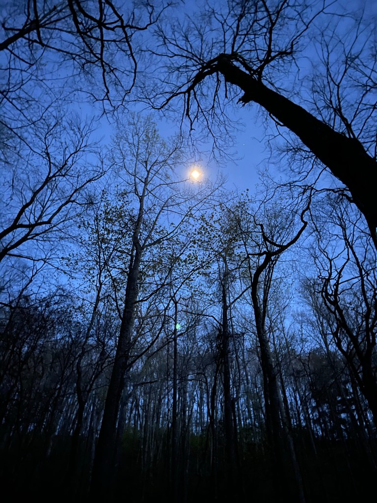
Hiker midnight (9:00 pm) had approached, this is basically “lights out” and bedtime around the Thru-hiker community and I headed home for the night. First though, I snapped this cool shot of the waxing gibbous moon, which will turn full our second night in the Great Smoky Mountain National park.
AT Thru-Hike Day 18
Cable Gap Shelter (2883 feet) mile 159.2 Fontana Marina (1,706 feet) mile 164.4 for a 5.2 mile day. We ascended a measly 922 feet and descended 2,252 feet, for a grade of 625 feet per mile.
The day was really uneventful, we just walked up a little and down a lot to the beautiful Lake Fontana.
Lake Fontana was created by damming the Little Tennessee River as it run through Fontana, North Carolina. It is a Tennessee Valley Authority (TVA) lake created to help the greater Tennessee River Valley alleviate flooding and to provide power during the war effort to a nearby Tennessee town. The largest dam east of the Mississippi River, it stands at 480 feet tall and over 2300 feet across and the Appalachian Trail goes right across the top of it as the Northbound (NOBO) Thru-hiker enters the Great Smoky Mountain National Park and the Southbound (SOBO) exits the park. Families, graves, and roads had to be relocated because of the creation of the dam. Towns, were flooded when the lake was formed and the water rose, and I was told by a local that when the water is low, in certain areas, one can see some of the remains of these towns. On the north side used to lay NC highway 288 and when the lake was created, the road was flooded. In the 70’s construction was begun on a replacement road, in the end, only a little over 7 miles of the road was completed, if I’m not mistaken there is a tunnel involved with this “road to nowhere”. It has been on my list to visit in NC and now that I know where it is and the area a little better, I’ll be moving it up on my adventure list.
