A cascade and tent stealth site, mile 240 to a trail intersection at mile 254.1 for a 14.1 mile day. We ascended 4,812 feet and descended 2,315 feet.
Oh my, oh my, where do I start with this day??? I guess at the beginning!
We woke up to thunder, we hurried to pack all of our stuff to keep it from getting anymore wet than it was and hike down to the intersection of Appalachian Trail and interstate 40 where we could unpack and eat and sit under the protection of an overpass.

Approaching the overpass we crossed the Pigeon River, a beautiful flowing, wide river, with great whitewater rafting.

We stopped, only briefly, under the overpass before a small silver car pulled up next to us, the driver rolled the window down and asked if we would like some food. At first, we were a little hesitant and said, “no thank you”, but then he asked if we wanted bananas and strawberries, ummmm, “yes please”, came the response. He had, strawberries, bananas, honeybuns, and best of all, he had ziploc bags we could put our trash into, again, the best trail magic is fruit and to help us reduce weight by taking our trash!
We stayed under the bridge a while, chatting with Tim, the teacher, from Nashville, TN. before making our way up the mountain. By up the mountain I mean we climbed our way from 1,735 feet to 4,169 feet. At the top lay, Snowbird Peak, on the top of this mountain peak was an FAA VOR station. Pilots use these stations to navigate to and from around the globe.

We headed back down after crossing this bald, but not all the way back down, we went to Groundhog Creek Shelter, 2,828feet. This shelter had a sign on it about bears running off with peoples food bags, and, big surprise, a mom and three cubs showed up later that night, and the hikers who were there ran them off, but we were long gone.
Somewhere along the way, the sky grew dark, and the rain started shortly after that, and boy did it rain!! It was like the Forrest Gump kind of rain, straight down, at an angle, sideways, never really from below though. It rained all the way until we got to Groundhog Creek Shelter, and continued raining for hours. For hours we sat in the shelter and waited for the rain to stop.
The rain finally stopped and we decided to get back on the trail to try to reach as close to Max Patch as we could.
We continued on, following the blazes. Blazes are the markings on trees that allows hikers to know where the AT goes. The Appalachian National Scenic Trail is blazed using white blazes to designate the main trail.
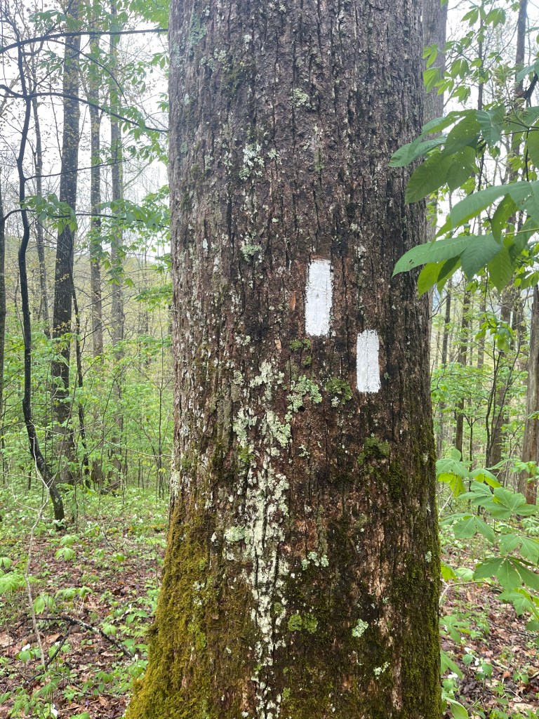
Usually there is a single blaze measuring 2 inches wide by 6 inches tall, roughly 6 feet off the ground, indicating you are on the correct path, keep on hiking. If there are two blazes stacked, like in the picture, the top blaze will tell the hiker the direction the trail turns, so in this case, the AT turned to the left. These are usually at a hard change intersection or there is another trail near by that could confuse the hiker. Another often seen blaze on the trail is the blue blaze. Usually leading to water or a shelter or some other spur off of the AT, but it isn’t the designated main path. This double blaze happened to be at the intersection of a trail that we decided to make camp at just one mile from Max Patch.
