VA route 630 (2,152 feet) mile 678.5 to VA Route 621 (1,538 feet) mile 689.3 for a 10.8 mile day! We ascended 1,851 feet and descended 2,484 feet!
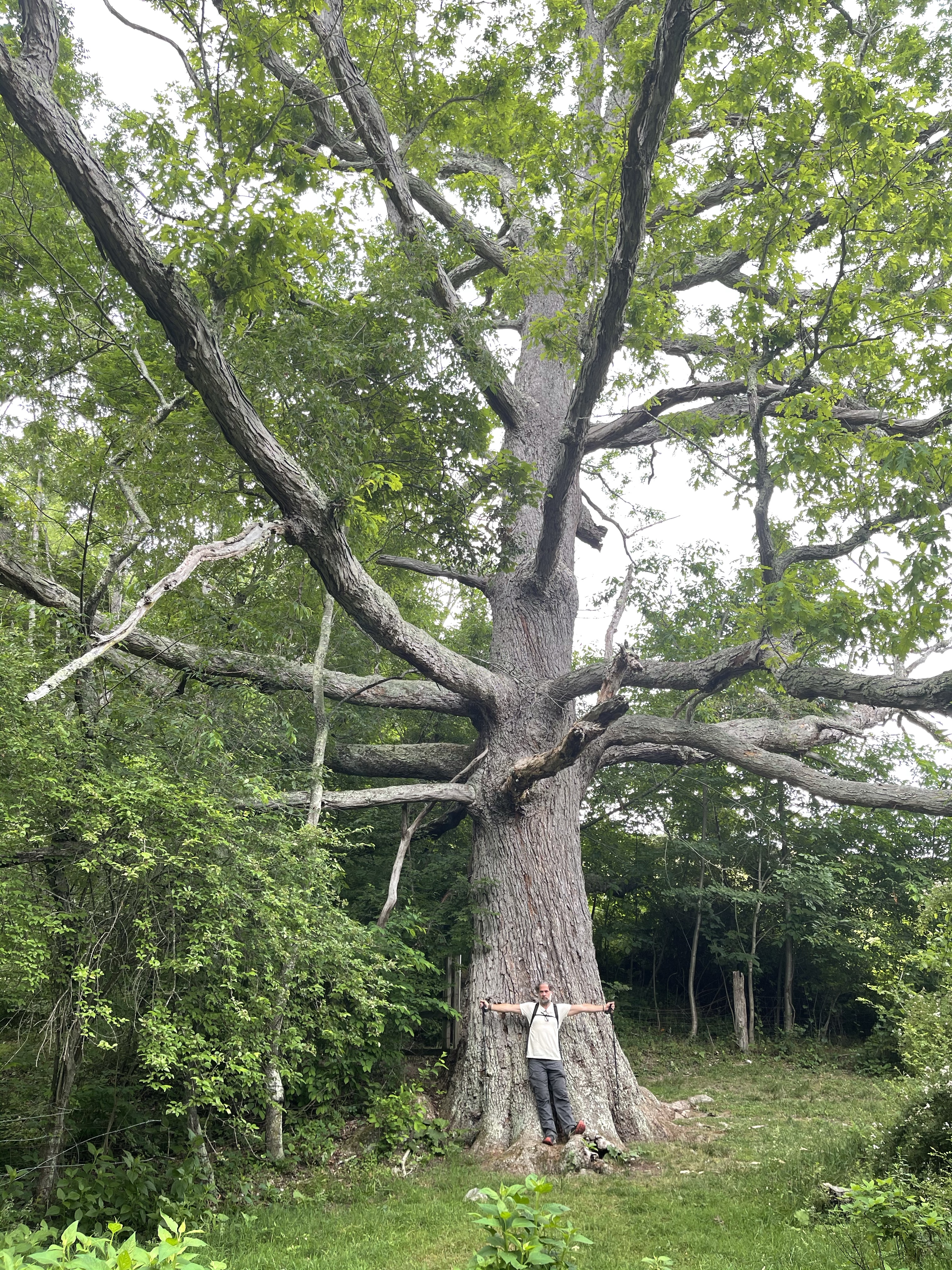
We started out the day with an amazing site, the Keffer oak tree, a 300 year old oak tree on the outskirts of a field of Silver Hair grass that was being cut for hay. The tree is one of the largest white oaks on the AT! It’s circumference is 235 inches and it is 56 feet tall. This means that when troops from the union and confederate armies marched through this area during the civil war, this tree was already 140 years old!!


We continued on our daily adventure and came to a weird site after our big climb for the day. On our AT map app, these rock formations were labeled as, Bruisers Knob Cairns, cairns are used, a lot of times to mark trails, and sometimes they would be used to store food. I am not 100% certain what these were used for but it appears that there are a number of large apple trees along this ridge, which could suggest that they were used to store apples.

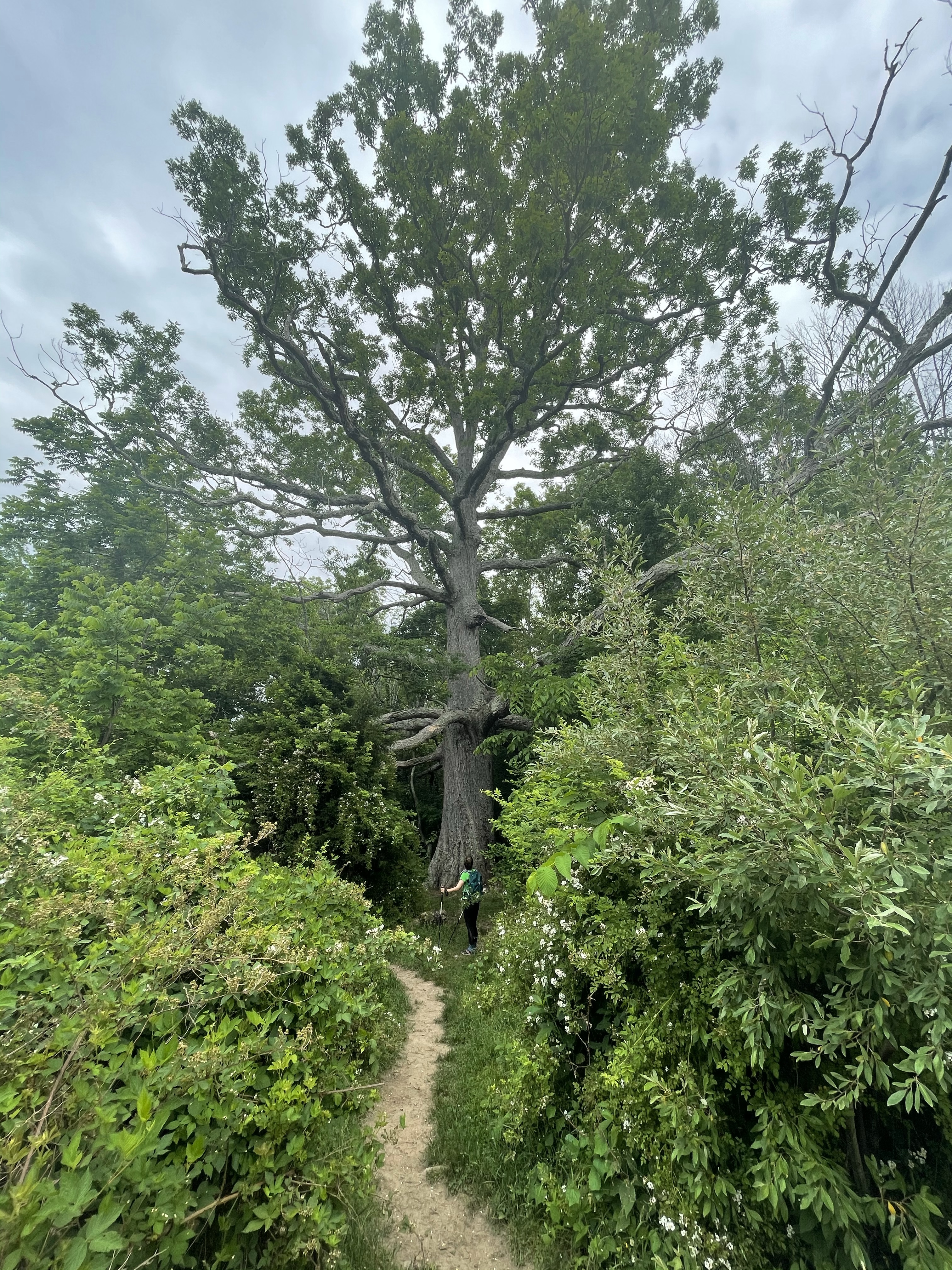
After walking a bit more we came to an area that is referred to as, Ledges. The ledges was basically a place where the trail designer thought it would be cool to send the hiker out on a ledge of rock that was sloping at a pretty good angle. What did this mean for us, the hiker, well, it meant one wrong move and, bye bye!! 👋🏽 I was so grateful that the day we came to the ledges it was not raining, this could have been a bad bad thing, for sure!!

From this picture, it is really hard to tell how bad it really was, so, take my word for it, it was bad!!
Now, next, we came to a spot that I found to be a little odd, I will explain. A little over half way through this day we found ourselves standing at a point in the middle of the woods, on top of a ridge line we had been walking for hours, we were looking at a sign that said, “Eastern continental Divide, <——Gulf of Mexico 1,920 miles Atlantic Ocean 405 miles—>”

We sat here and ate our lunch, I called a local running store to see if they had a pair of Hoka Speed Goats in my size and they did, so James, Kelly’s husband, stopped by the store and picked up the shoes for me.
After lunch we started hiking down hill, it was a long downhill but we had a super cool sight while on our way down. Standing not far from the trail at one point was a momma deer and her fawn. As we approached, the momma decided she was cool with us so she just walked a little farther away from the trail. The fawn, it wasn’t sure what to do, so it ran a short distance and then decided it would “hide” behind a log! Hahah
After this wonderful sight, we continued our climb down the mountain. We got about a mile and a half from where we would setup camp for the night and we grabbed some water. We left our bags at the intersection of the white blaze and the blue blaze, remember, blue blaze is a side trail off of the AT that usually leads to water or a shelter/campsite. We left them here because James has a tendency to walk in for a mile or two to meet us and then we all walk back down. Well, sure enough, we got back up after getting water and there he came, be bopping up the trail with Pickles.!
Getting back down to the bus, we found a large trail magic celebration going on! James said there was trail magic but we were afraid it would be gone by the time we got there, but it wasn’t!! This was trail magic like never before, hamburgers!!! James made a loaded Mac and cheese to add to the feed and it was a huge hit!! Salty and Were the trail angels for this magic, they were both through hikers who were injured and came off trail. Now, they are doing trail magic until they are well enough to get going again.
Salty Express or Safety Patrol is what they called themselves!!

