AT Thru-Hike Day 116

Mad Tom Notch Road (2,445 feet) mile 1659.5 to VT Route 140 (1,102 feet) male 1680.1 for a 20.6 mile day.

We started the morning with a crisp 52° day and a 935 foot climb, this day did not disappoint.

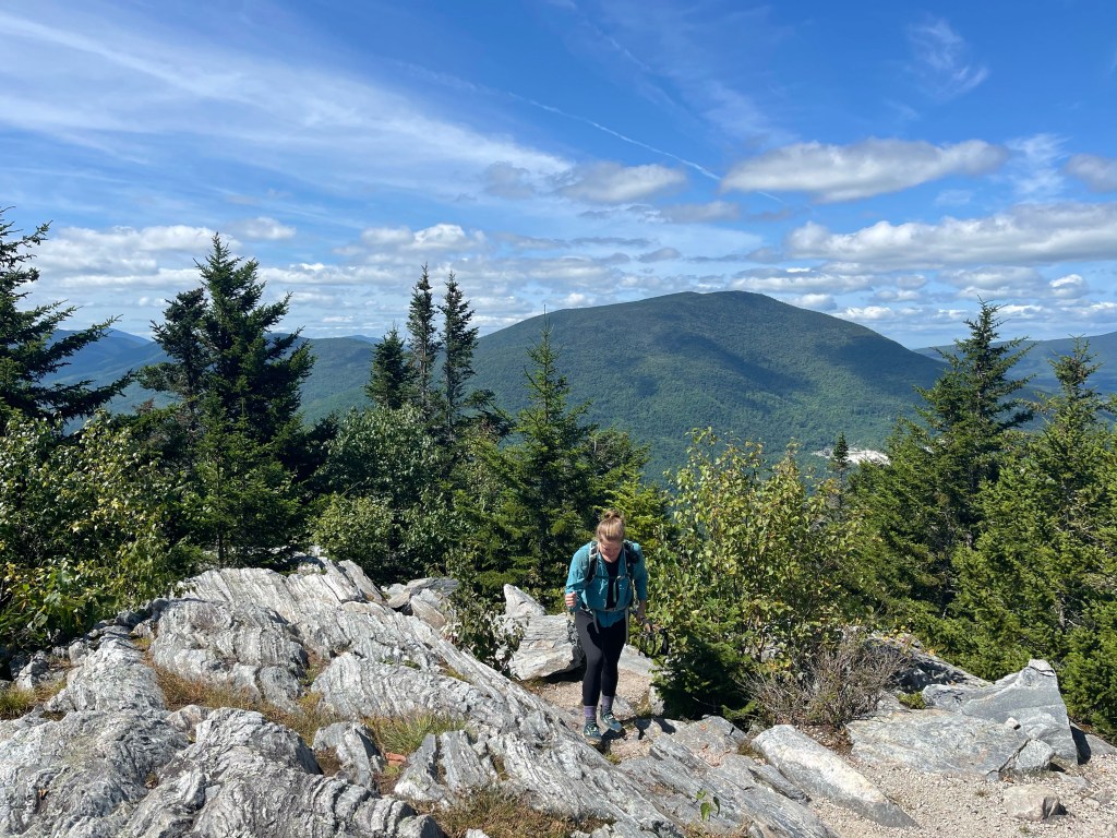
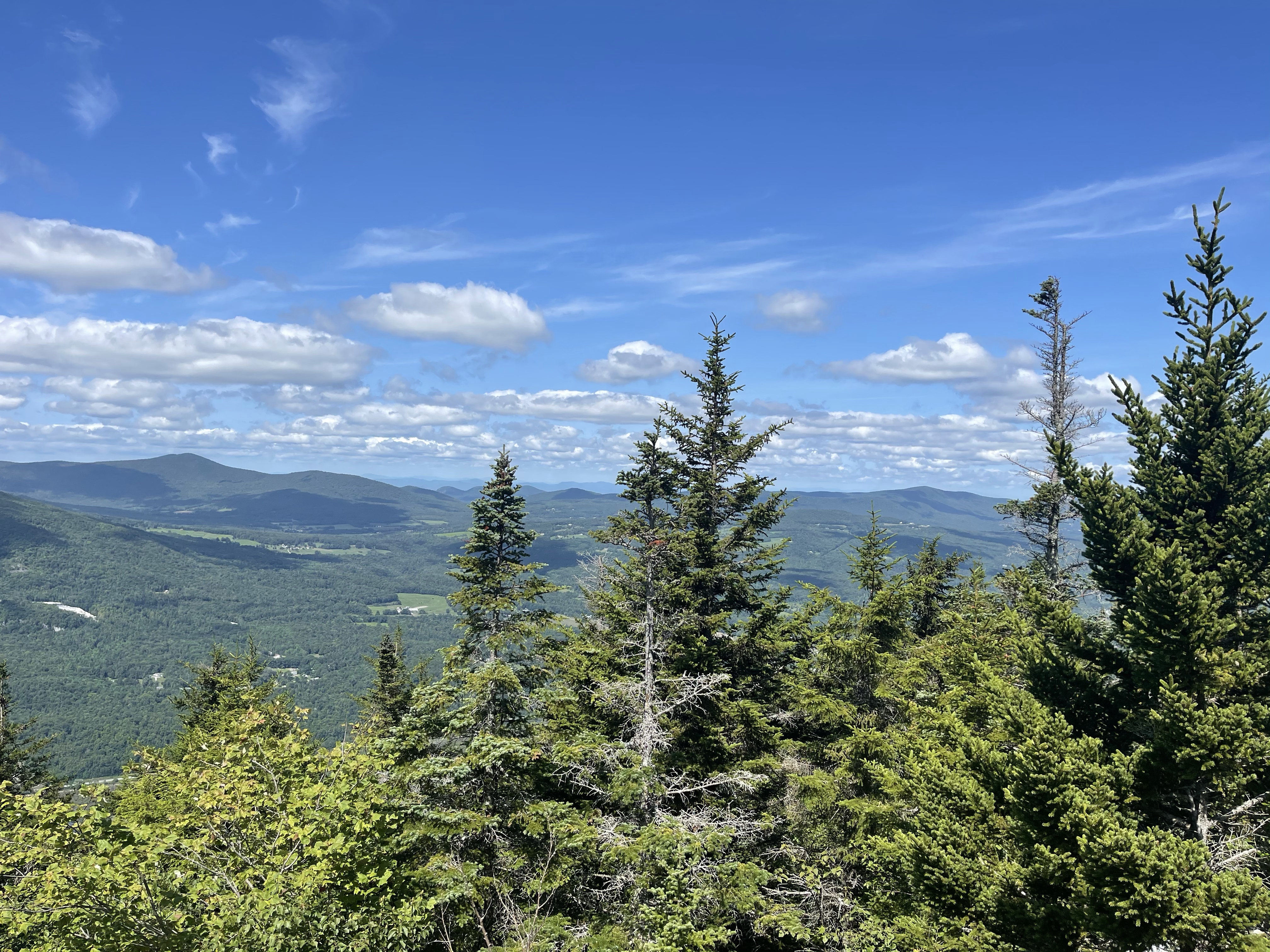
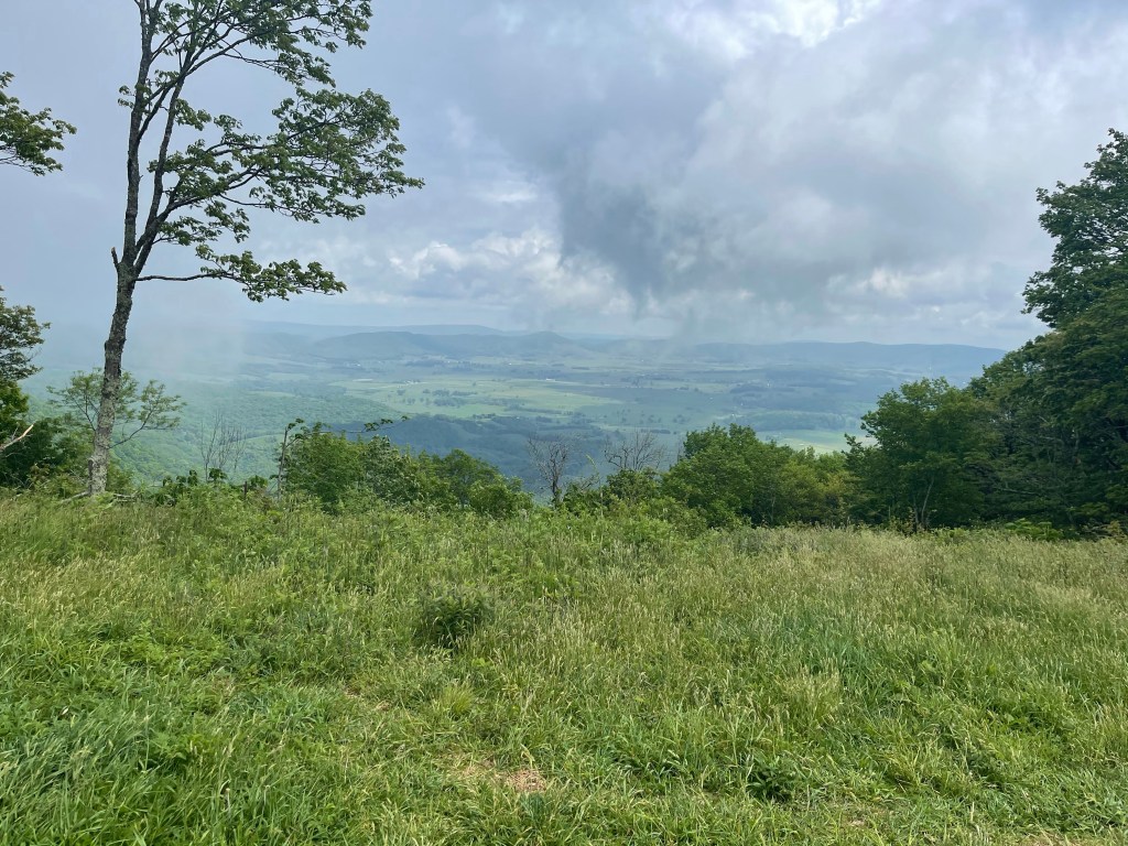
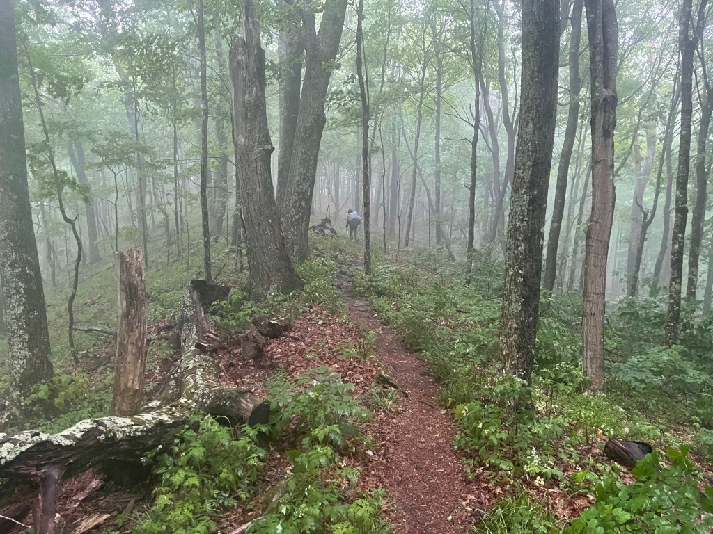
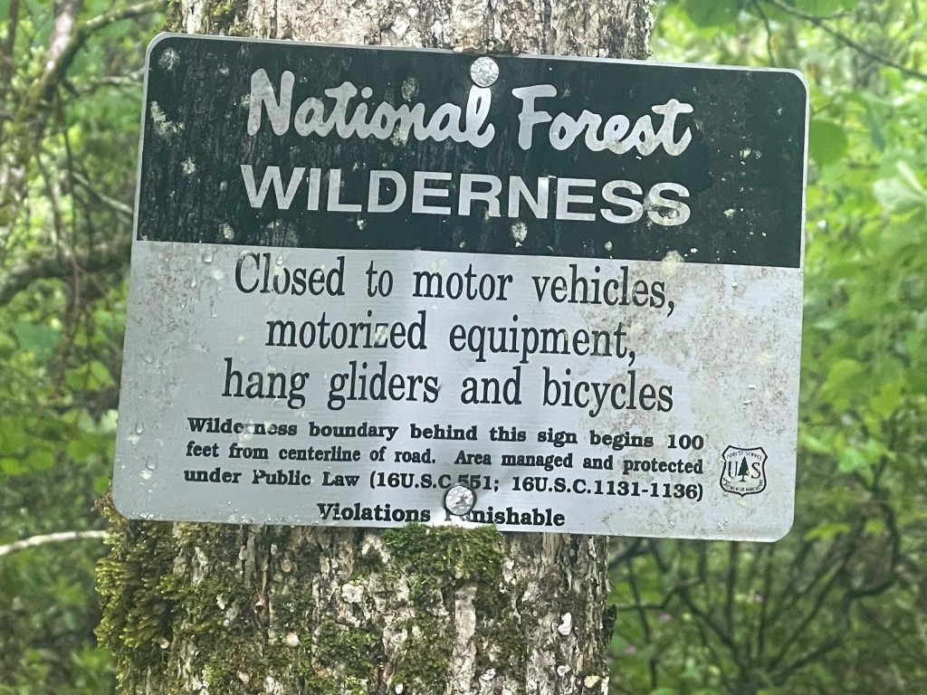
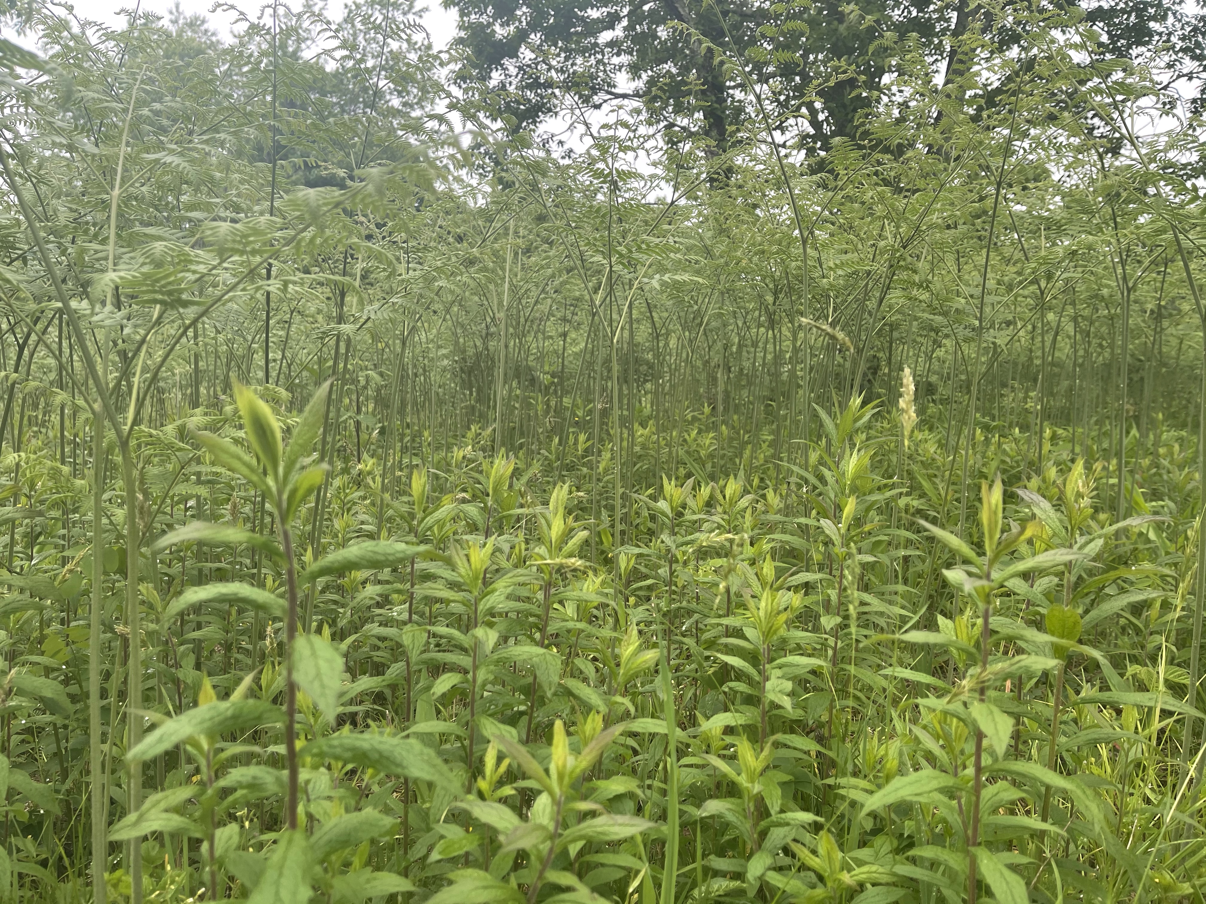
The day was filled with pine forests and the wonderful smells that accompany them. It’s been a week now since I was back on trail and my legs and feet seem to be getting used to it all again. I am so thankful for that! We hiked up Styles Peak and continued across a high ridge and then down into the Peru Wilderness. The wilderness takes its name from the highest peak in the area, Peru Peak at a little over 3,000 feet in elevation, and it contains over 7,800 acres of forest.

Crossing over the Lake Brook we made our way to Griffith Lake, a beautiful mountain lake where we saw families enjoying a day out in the beautiful weather around the lake.

Hiking on we came to Baker Peak, a rocky open ledge with some wonderful views. We always know when these types of rocky climbs are coming up because we see the signs that say, “bad weather trail”. These bad weather trails provide safe passage around the rocks that become slick in the rain.

Further north waiting on our arrival was Little Rock Pond. I am assuming this pond fits it’s name from a large rock out cropping on the other side which begged for jumpers to enjoy the lake with a splash. We saw some other NOBO hikers here enjoying a lunch break, while I took some time to enjoy the privy and Birdie had cell service to make her Sunday call to her dad and touch base with James who was picking us up once we reached the 20 mile goal. Making our way around the lake for about a half mile we enjoyed some beautiful views of yet another mountain pond.

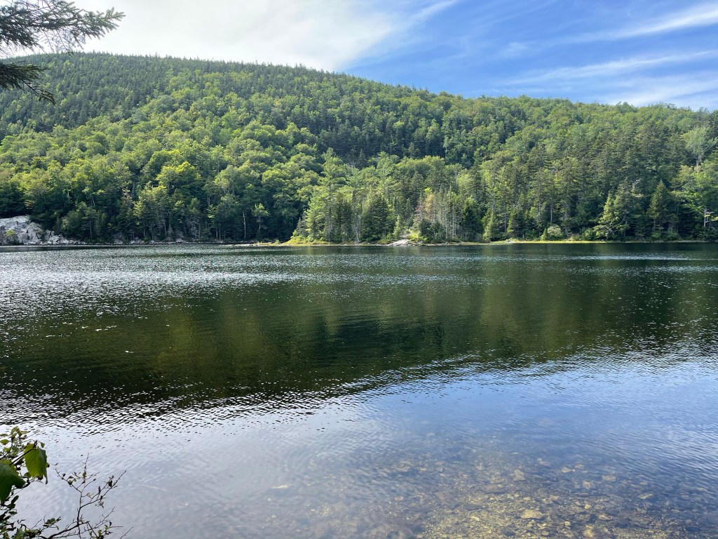
Swimming off in the distance we had our first sighting of a Common Loon, a beautiful black headed white and black speckled bodied bird with a wonderful song in its lungs. Today we were not fortunate enough to hear this song but the day before we heard the song of the Loon off in the distance. (Google Loon call to hear and see the bird) As we came to the end of the pond the Loon had gotten closer but still not close enough for a good photo, it must have been feeling camera shy today.

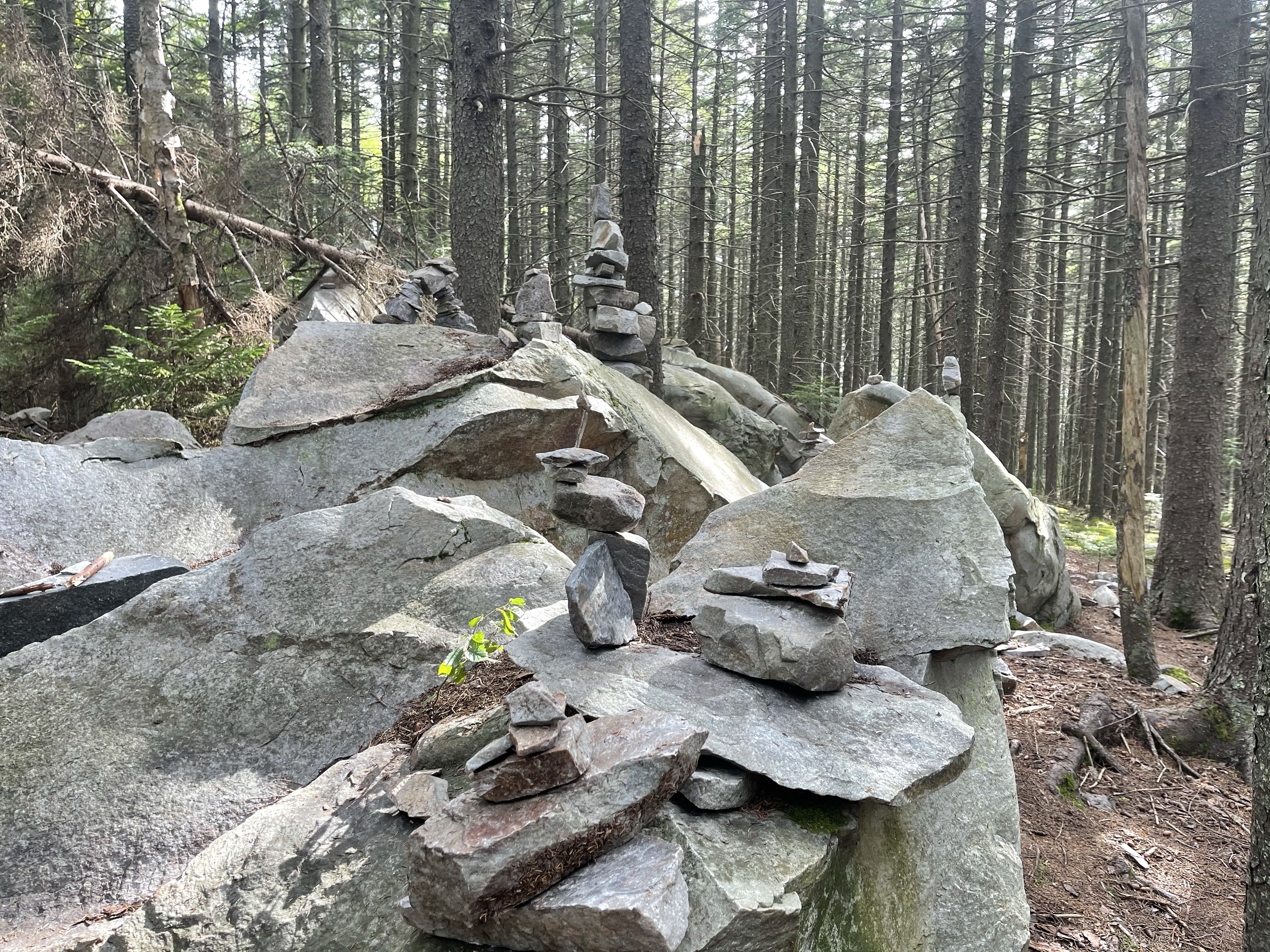
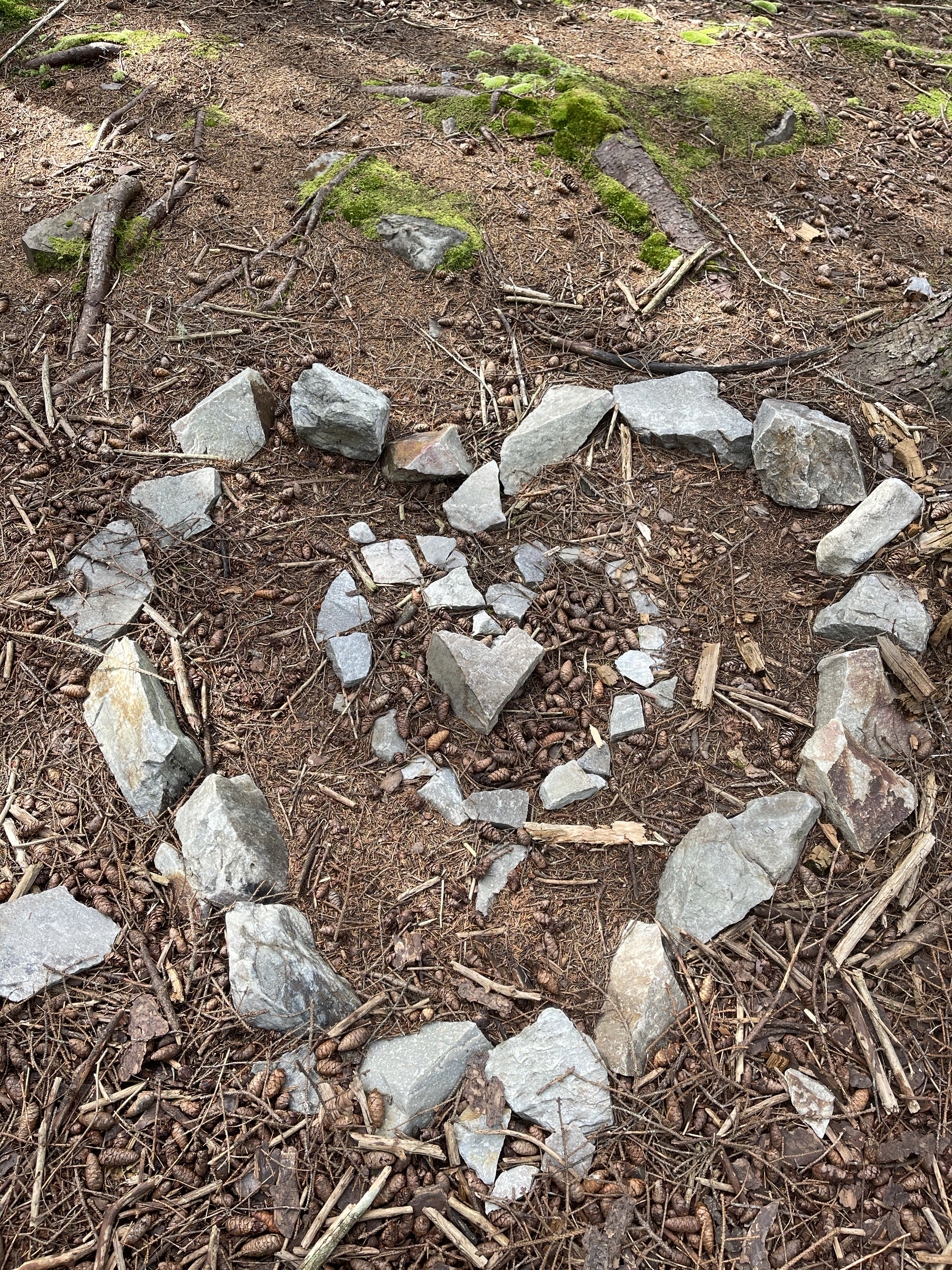
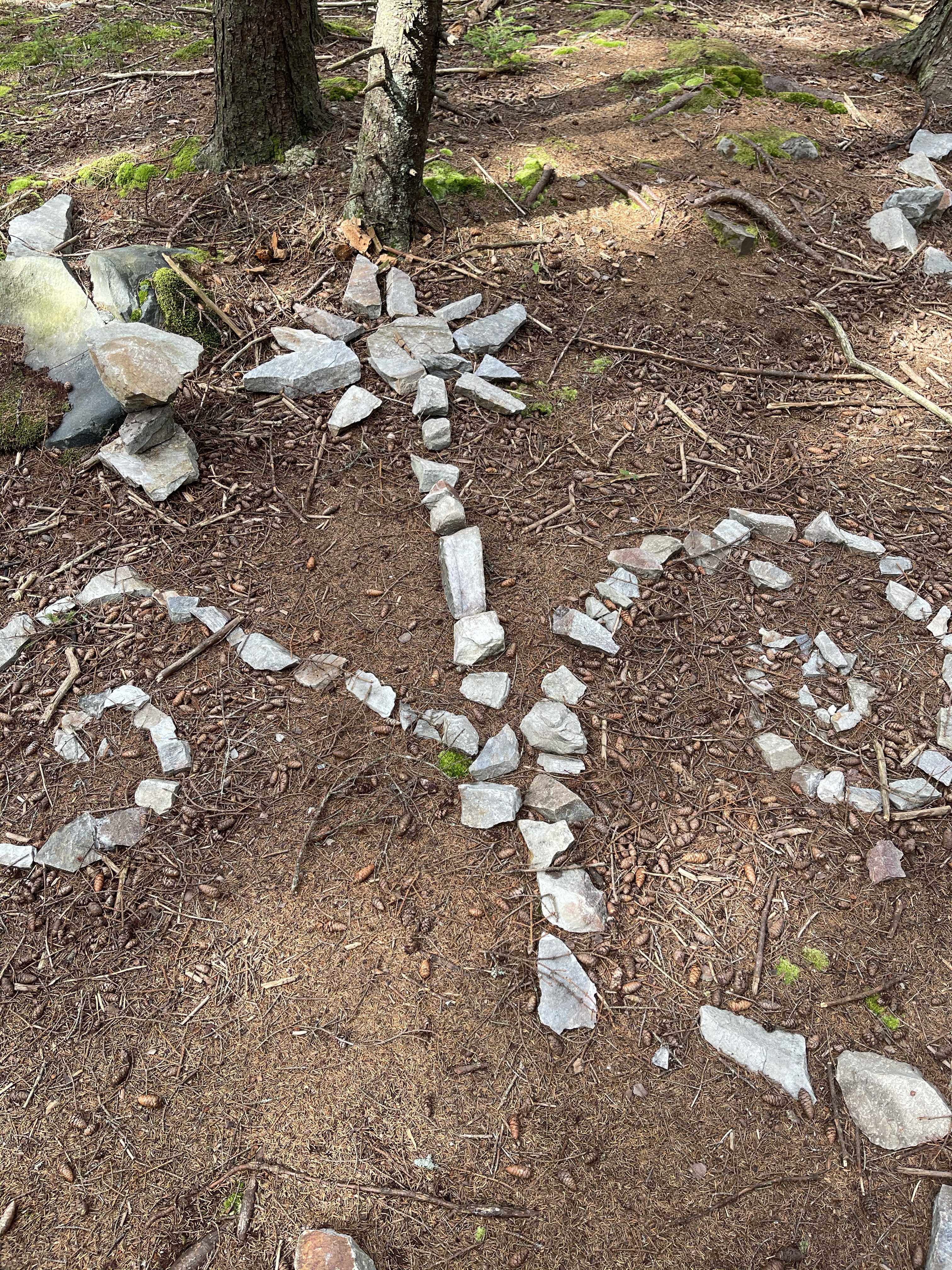
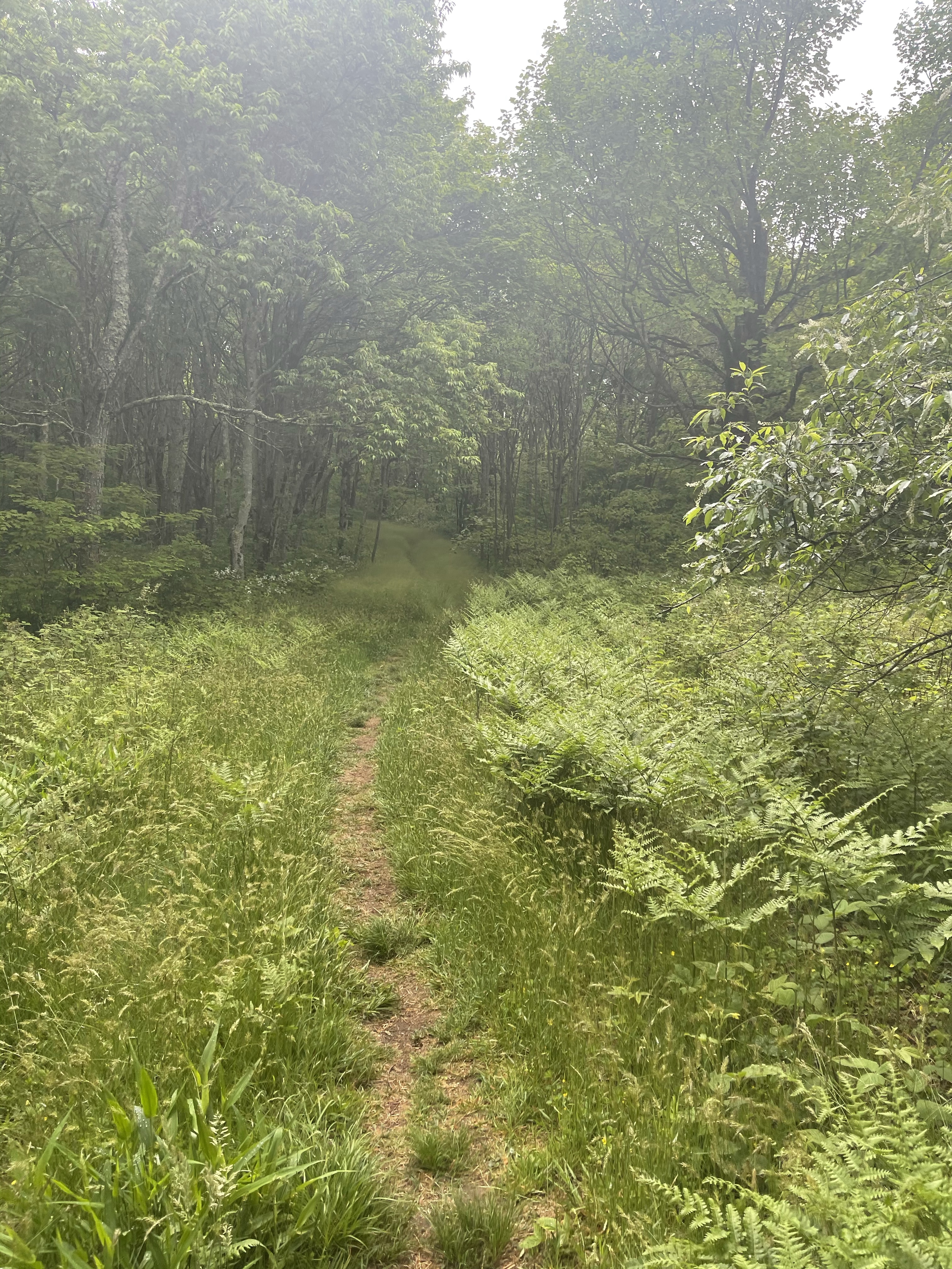
Looking at what was coming up ahead for the day in my Guthook app, I saw what was labeled as “Rock Garden”. We hiked on waiting to see what this was going to be about and we finally made it to the garden. It was a rocky area that looked like a fairy garden, something that would be in the Disney movie Trolls.

I’ll put more photos in a gallery at the end of the blog.

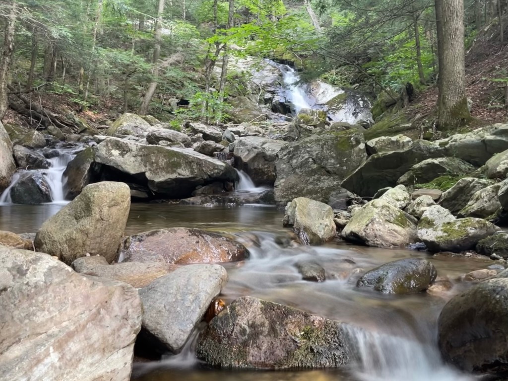
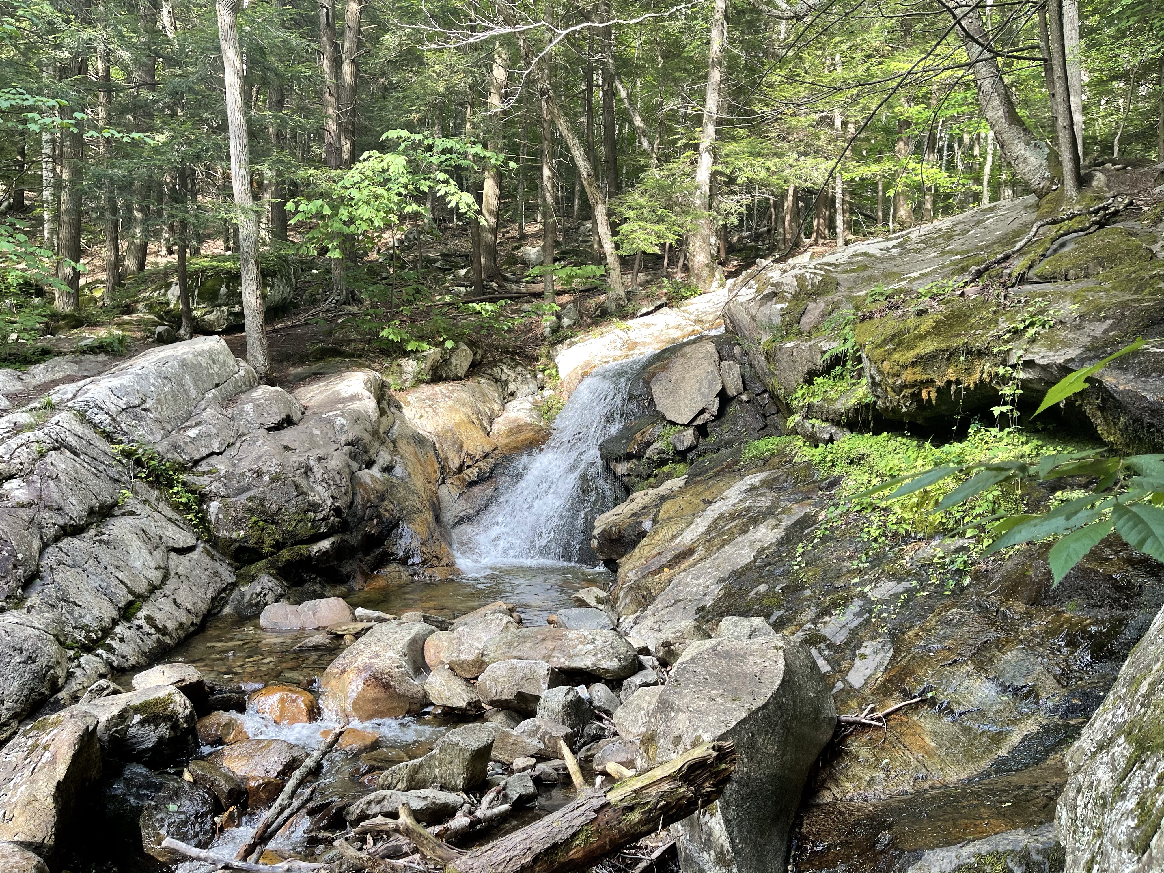
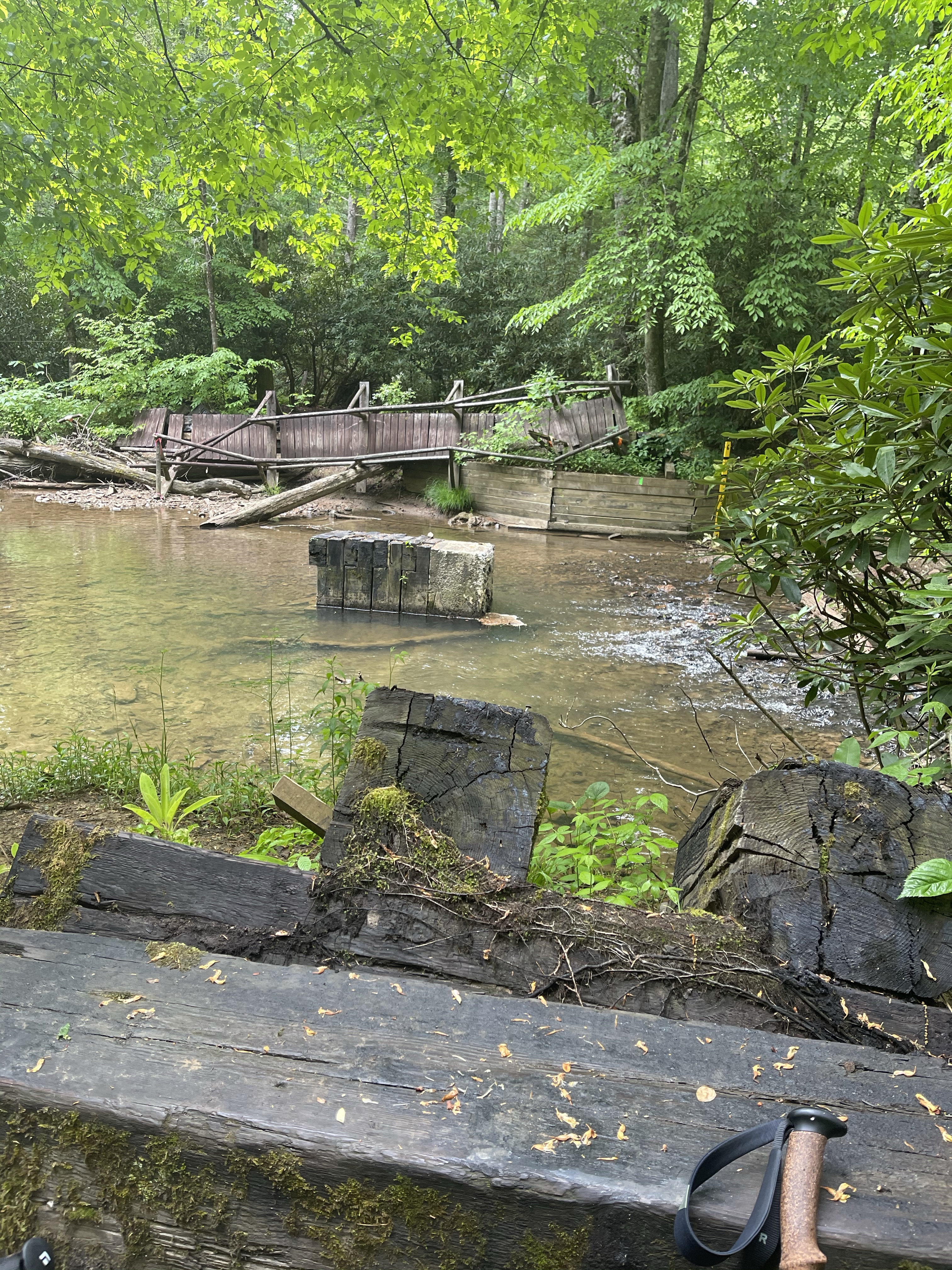
Towards the very end of the hike was a nice flowing river with lots of small waterfalls. Waterfalls are such a pleasant and soothing sound, the perfect sound maker! Bully Brook flows north out of a small pond to the south and into Roaring Brook which is near where James will be picking us up. There are several 10-20 foot drops on the Brook that I just couldn’t safely get down to get photos of, but the photos I got were great nonetheless, I think. ☺️

Bully Brook

AT Thru-Hike Day 74

Gravel Springs Gap (2,663 feet) mile 958.9 to Manassas Gap (791 feet) 980.3 for a 21.4 mile day. We ascended 3,876 feet and descended 5,491 feet.

Another day in the Shenandoah National Park, well almost a whole day. It was the last day and it disappointed, yet again, with its no views and continued pointless ups and downs, but, we had to do it to get to our final destination.

We stopped at two really nice shelters, first was Tom Floyd Wayside, it is the first shelter north of Shenandoah National Park, the second was, Tom and Molly Denton shelter. I took some time at the Tom Floyd shelter to put my feet up to get the blood flowing away from them for a bit.

This shelter as well as the Denton shelter had a deck off the front, the Floyd shelter had a picnic bench whereas the Denton shelter had a picnic bench under a pavilion as well as and Adirondack couch, flower gardens and a horseshoe game space.

After continuing down to our pick up location, actually not far from the location, we came to a sign talking about colonel John Mosby.

Later that night, Suzanna and I went by the outfitter in Front Royal on our way to dinner. There, we saw this whiteboard showing records for AT accomplishments.

Obviously, my name is nowhere on here, but, I’m going for completion not recognition! We walked next door and enjoyed a decent meal at the Front Royal brewery, where, all that mattered to me was this dessert!!! I have always had a think for a good pecan pie or bread pudding!

AT Thru-Hike Day 48

Lynn Camp Creek (2,373 feet) mile 561.5 to Jenkins Shelter (2,246 feet) mile 580.5 for a 19 mile day! We ascended 4,554 feet and descended 4,480 feet!

A new longest day with a full pack for me today! The day started with a 700 foot climb out of camp, that climbed was followed by a downhill that rolled right back into another climb, this time, 2,135 feet!! Here is the great thing about this one though, this wasn’t a pointless up and down, it lead to the Chestnut Knob Shelter (4,407 feet), what’s special about this shelter besides that elevation? Well, for starters, it is an enclosed shelter with four walls and a door. This shelter actually used to be a fire wardens cabin. The fire tower has been torn down but the cabin was converted to a shelter with 8 spaces for sleeping.

Chestnut Knob Shelter

But, the most impressive thing about this shelter, is its view. See this shelter over looks an area called Burke’s Garden, which sits inside of a fascinating geological formation. It’s inside of a limestone sinkhole! This is not just any sinkhole though, it is and 8 mile by 4 mile crater. At first glance, I thought it was at one time a volcano. I have no phone service but want to check this fact at some point.

We sat here for lunch just enjoying the view… until the rain started pelting me in the back. We didn’t run for the shelter though, nope, we started hiking! From this point, we started a 12 mile dry run, meaning there is no water sources available for 12 miles.! I also noticed, because the trail is on the backside of the “crater” for a 8 miles around, there are no campsites for about 10 miles, the mountain is too steep on both sides to put up a tent. A ton of good hammock places though, but no water!

The only water that was available today was coming from the sky! It rained so hard and the wind blew so hard, it was a real toad strangler!! I later saw a frog hopping for its life, it was raining hard!

As we marched closer to our shelter for the night, needed a dry place to eat, I saw a sign I have not seen before. Well, I have seen a similar sign but not with these words.

hang gliders??? I guess the sign is there for a reason, someone must have gotten caught hang gliding!

Food for thought, as I sit with 30 days left.

As I sat down to write this post I checked a message on my Facebook page from a high school friend back in Lake Charles, La, Eliot, and it was asking about what all was in my bag so he could get ideas for future hiking and camping trips. Well, it just so happens, my last post was about “whats in my backpack”. After I shared the post with him he told me, same as many other folks, he was looking forward to following along on the adventure. Though this was not originally what I was going to post about, I thought I would include a short bit about my thoughts and then I would share with you what I am carrying in my food bag.

So, first off

To all of those out there that are looking forward to following along on this journey, thank you! I never thought that folks would enjoy following along with a guy who grew up in the low, flatland of Sulphur, Louisiana, walk for 2,193.1 miles up mountains and down valleys for 6 months.

Second

Although I am glad that there are folks looking forward to following along, it is not for you or them that I am doing this hike. I am doing this hike because I have never in my life set out to do anything, to have any goals, to make a difference in any way. I have lived a life full of fear, fear of many things. I played baseball when I was younger, I could have been better, but I was afraid. I was afraid to catch a ground ball because, God forbid, what if it hit me. I played the piano and as much as I fought with mom about practice and playing, I still enjoyed it and wished I had continued, but that one parent that laughed out loud when the piece I was going to play was announced, I botched the whole piece and didn’t really care to play much after. I had absolutely no intention of going to college after high school, many reasons, my dad owned a successful mapping company that I could work for, my English teacher in 10th grade said I wouldn’t make it through college. I could go on with many others, but I don’t want to loose you in all of this.

The times of overcoming:

Oh, 2004 I graduated from UNC Charlotte with a 3.7 GPA and made the deans list one year. 🤪🤪🤪

Until last summer, I had never spent the night in a tent outside! I always had a fear of what was going to happen to me out there, what sort of animal was going to eat me! I have since gotten over that and have camped outside many times and even did a 3 day backpacking trip all alone. Yay me! I was a shy bashful kid, like 75% of the population, I had Glossophobia, the fear of public speaking. For 15 years, starting around 1999, I performed in live theatre, even at one point playing a roll with 4 other actors, where I played 5 characters in one show!

So, WHY am I hiking the AT?

  1. To learn to overcome and embrace a challenge
  2. To see that I can overcome fear and accomplish what I set out to do even if its waaaaaaaay bigger than me
  3. To create a better Stuart
  4. To meet God in the wilderness
  5. The people/community
  6. To see that I can live life with less
  7. Though a late in life one… it checks a box on the bucket list.
  8. To share the beauty of God’s creation from a different perspective with those around me.

I am editing this into the post because it is too good not to mention as another why. I was going to talk about this at a later time, but, no time like the present. My friend Amy, called me this week to ask me if I could do something for her BFF. You see, several years ago Lucy’s husband, Derren, passed away with brain cancer, he had always wanted to hike the Appalachian Trail. She wanted to know if I would be willing to carry a golf ball with his name on it that she had made for his funeral. It was not a request to carry it all the way to Katadhin, but, I insisted on carrying that golf ball and his memory, even though I did not know him, all the way to the end!

What if I want to quit?

  1. Remember that, while I was acting on stage, I used my fears and nervousness to make me better.
  2. Remember that not many people my age get the chance to drop it all and set out to hike for 2,193.1 miles
  3. As much as I say this isn’t being done for the reader, I have people living vicariously through me and wanting me to go on. That fact is, I have told many people about this and have enjoyed the conversations it has led to and the wow! on their faces and I will push on because of them.
  4. There have been many situations in life that I have felt like giving up on but I didn’t and I’m still here and better for not giving up.
  5. I read on a post and will keep this with me, “…that deep down the temporary satisfaction of stopping would not be able to compete with the satisfaction of completing the hike.” -Heather “Anish” Anderson (Alexa Bonsai Shapiro 2019: Overcoming the Desire to Quit During a Thru-Hike. https://thetrek.co/overcoming-desire-quit-thru-hike/)
  6. I don’t want to live with the regret.
  7. I have bought all of this dehydrated food and don’t want to have to sit at home and eat it all! My girlfriend would probably not like date nights to included dehydrated backpacking meals, as good as they may be! 🙂
  8. See edit portion above this section. 🙂

Okay, so, I have went on about this more than was originally intended. Never knew how things would just start flowing if I sat down to write. I am going to push off what is in my food bag until next week.