AT Thru-Hike Day 37

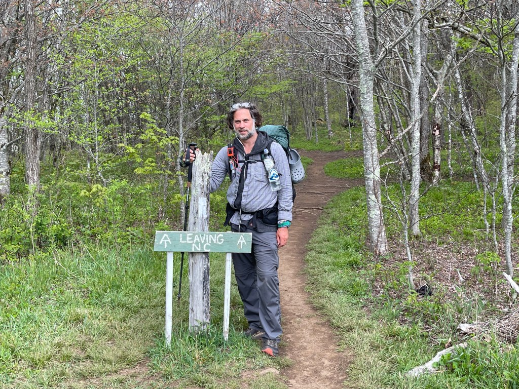
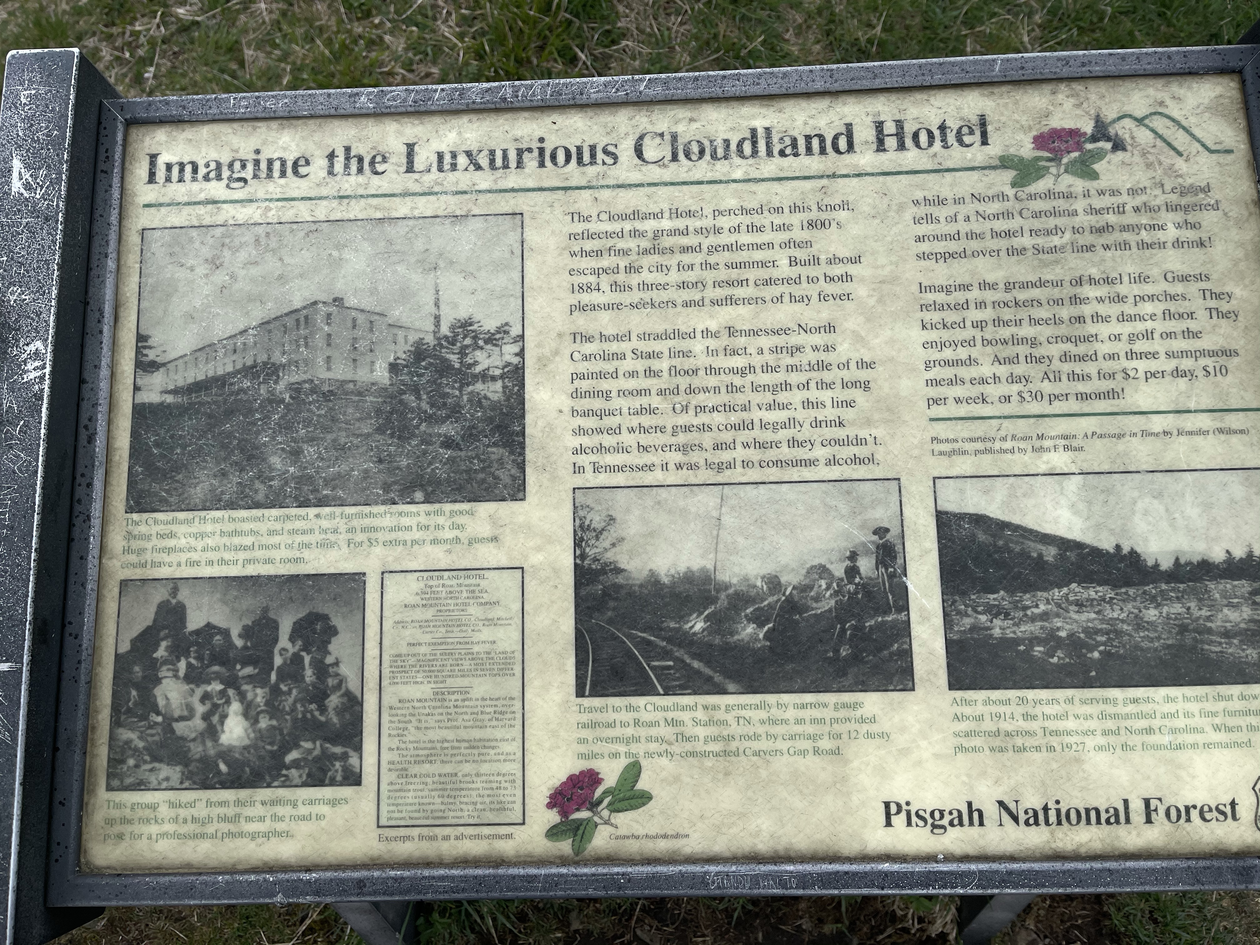
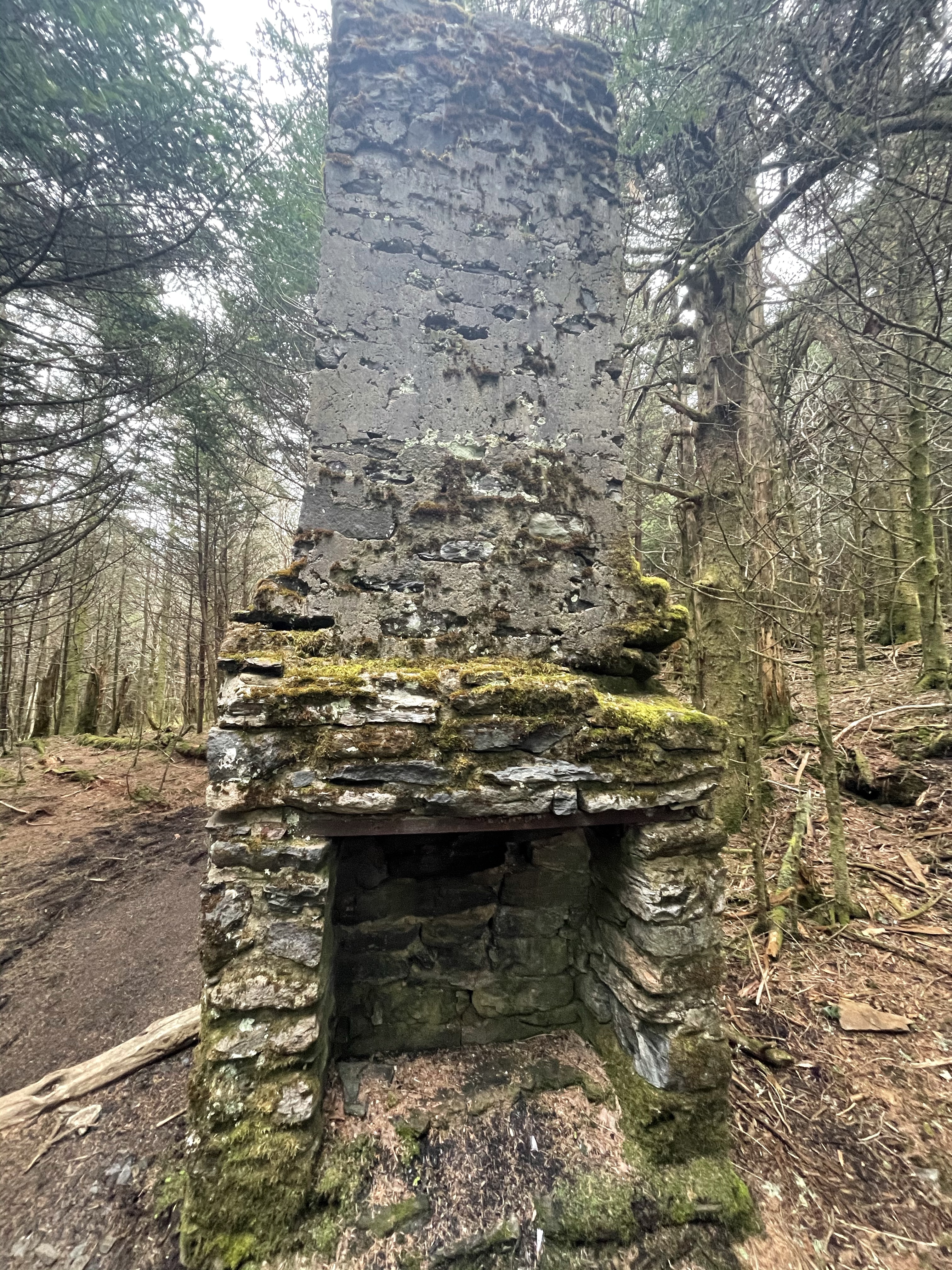
Highway 19E (2,861 feet) mile 395.3 to Moreland Gap Shelter (3,823 feet) mile 413.7 for a 18.4 mile day!

What a day today was!! It was a long day, but I came, I saw, and I conquered this day!!

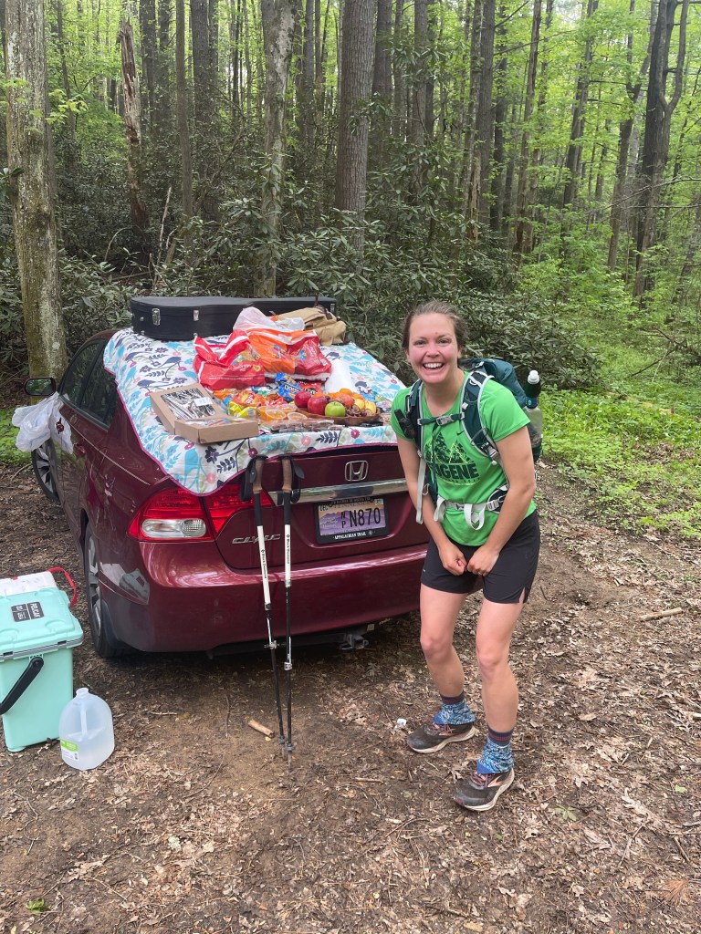
It started out with a trail magic breakfast, you see, it appears that someone may have made a donation to the hostel through http://www.trailmagicdesk.com, and super cool website that they have setup that allows folks to give trail magic virtually but the Thru-hiker receives it for real!! So, I willingly accepted, scrambled eggs, biscuits and gravy, a pancake, and potatoes, and enjoyed every bit of it, oh and it was all you can eat!!!

Started this long day climbing up and out of the gap that Highway 19E was in up to around 3,800 feet, it was a 1,200 foot climb in 2.7 miles.

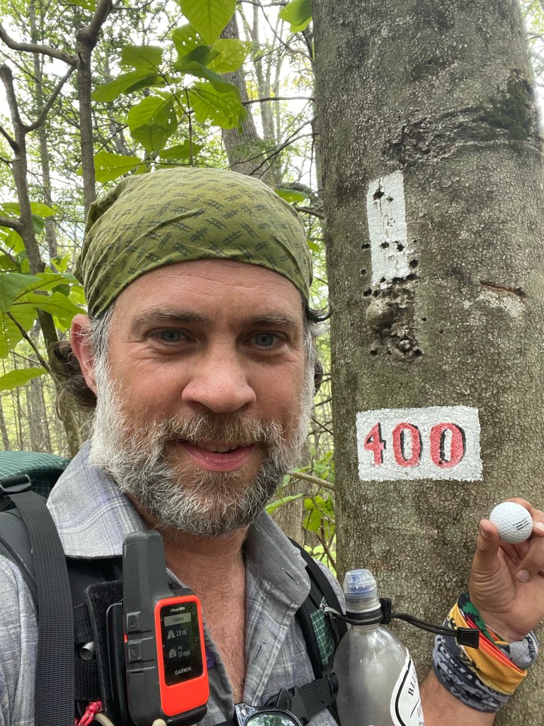
As usual, we got to the top and started right back down, but this time, there were two rewards down the trail, the first was mile 400!!!

The second was the beautiful, Jones Falls. The falls are about .2 miles off of the white blaze trail down a blue blaze, but oh was it worth it, even if for a brief moment.

Jones Falls

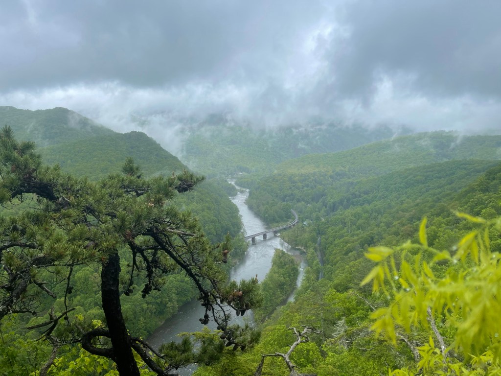
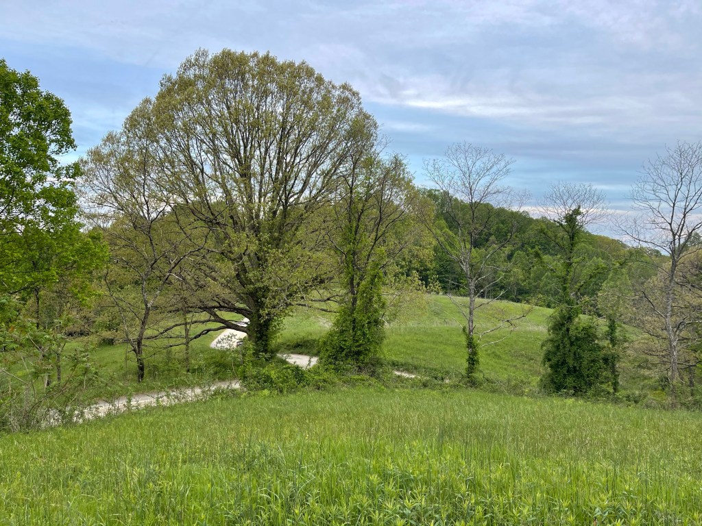
Back on the white blazes for another mile and then came to a nice size river running along the trail. The Elk River runs along the trail for about a mile with some nice views to be had and if you’re feeling strong, you can take a dip in the river because the banks aren’t too steep!

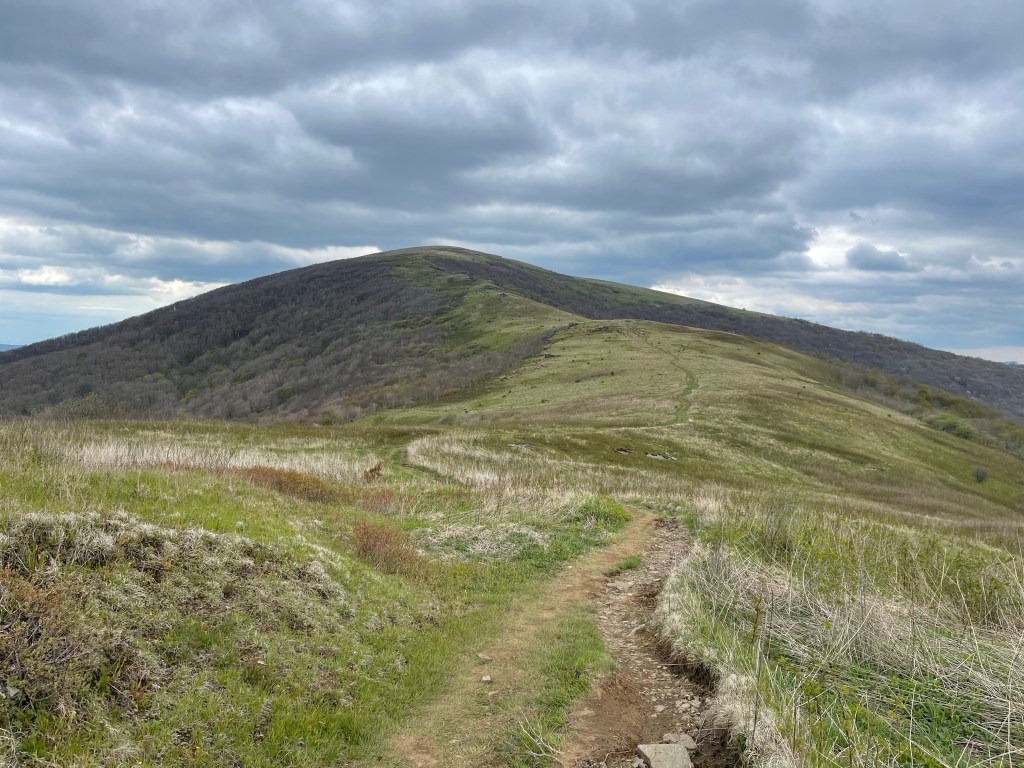
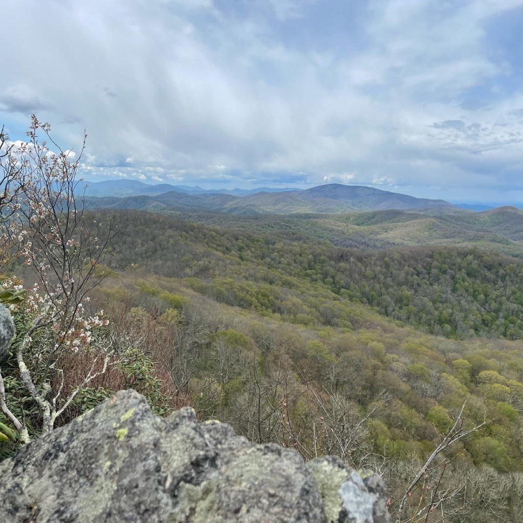
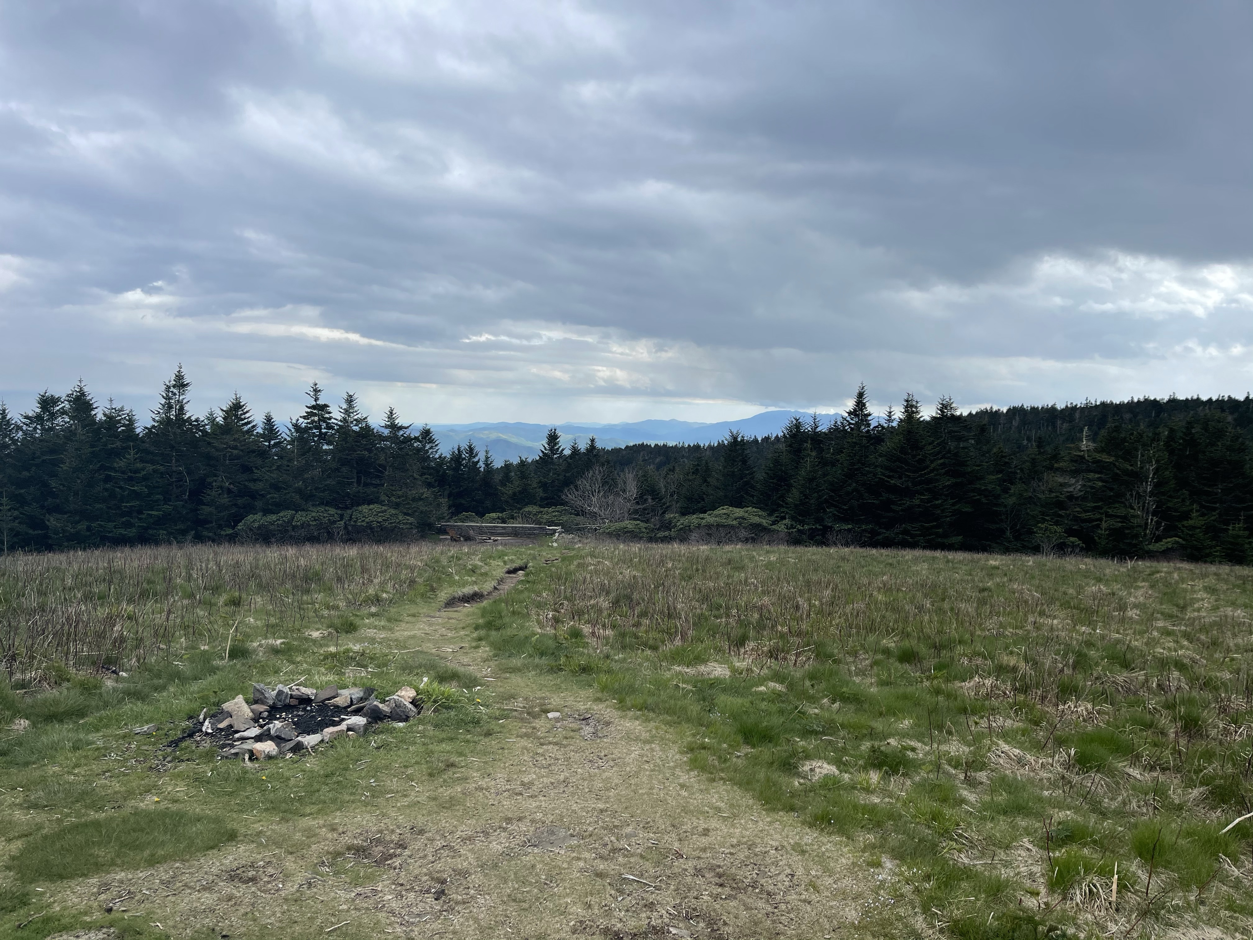
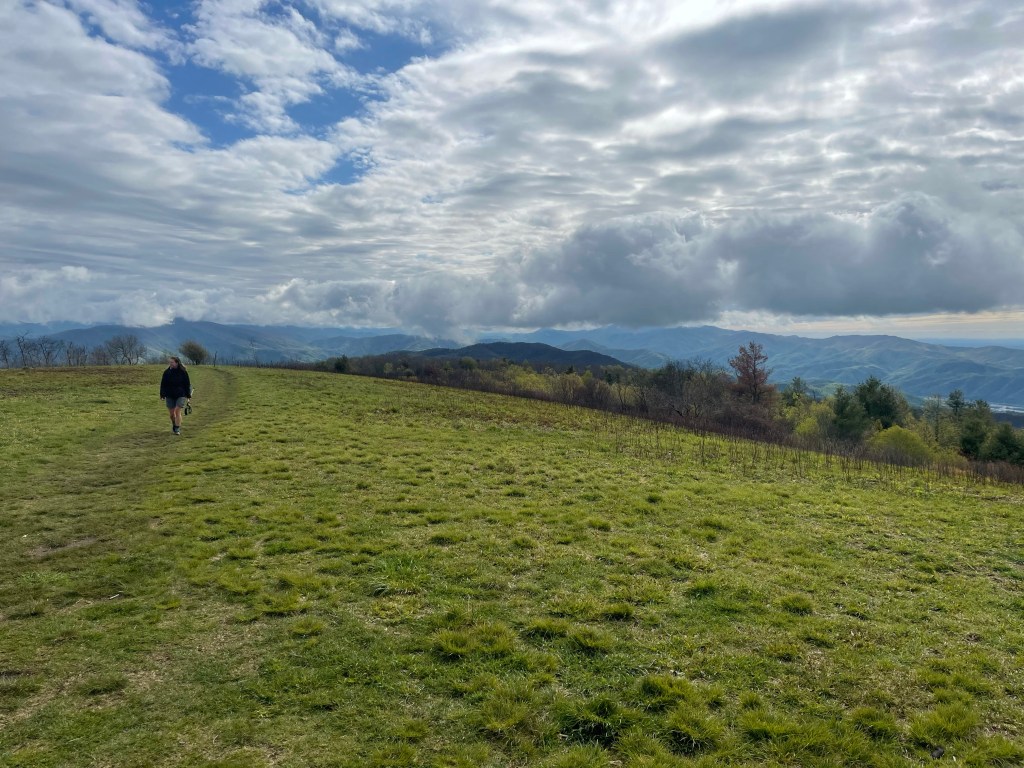
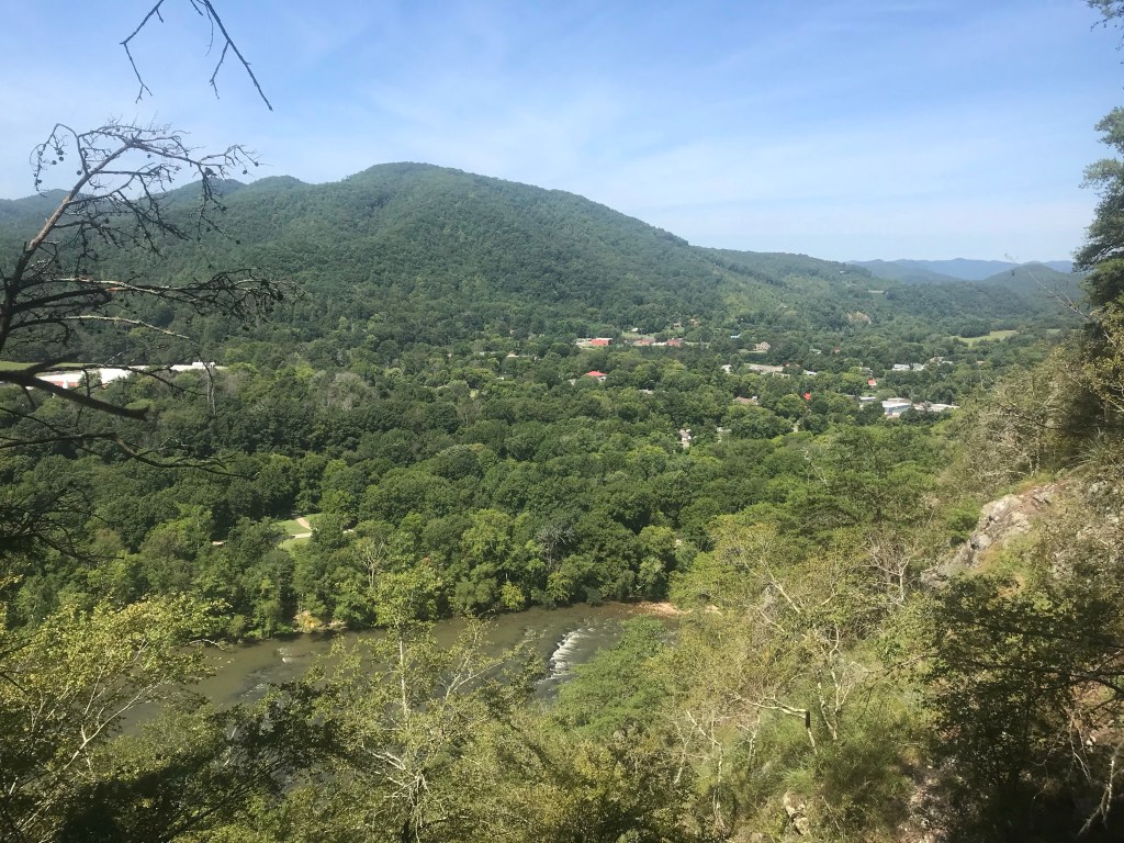
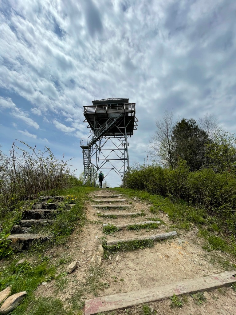
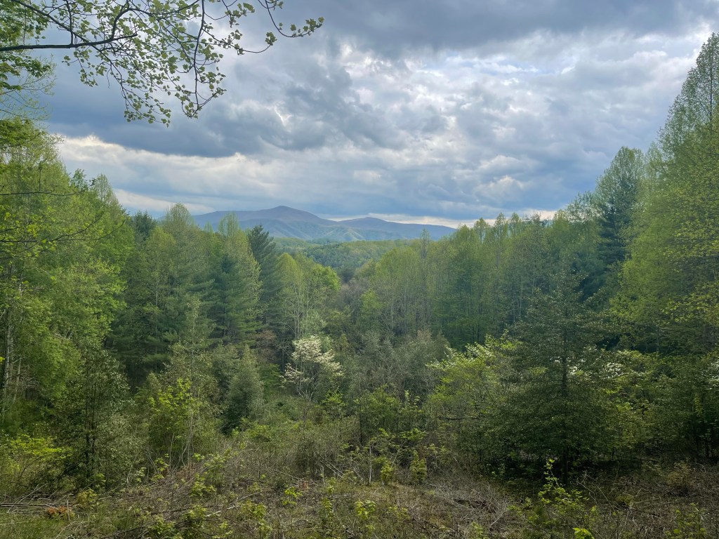
There was a nice view about 6 or 8 miles ahead that was nice.

I was getting to be around 5:00 and I was starting to get tired, and my feet were arguing with the rest of my body to stop, but the rain was coming and I needed to get to the shelter so I had a dry place to eat and to wait for the rain so I could set up my tent.

I kept pushing forward and with .5 miles left, I could see the rain moving over Roan Mountain, TN, so I did the only thing I knew to do, I prayed and asked God to hold it off for a bit and then I walked fast and at times ran!!

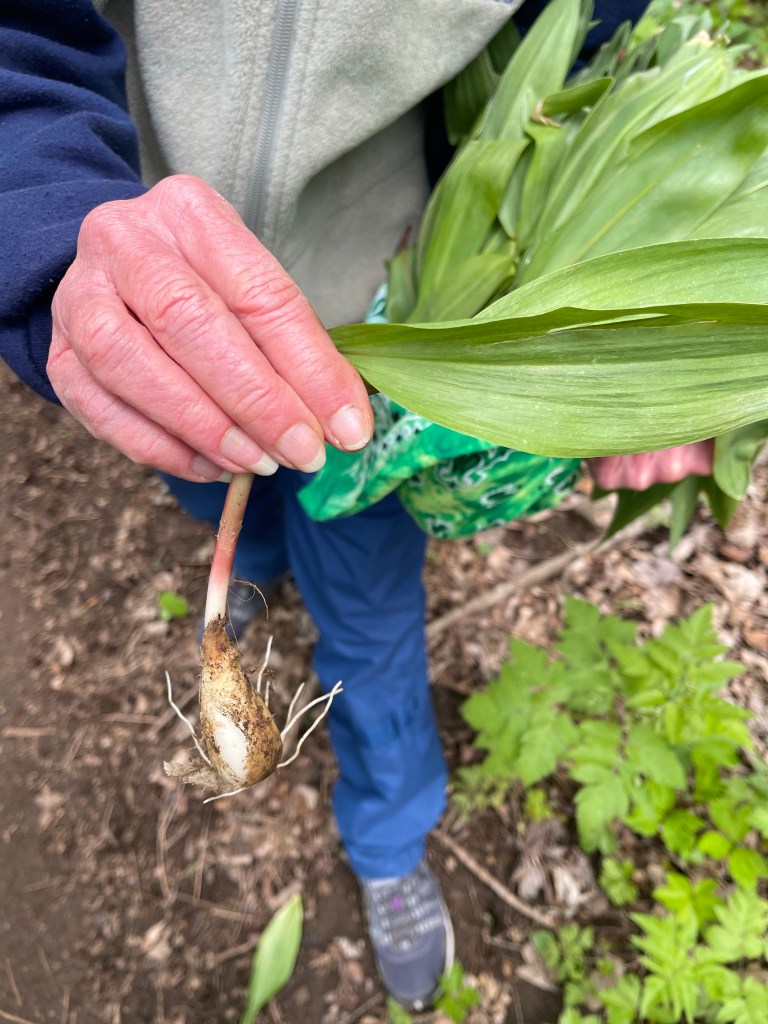
I got to the shelter, no rain, through up my tent, and the drizzle started!! Thank you Lord for keeping me dry. I made my dinner, and in my dinner, i had fresh veggies, where did i get them you might ask, i got them around the shelter! I added ramps and Garlic Mustard plants to my spaghetti, and it added some great flavor.

Then I hung my food bag, and got in my tent, dry. Now, as I finish this, it’s raining.

AT Thru-Hike Day 36

Carvers Gap (5,506 feet) mile 380.5 to Highway 19E (2,861 feet) mile 395.3 for a 14.8 mile day!

What an amazing day today! It was a day field with balds! I went over, Jane Bald, Round Bald, Grassy Ridge Bald, Little Hump Mountain, and Hump Mountain! This photo is super cool, it is looking north from Little Hump to Hump Mountain, and it’s been the only place, so far, that I could look into the distance and see the trail, what seemed to be miles away!

A bald is basically what it sounds like, a mountain with no trees on it, just as Max Patch was, but this time, the clouds weren’t down on my level. I believe this is what is called the Roan Highlands.

After climbing these balds and seeing the world around me it was time to make a descent. This was not any descent though, it was a 5.5 mile long descent down 2,845 feet in elevation! It was covered in rocks, big rocks, little rocks, medium size rocks, wet rocks, dry rocks, and rocks that were covered in moss and old dead leaves, in other words, there was some slick rocks!

About 1,000 feet into the descent there is a tent site called Doll Flats, mile 392.3, this is the point at which I left my home state of North Carolina for good! See you in September, North Carolina!!

Continuing on, I came to Highway 19E, and called The Station at 19E, where Dave and Amy and the gang run a great little hostel. Dave came and picked me up and brought me the .7 miles to the hostel where I had a nice dinner and watched a little bit of a movie, “The Postman”, with Kevin Costner. I put this here so I can remember the name of the movie!

AT Thru-Hike Day 35

Iron Mountain Gap (3,703 feet) mile 364.5 to Carvers Gap (5,506 feet) mile 380.5 for a 16 mile day!

The first 10 miles of the day were a fairly easy day, there was not much climbing and not much descending compared to the 375 miles previous, but it was still a tough hike and a great day as a whole.

Today was the first day in quite some time that we have seen full trail maintenance crews doing their thing along the trail.

I think some of the reason for this is that the Appalachian Trail Conservancy has lifted the COVID-19 work ban as well as restarted the tag program and the 2000 miler program. The tag program is basically a program that distributed tags to Thru-hikers to show that they are Thru-hikers for the current year. Because of COVID restrictions on trail they have refused to issue tags. The 2,000 miler program is a program to recognize folks who have hiked 2,000 miles in a year, basically acknowledging the AT Thru-hike. We will not qualify for the program since we will have hiked less than 2,000 miles since the date they started the program back, May 11, 2021. It sucks, but I don’t need their recognition to say that I hiked the whole trail, in the end, I and all who have followed my blog and my social media will know that I did the whole trail!

We continued on with our hike and made it to Hughes Gap Road (4,084 feet) mile 374.1, where we walked up to trail magic! It was great to sit for a spell and chat with a few AT FlipFlop Hikers class of 2019.

We started up the big climb to the old Cloudland Hotel site and on the way, we ran into a lady carrying a sack of plants. She had walked up the mountain to pick some Ramps, a flowering species of flowering onion widespread across the eastern United States.

We continued the climb up which got steeper and steeper as we went. We stopped for a short lunch break with an amazing view.

And then started tramping through another 6,000 foot plus spruce pine forest, which was dark, rocky and smelled amazing!!

Continuing our climb, we came to the old Cloudland Hotel site. I won’t go into much detail about it, but, it was built in 1884 and was opened for 20 years before being dismantled. It was a three story resort that catered to pleasure seekers and those suffering from Hay Fever. Weird, but okay.

Another mile and we made it to the end of this hike at Carvers Gap, where Suzanna was waiting for me after coming straight up after work. Kelly thought the stark contrast of Suzanna and I deserved a photo! Haha

AT Thru-Hike Day 33

Spivey Gap (3,184 feet) mile 333.1 to Beauty Spot (4,436 feet) mile 354.9 for a 21.8 mile day!

We started at Spivy Gap this morning, uphill for a little bit following the stream. It’s been kind of flat for the most part today! Which is strange but good. We have currently about 2 1/2 maybe 3 miles left to get to the 10 mile halfway point, doing a 22 mile day today. Going from Spivy gap over to Beauty Spot. It’s been raining all day long hands cold cold cold finally starting to warm up the hands a little bit, and the rain has finally started slacking off some, and that had warmed my hands up a little easier.

Today, Birdy and I met a guy called Spokes, he rode his bike from Anchorage, AK to his home in Virginia, some 4,100 miles, later, we found that after hiking with him for a while, today was his birthday! Happy birthday Spokes, nonetheless we got down to our 11 mile point at uncle Johnny’s Hostel, and later saw Spokes coming down the trail and met some woman who gave him a red sack. I thought maybe it was Uber eats. But come to find out it was his wife! She surprised him with birthday cinnamon rolls, and he brought them over and laid them out on the table for the other hikers, who were sitting around, to eat. He had no idea she was making the 6 hour drive to meet him at this point on trail! So sweet, so thoughtful!

Our descent into Uncle Johnny’s and the Erwin, TN area had been covered in fog and rain as most of the morning had, but as we came down in elevation we dropped below clouds enough to see this beautiful view of the Nolichuky River.

View of the Nolichuky River

The Mountain Laurel has been blooming nicely along the trail today!

Mt Laurel in bloom

Finishing lunch with some other hikers at UJ’s we marched on for our climb up to Beauty Spot. It was a fairly uneventful climb up the mountain, on these long days like this, especially with the rain, or change of rain, we rarely stop for breaks, even at shelters, just because we have so much ground to cover.

We followed a beautiful little creek for a while again on this climb, which always makes the day better with the sounds of cascades along the path.

We continued on and made it up to Beauty Spot, and what a beauty it was!! We finally got onto a bald and had some half way decent weather on top to enjoy the views as we waited for our ride back into town.

Beauty Spot

AT Thru Hike Day 31

Devils Fork Gap (3,102 feet) mile 311.1 to Sam’s Gap (3,719 feet) mile 319.7 for an 8.6 mile day. We ascended 2,702 feet and descended 2,096 feet.

All in all, this was a short and slow day. We have gotten to where we can hike 15 to 16 miles a day without a problem by 5:30 or 6:00 PM. This day started our week of slack packing, thanks to Christy and Matt McDonald, Kelly’s sister and brother-in-law! It has made for some big mile day, but today was short so we could come to a good stopping point for them to pick us up.

We woke early so Kelly’s husband James could get back on the road to Charlotte. It was a beautiful start to this short hike, even though it was a wet one!

It was a beautiful, and wet short day, but the waterfalls were plentiful along this stretch, at least in the first 3 – 5 miles of the trail which followed a nice mountain stream!

The rest of the day was wet and dreary, but it got us to where it we needed to be. As we came down into the area where we were to be picked up along I-26 we saw this plaque that was set by the family that gave some of the land for this portion of the AT!

AT Thru-Hike Day 30

Allen Gap (2,226 feet) mile 289.7 to Devils Fork Gap (3,102 feet) mile 311.1 for a 21.4 mile day. We ascended 5,023 feet and descended 4,336 feet.

This has been our longest day so far, even though we did it slack pack, we still walked 21.4 miles, it was still tough, and we were still beat when it was done! Slack pack is a term used when you are not carrying the full burden of your pack, basically you carry as little as possible because you are dropped off and picked up the same day. Since Kelly has family near by, they have offered to slack pack us and feed us on the daily, who would turn that offer down?

We set out on this bright and sunny day reminded that it was Mother’s Day, and pushing for a long day and crossing the 300 mile mark. I lost my mom to cancer September 6, 2012, and I am very thankful for the life that she lived, and all of the wonderful times I had with her. Mother’s Day’s aren’t the same anymore, for me at least. It’s not a time of sadness, it’s not of a time for remembering her life and the life of the other wonderful moms in my life.

We had hiked a little over a mile on this Mother’s Day before we came to some trail magic. This was the first trail magic we had had in quite some time! It was fruit, candy, chips, drinks, donuts, and some other pastries.

We sat and chatted with Mickey and Minnie, the trail angels, for about 30 minutes or so while we enjoyed our bounty. Mickey and Minnie met and started dating, Mickey said he wanted to Thru-hike the AT, Minnie, said okay, let’s go, and now they are married, and they did complete their Thru-hike, SOBO! Then, we were off to conquer this long day and the scenery that was to come. Seven miles up hill to start the day, along the way, about four miles in, we stopped at Little Laurel Shelter (3,360 feet) to rest for a few minutes and get a drink of water! Shelter stops are normally a good time to catch up with other hikers who we may or may not know.

Continuing on, about 6 miles, we came to the 300 mile mark, but first there was the beautiful and rugged rocky ridge section leading to the 300 mile mark. Master trail builder Howard McDonald, thought it would be possible to move the AT from a point on the lower side of the mountain to the absolute top of the ridge line. Because of the exposure on the 4,500 + foot ridge, they left the old trail as a bad weather alternative to escape the wind and slick rocks the rain would create.

This was not an easy task, it took them 5 years to create this 1.4 mile section of trail, moving huge rocks here and there to create more noticeable path for the hiker. The views this created in the process are spectacular!

Just as the bad weather trail and the exposed ridgeline trail join back together we came to the 300 mile mark!!

300 miles!!!!

Blasting past the 300 mile mark, we climbed Big Butt at 4,809 miles. This was the rockiest big butt I’ve every seen, I’m not going to lie!

From here we continued down hil to meet up with Kelly’s husband, James at Devils Fork Gap.

Devils Fork Gap

AT Thru-Hike Day 28

Garenflo Gap (2,467 feet), Mile 268.3 to Hot Springs, NC ( 1,336 feet) mile 274.9 for a 6.6 mile day. We ascended 974 feet and descended 2,125 feet.

You know, I’m going to be honest here, this was not as suck of a day as the last two but it was short and fairly uneventful! We walked down hill a lot and thankfully it was not nearly as slick as it was on the way down the day before. I didn’t fall any and nor did I slip any either, and that was saying a lot!!!

We passed Deer Park Mountain Shelter and saw another through hiker, he was standing in front of two grave stones, so, we had to stop and check out the situation. Not that there was really a situation to check out, it you know what I mean.

I did a little google searching on Eva Gragg and was not able to find much. Just a few posts on various AT websites and most commented on the quote at the bottom of the head stone, “Absent, Not Dead”. I am thinking that the Gragg family may have owned this property before the forest service bought it but I am unable to find any evidence of that. About the quote though, I don’t see any confusion with this quote at all, as a matter of fact, I think they are great words that I would like to have on my headstone, “Absent not dead”. God says in His word, “to be absent from the body is to be present with the Lord.” When death comes over us we leave this body that we have been given and therefore we are absent from it, and if we are believers in Christ, the Bible says we are in the presence of God immediately following death.

We hiked on from here and was shortly transported into the first real “Trail Community”, Hot Springs, NC.

In town, the Appalachian Trail runs down the sidewalk and instead of white blazes marking up the city, the AT logo is in the sidewalk.

Here is the golf ball I am still carrying for my friend Lucinda, on it is written her husbands name, Derren Supernavage, in memory of him and his love for golf. Well, he also had a love for the AT and wanted to hike the trail one day, now he is hiking it, right along with me!

AT Thru-Hike Day 29

Hot Springs, NC ( 1,336 feet) mile 274.9 to Allen Gap (2,226 feet) mile 289.7 for a 14.8 mile day. We ascended 4,467 feet and descended 3,725 feet.

For the first 6 miles, Kelly and I hike with Pickles. Pickles is a Golden doodle that Kelly and her husband James have, and she is an awesome dog and is a great off leash hiking companion. Pickles will walk in between the two people walking, she may slow some here or there but then she runs to catch up as to not slow the person in the back down.

Pickles

Just outside of Hot Springs, NC is Lovers Leap Rock, a great place to see the town of Hot Springs as a whole.

Hot Springs, NC from Lovers Leap Rock

We hiked the six miles with Pickles and then met James, Kelly’s husband, at Mill Ridge Road to drop off Pickles.

We crossed Tanyard Gap (2,259 feet) and started the climb of tree limbs cut into two and a half foot length pieces laid on their side, to form stairs. It’s super cool out here the way a vast majority of the things that create the trail are from the land.

We finally finished this climb and came to Rich Mountain Fire Tower.

Rich Mountain Fire Tower

Kelly hurried to the top of the tower to get a nice spot to enjoy views and lunch, but instead found a man asleep, at 1:30, in a sleeping bag. We later talked to someone who saw him move so we know he was alive! It just didn’t seem right so we walked up the trail a ways to a campsite and found a nice log to sit on for lunch!

One of the things I was looking forward to during this hike, was the chasing of spring. From dormant trees at higher elevation and walking down in elevation and seeing trees budding and greening out to flowers starting to bloom all around. One beautiful flower I have started seeing is the Lady Slippers Orchid.

Lady Slipper Orchid

Tomorrow we have a long day, we are going into the 20’s for the first time, our plan is to hike 21.4 miles!!

AT Thru-Hike Day 27

From a trail intersection at mile 254.1 to Garenflo Gap (2,467 feet), Mile 268.3, for a 14.2 mile day. We ascended 2,476 feet and descended 4,268 feet.

5:00 AM, the alarm sounded and it was time to climb the one mile up to Max Patch, one of the awaited views on the Thru-hike, so we could catch the sunrise. Well, I turned my headlight on and unzipped the tent, and all I saw was the light shining on a blanket of white, we were covered in fog! Nonetheless, we pressed on to Max Patch!

Mac’s Patch, as it was originally named, is one of the most anticipated views on the Appalachian Trail. One would have probably found cattle and sheep grazing on this lush, Scottish Highland looking meadow in the early 1800’s. In the 1920’s and 30’s this 4,692 foot dot on a map was used as an airstrip, somehow, and in 1982 the United States Forest Service bought mac’s patch keeping it a grassy highland, and periodically it gets a haircut to keep its lush field of green look.

Well, we made it up there and we were in fact white walled by the fog! So, we sat down and enjoyed some breakfast and coffee behind a pair of rocks to block the wind. It was now time to move on to get about hiking to our campsite, just six miles out of the town of Hot Springs, NC, another 13.2 miles away from these rocks that shielded us from the blistering wind. As we got up, we noticed the fog was lifting behind us and we didn’t even know it, and then we turned back around and it was now lifting in front of us.

Mack’s patch fog lifting

All in all, we waited around another 30 minutes to enjoy some absolutely amazing views of this iconic place. I can see now why people flock to this location to setup their tents and await the sunset and the sunrise that awaits them on a beautiful day. Unfortunately, a vast majority of those enjoying this absolutely gorgeous creation of God, do not care for it much past the camera lens. There is often times, even today, trash scattered on this beautiful place, because people come up here and brave the winds to get that special time with their people but fail to practice Leave No Trace.! If you can carry it in, how hard is it to carry it right back out!?!?

Mack’s Patch

After enjoying these views we hiked on, stopping briefly at Roaring Fork Shelter (3,980 feet) at mile 257, for some water and a stop at the privy! From here we marched forward to Walnut Mountain Shelter (4,241 feet) mile 261, and stopped there for lunch and to dry out clothes.

Before getting to the shelter, we crossed Lemon Gap, and here, we learned a little something from an Appalachian Trail Conservancy employee. Garlic mustard, is a very invasive plant that puts out a chemical that keeps other plants from growing. It was planted around the Appalachian Mountains by folks living in these mountains years and years ago, because it has delicious edible leaves, but it can produce 5,000 seeds and they can live in the ground for five years or more! So, through out the growing season they will come out with bags and pull these weeds in certain areas, sometimes collecting as many as 200 pounds of garlic mustard weeds!

Once at the shelter we got our clothes dried out and enjoyed some sunshine and then a little rain came back in, after a short nap and the rain stopping we decided to make our way the remaining 6+ miles to Garenflo Gap!

About a half a mile or so north bound, the rain started back, and it did not stop until we got to Garenflo Gap!! Then, once at the gap, there was a group of women who were on a backpacking adventure all setup in the space we planned on the tenting. We were not sure how this would work out, and then they told us they were leaving, the were tired of the rain! Two days of rain takes a toll on anyone! But, we survived!

AT Thru-Hike Day 26

A cascade and tent stealth site, mile 240 to a trail intersection at mile 254.1 for a 14.1 mile day. We ascended 4,812 feet and descended 2,315 feet.

Oh my, oh my, where do I start with this day??? I guess at the beginning!

We woke up to thunder, we hurried to pack all of our stuff to keep it from getting anymore wet than it was and hike down to the intersection of Appalachian Trail and interstate 40 where we could unpack and eat and sit under the protection of an overpass.

Approaching the overpass we crossed the Pigeon River, a beautiful flowing, wide river, with great whitewater rafting.

Pigeon River

We stopped, only briefly, under the overpass before a small silver car pulled up next to us, the driver rolled the window down and asked if we would like some food. At first, we were a little hesitant and said, “no thank you”, but then he asked if we wanted bananas and strawberries, ummmm, “yes please”, came the response. He had, strawberries, bananas, honeybuns, and best of all, he had ziploc bags we could put our trash into, again, the best trail magic is fruit and to help us reduce weight by taking our trash!

We stayed under the bridge a while, chatting with Tim, the teacher, from Nashville, TN. before making our way up the mountain. By up the mountain I mean we climbed our way from 1,735 feet to 4,169 feet. At the top lay, Snowbird Peak, on the top of this mountain peak was an FAA VOR station. Pilots use these stations to navigate to and from around the globe.

We headed back down after crossing this bald, but not all the way back down, we went to Groundhog Creek Shelter, 2,828feet. This shelter had a sign on it about bears running off with peoples food bags, and, big surprise, a mom and three cubs showed up later that night, and the hikers who were there ran them off, but we were long gone.

Somewhere along the way, the sky grew dark, and the rain started shortly after that, and boy did it rain!! It was like the Forrest Gump kind of rain, straight down, at an angle, sideways, never really from below though. It rained all the way until we got to Groundhog Creek Shelter, and continued raining for hours. For hours we sat in the shelter and waited for the rain to stop.

The rain finally stopped and we decided to get back on the trail to try to reach as close to Max Patch as we could.

We continued on, following the blazes. Blazes are the markings on trees that allows hikers to know where the AT goes. The Appalachian National Scenic Trail is blazed using white blazes to designate the main trail.

Usually there is a single blaze measuring 2 inches wide by 6 inches tall, roughly 6 feet off the ground, indicating you are on the correct path, keep on hiking. If there are two blazes stacked, like in the picture, the top blaze will tell the hiker the direction the trail turns, so in this case, the AT turned to the left. These are usually at a hard change intersection or there is another trail near by that could confuse the hiker. Another often seen blaze on the trail is the blue blaze. Usually leading to water or a shelter or some other spur off of the AT, but it isn’t the designated main path. This double blaze happened to be at the intersection of a trail that we decided to make camp at just one mile from Max Patch.