Elk Garden (4,449 feet) mile 494.9 to Brook Campsite (3,438 feet) mile 511.8 for a 16.9 mile day!
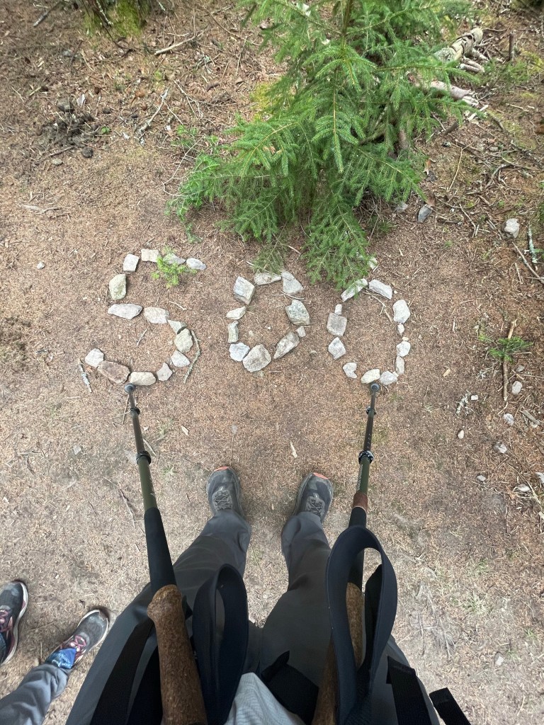
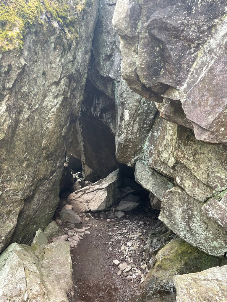
Lots of things today, Grayson Highlands and the Ponies, Fat Mans Squeeze, 500 miles!!!
It was also a suck day, you see, the Grayson Highlands trails are mainly rocks, big rocks, little rocks, medium rocks, some move, and some don’t! This makes for slow hiking because you have to be very careful not to twist or blowout an ankle.
I started up through that beautiful meadow I saw from the campsite the night before, and it was just as pretty walking through it, but it didn’t go as far as I thought it would. From the Elk Garden parking lot, it was about a five mile hike to get back up to the highlands which were a Bald area where the ponies lived. I found out that there is a parking area called Massie Gap, so if I ever come back here, I can park there and not have to walk the 5 miles in to get to the ponies.
On the way north we passed the Mt. Rogers trail, which leads to the highest point in Virginia, we didn’t take it since it was a half a mile one way with no views at its “summit”.
It seems like to is was the point where the rocks really started, they only got worse from here though.

Just before we officially entered the state park, we crossed a major milestone, that happened to be made out of stones! We have officially walked 500 miles now.
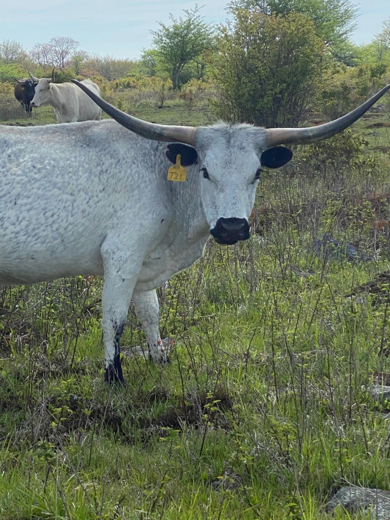
Grayson Highlands State Park, is a series of balds with spruce pines spread here and there, it sits at 4,999 feet and is covered with huge rock boulders with a pinkish color and a volcanic rock looking texture. I will have to research later to see if they could be possible right here. The balds keep their highland look thanks to a band of ponies and long horn cows. These beautiful animals help to keep the grass short and a lot of the other vegetation trimmed down nicely. Oh, and they aren’t scared of humans much either, although signs said not to feed them… duh, and they would kick, again, duh!

There is a section in here, I think it’s just for fun, because I saw a perfectly clear and easy route around it, called “The Fat Mans Squeeze”. The AT trail goes through this small narrow rock outcropping to get out to the other side.
We continued for the rest of our day to see ponies and while eating lunch we saw a big herd of long horn cows. Calving season was recently, there were babies everywhere!

The rest of the day continued to be rocky, even after passing the highlands, and this just add for a miserable day. The rocky path is so hard on the feet and ankles and when it’s 12 miles or so worth of rocky walking, ugh, but, we gotta do what we gotta do, and so it was done! We rock!!!

Love traveling along!!!
LikeLike