Canopus Lake Beach (916 feet) mile 1426.9 to Morgan Stewart Shelter (1,303 feet) mile 1,440.9 for a 14 mile day.
Canopus Lake is a beautiful lake that is located in Clarence Fahnestock State Park. It is a really long lake running north to south. Not real sure why, but, there is no swimming on the south end of the lake but at the north end there is a beach where locals come out to spend the day and swim. Near the beach is also an area that is designated for thru-hikers to set up a tent and camp, they have access to showers and such there too. The park is in the construction phase of a new shelter that hikers will also be able to use there. Another thing I can’t understand, why is there so much shoreline on this lake and the trail only walks by it for about 300 feet! It would be such a beautiful hike in an area that had only one view in fourteen miles!

We stayed in the campground area of the park with Kelly’s in laws, John and Lou. It was great to see them again and get some good food I. The evenings! New Jersey and New York have delis all along the trail and there is hiking here called deli blazing, and it has been a great treat and a great way to add calories in the day! Haha
We hiked back out the .7 miles blue blaze to meet back up with the white blazes of the AT, put our blinkers on and headed North!
We hiked for about 2.5 miles north and finally came to a wonderful view from atop Shenandoah Mountain that looked back over the lake and far beyond. At the top is painted this lovely tribute to the tragedy of September 11, 2001

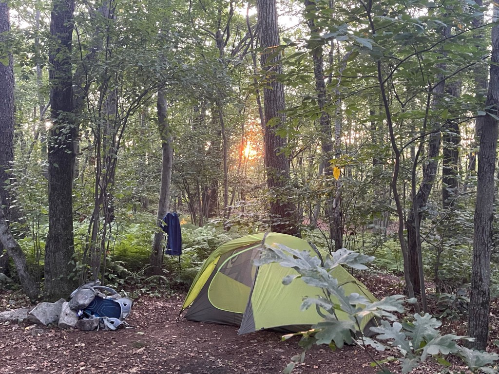
We continued on the monotonous and boring hike through the lowlands of the state of New York. It felt like the trail designers had gotten some push back from the area for bringing hikers through their area so they said, fine, if you can’t figure out how to go around, you can come through this area with no views. Nonetheless, we pressed on and came to our shelter where we would setup camp. New York and Connecticut have wells drilled at some of the shelters, but there is now a problem. The National Park Service recently did a water test on the wells and it was determined that the water in the wells was not up to the standards to be drinkable.
The Appalachian Trail Conservancy gave this statement in a text message that came out today, “Hikers should take extra precautions and plan on carrying extra water through these sections, particularly in hot summer months when seasonal springs could run dry,” said Andrew Downs, Senior Regional Director for the ATC. Keep in mind, there are very few alternative sources for water in these areas due to surrounding farms, and highways and such. It may be 8-10 miles with no water, then you get to a shelter where you cook and do other camp chores needing water and the only water you have is the water you can carry in. So, the ATC accepted 19 million dollars from a pipeline company because the trail view was disturbed by the new pipeline, but they can’t get funding to update the well systems or dig new wells? Yes, the ATC, “oversees” the trail, but they do so without care for the hiking community. Politics suck as does political figures in non profit leadership positions. Oh, yes, I hand pumped my own water and it was delicious and cold!!

Sorry for the tangent there, I’m done.! Good night!

Hahaha…. You’re allowed to go off on a tangent (especially when dealing with politics!). All good!!!!
LikeLike