AT Thru-Hike Day 10-12

AT Thru-Hike Day 10

Mile 81, Muskrat Creek Shelter ( 4,567 feet) to Mile 93.5 Carter Gap Shelter (4,518 feet) for a day total of 12.5 miles. We can not and will not do anymore 12 mile days too soon. It takes a huge toll on the body to hike in these mountains!

We left out of camp around 8:30 today with a goal to get to Standing Indian Mountain (5,478 feet) for lunch and hang out and eat. We made it there just in time, 12:00 on the dot!

View from Blood Mountain

The Cherokee name for the mountain translates to, “where the man stood”, according to a reference in Wikipedia. The story goes the man was supposed to stand guard on the mountain to protect the children from being stolen by the winged monster. The tribe prayed to the great spirit for protection, the protection came in the way of thunder and lightning, which scare away the man standing guard. Because he left his post he was turned to stone.

We descended Standing Indian Mountain with the intent to set up camp at Beech Gap but it was a small tight space with lots of low hanging trees and no where to hang a bear bag.

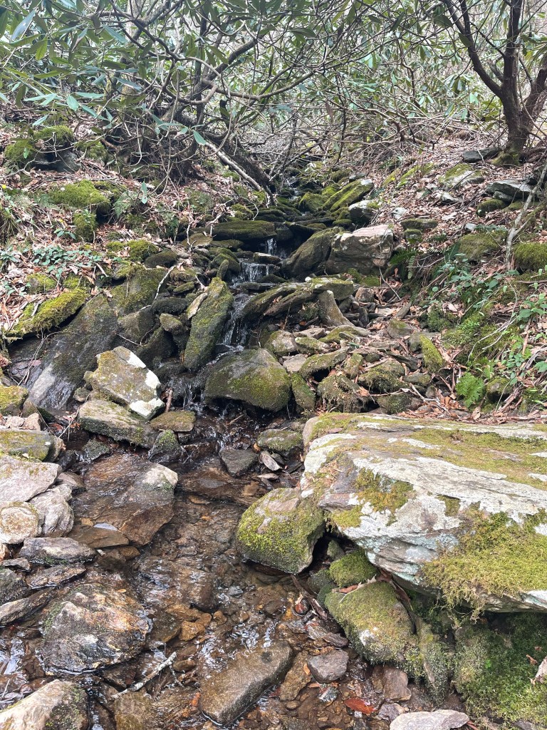
Found a great stream finally today to photograph and to get water. Most of the streams have been really small and slow flowing, but not this one!

We finally made it to Carter Gap Shelter and got camp set up and cooked. Just my luck, I ran out of gas tonight so I had to borrow some, it worked out though. The guy had an extra can so now I get to eat tomorrow night! Haha

AT Thru-Hike Day 11

We hit mile 100 today!! We started at mile 93.5 Carter Gap Shelter (4,518 feet) to a stealth campsite at mile 103 near Glassman Gap ( 4,162 feet). We ascended 1,705 feet and descended 2,200 feet for a grade of 397 feet/mile.

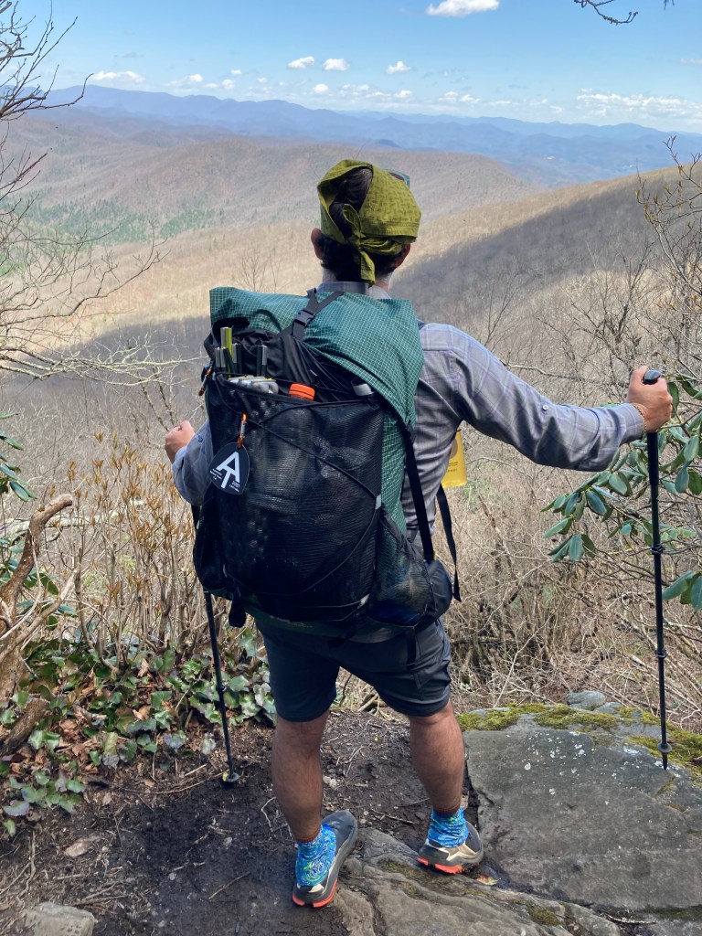
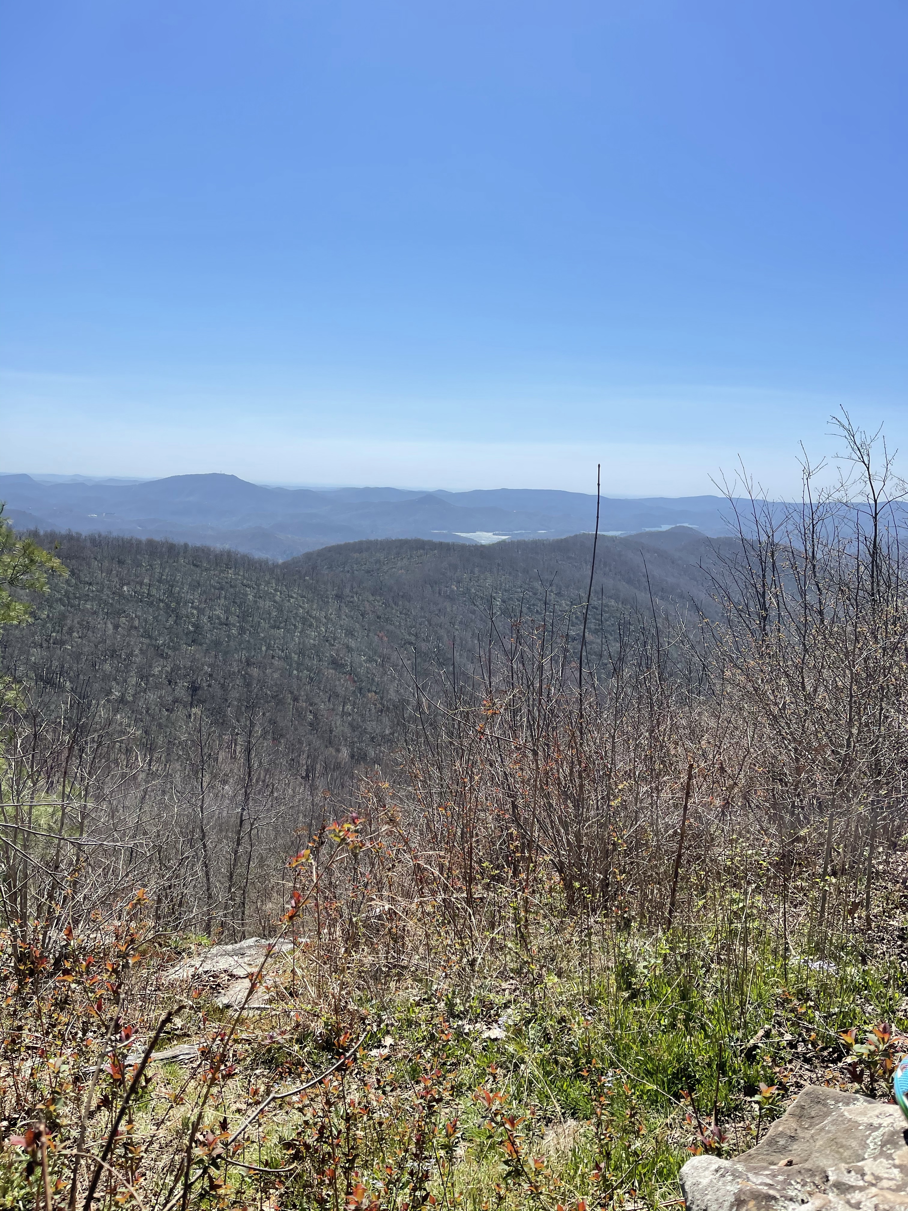
At mile 98.5 we turned off trail to see one of the most amazing views we have probably seen yet.

From here we continued on, passing through Mooney Gap and walking a razors edge of a trail up to Albert Mountain, our big climb for the day.

A few tenths of a mile before the hand over hand climbs up Albert Mountain there is a road passing along side the trail, it’s a gravel forest road, there we saw a familiar sight and a familiar face, we saw Onesimus again doing trail magic, handing out ice cream sandwiches! The climb up to the 100 mile mark was a tough one, so we sat and ate an ice cream sandwich and lunch, not in that order of course, Who eats dessert first, to boost us over!

What is that .2 mile section like from the road to the top, well, 4,830 feet up to 5,213 feet, that’s what it’s like!

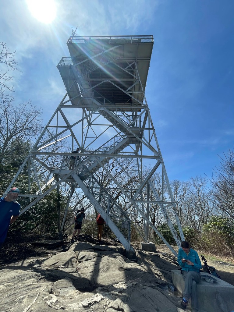
The unofficial, photo opp spot for the mileage marker is the Albert Mountain Fire Tower.

100 miles!!!

The fire tower was built in 1951 to protect the Coweeta Basin from fire. The structure is 40 foot tall steel with a 14 x 14 “room” on top. It was the last of its kind built in western North Carolina.

After hanging at the tower for a while with others we headed down hill.

Funny enough, as you see, written on the fire tower is the 100 mile mark, but, it’s actually about 2 tenths of a mile north.

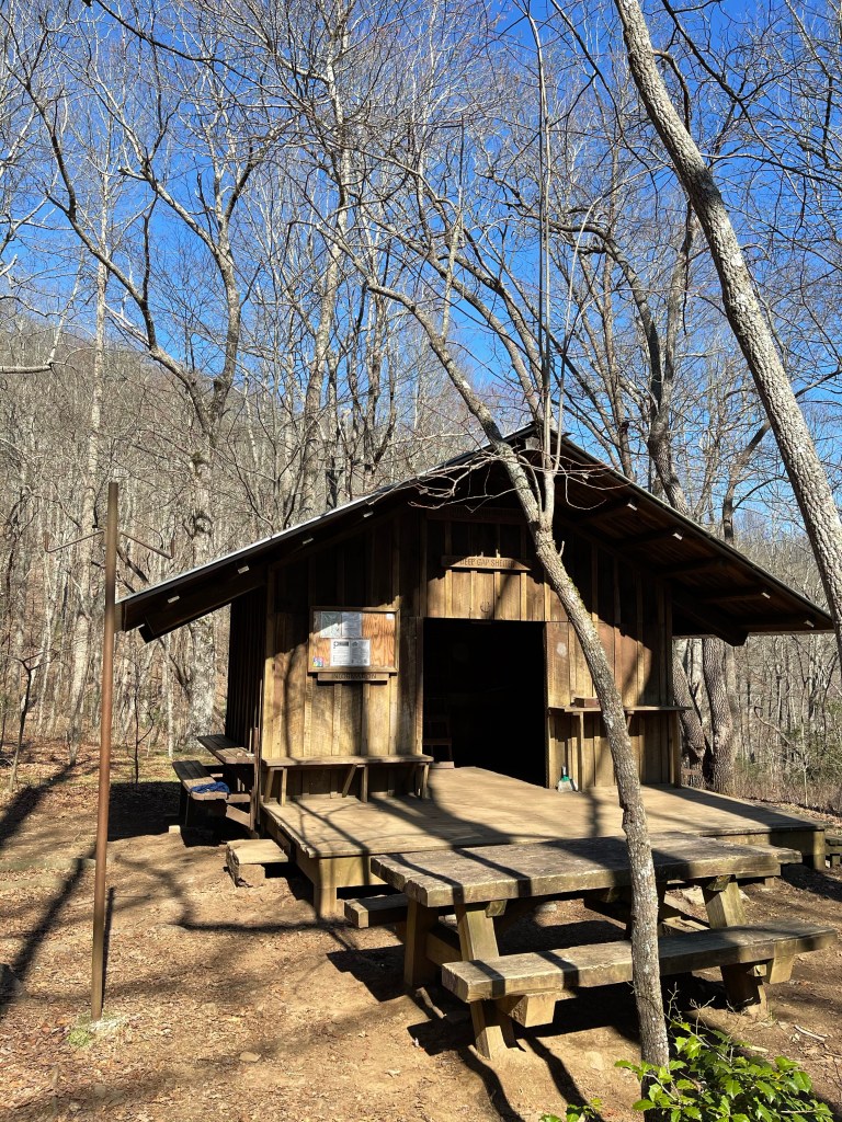
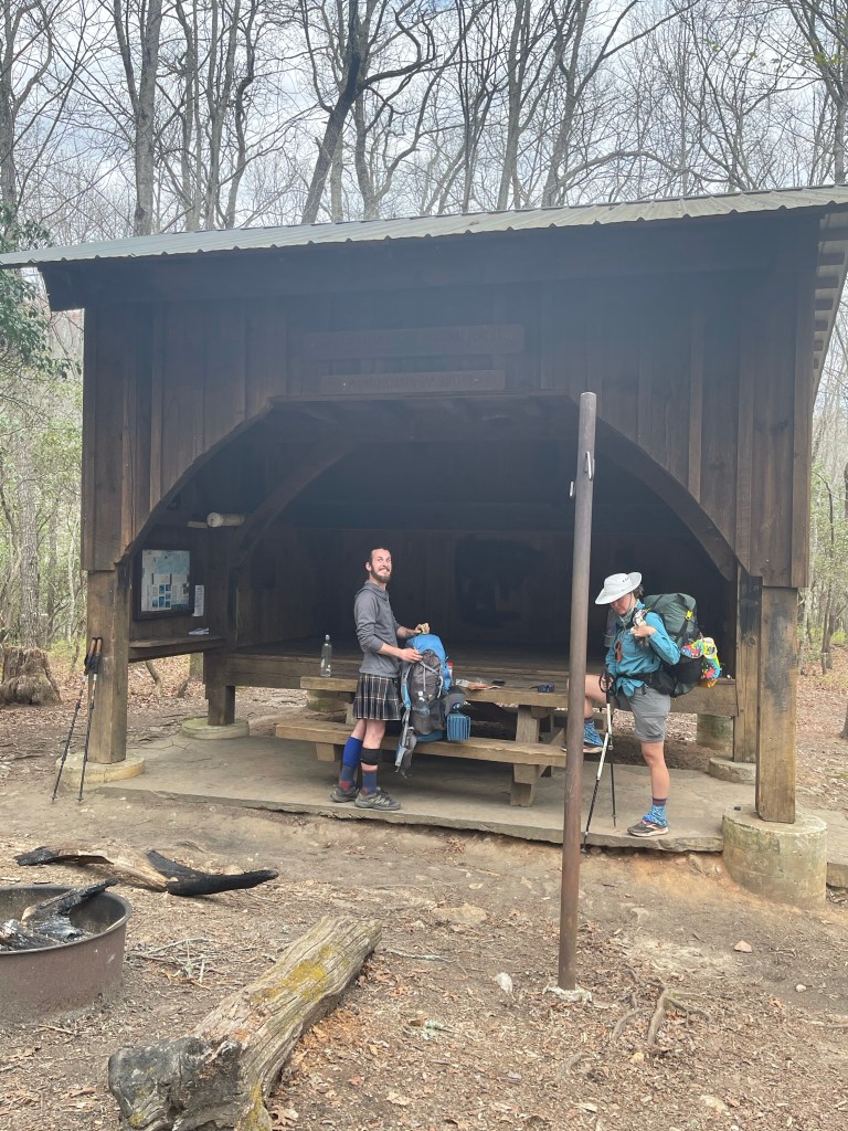
We continued down to the shelter where we had planned on staying, by this time, my feet were hurting and my right calve muscle was telling me I should not just think about stopping but should definitely stop. Then, we get to the shelter, long branch, mile102.1 and 4,431 feet. It was a horrible place to put a tent. The shelter was very nice and pretty new, but tent spaces were not good. So, I told my feet that they needed to push on a few more miles, and they did, one more mile to an area called Glassmine Gap mile 103 (4,162 feet).

AT Thru-Hike Day 12

We slept in late today knowing we had only 6.4 miles to hike to get to the road for our pickup at Winding Stair Gap.

We left from Glassmine Gap mile 103.0 and headed to Winding Stair Gap mile 109.4, we ascended 1,020 feet and ascended 1,532 feet. Pretty easy day all around.

We made our way down to Rock Gap Shelter (3,797 feet) and came around a bend to see the privy. When I say we saw the privy, I mean right inside of it!! Glad no one was sitting on the toilet when we went by or we would have seen right in there!!

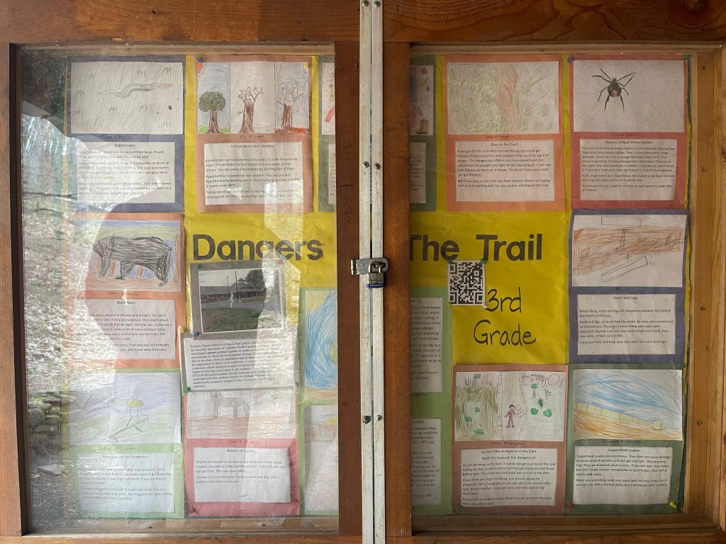
The shelter was super cool in that, it had on the wall a big sign made by a 3rd grade class from a school in Cashiers, NC. The sign was titled, “Dangers of the Trail”. It listed about 14 or so things lurking in the forest that could shorten a Thru hike attempt!

“Dangers of the Trail”

Leaving the shelter and heading into Rock Gap (3,735 feet) we saw a group of cars with hikers standing around, this usually means one of two things, “trail magic” or “water”, this one was trail magic!!! Banana’s!!!! Oh, and some candy and donuts, and boy were they covered in sugar and other things that made me feel horrible after eating them!!

Going up and over another hill, passed a road leading to Standing Indian Campground we began climbing, and this would be our final climb for the week before descending down into Winding Stair Gap (3,688 feet).

Here we ran into “Snoopy” again, a trail angel who we had seen a day earlier, he is following along with his wife, “Hiking Hobbit”, who injured herself on Blood Mountain, some 80 miles back!!! Good on her for pushing on after that fall!

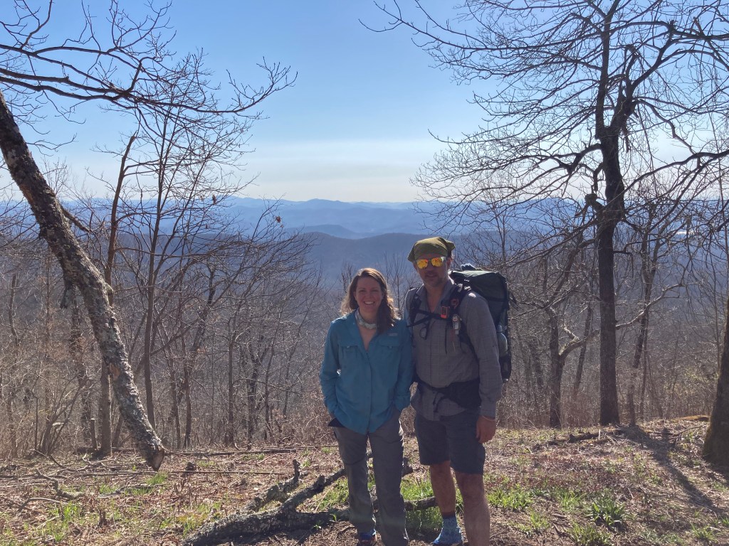
We weren’t there for 2 minutes before my dad and stepmom showed up!

AT Thru Hike, Day 7 and more

Suzanna drove me back out to Unicoi Gap to get back on the trail. There were van loads of hikers unloading when we got there. It took us 5.8 miles to catch up to them since we stayed around at the gap taking pictures of Blue Blaze beer cans. Blue Blaze is an AT themed brewery in west Charlotte, it’s actually where Kelly and I met.

We hiked 2.7 miles, up and over Rocky Mountain to Indian Grave Gap. From there we hiked up Tray Mountain and started back down and stopped at Tray Mountain Shelter, for an additional 3.2 miles and 1,300 feet!

There were several amazing views along the way.

Next we hiked up and over Tray Mountain, a 1.8 mile journey up 600 feet and down 1,200 feet! In hiking, uphills wreck havoc on the thighs, butt, and claves. What the uphills don’t get on the legs, the downhills do! Then we went up and down, up and over for the next three miles to Sassafras Gap! Here we set up camp, ate and waited for the sun to go down before calling it a night.

Life on the Appalachian trail is wonderful, it, for the most part, runs north to south and therefore, every evening and every morning has its sunsets and sunrises!

Today as the first time that my feet started hurting. It feels like with ever step I take my feet stretch. Not sure if it’s planter fasciitis or just stress of walking 8-10 miles per day. I have rolled it with my cork ball after diner and will see how the 6.4 miles feels tomorrow.

AT Thru-Hike, Day 8

Slept horrible last night! Not sure if it was because I was in a bed the three nights previous or what!

We left Sassafras Gap headed for Dicks Creek Gap, a 6.3 mile hike for the day, from mile 62.9 to mile 69.2. We ascended 1,577 feet, and descended 2,351 feet, the total grade was 615 feet per mile.

It was not the toughest of days but it was a lot like life, up and down!!

The first climb, basically right after getting out of bed, was up Kelly Knob, (4,144 feet) and it was 800 feet in .9 miles.

Kelly standing on Kelly knob.!

One thing I try hard to do when I’m hiking is to not stop mid climb, now obviously if it’s 2 miles of climb, that’s different! I like to make the climb and the enjoy the reward, the view, well, and some water!

From this beautiful view, we headed down the mountain to check out the Deep Gap Shelter (3,454 feet), where we sat for a few minutes and used the privy. 🙂 Way better than digging a 6 inch cat hole! :-0

Deep Gap Shelter

We continued up and down the trail to Powell Mountain Vista (3,886 feet), what an amazing view!!

Powell Mountain Vista

North we went, for 3 plus miles to Dicks Creek Gap (2,654 feet). Here we waited for George and Sherrie Warren, my stepmoms dad and stepmom to pick us up. We rode into Clayton, Ga. with them to stay at their house, and while there they loaned us Charlie’s (the lab) car, it’s the car he can ride in, hahah and we went into town to Outdoor76 and grab some Mexican food. We went into Walgreens to get some stuff for Kelly and I checked to see if they had any no show COVID-19, and they did, so I got my second vaccine! I’m not a vaccine guy but being out here with all of these people and going into all these towns, I thought it best to go ahead and get it.

AT Thru-Hike Day 9

Dicks Creek Gap (2,654 feet) Mile 69.2 to Mile 81, Muskrat Shelter ( 4,567 feet) we ascended 4,251 feet and descended 2,364 feet!

We had originally planned to only go about 8.5 miles, but when we were almost to that gap, someone told us there was Nora Virus in the water and we wanted nothing to do with that!

We stopped in after hiking 4.5 miles we stopped at Plumorchard Shelter (3,008 feet). It was a super cool shelter with three levels! There was a sign on the wall that showed a shelter being lowered in by helicopter and we assumed that is how it got there.

Scotsman and Kelly packing up to head back out

When we walked up to the shelter, we were greeted by the most loving, giant dog!! His name is Diesel, his mom isn’t sure, but I think he is a wolf dog!

Getting some love from Diesel

From plumorchard we made our way to the North Carolina/ Georgia border (3,885 feet). We were in need of water, I finished off 5.5 liters, and we were climbing up the side of Sharp Top Mountain and saw some folks standing around, we got excited it was water, but it wasn’t water, it was NC!!

One state down, thirteen to go

From here, the plan was to hike to Bly Gap Shelter (3,820 feet), and this is where the supposed case of the Nora Virus came from. We changed our plan and hiked on to Muskrat creek Shelter (4,567 feet), mile 81.0. This added 1,443.6 feet to our ascension!!

We hung at the shelter and set up our kitchen, cooked our dinner, ate, and then headed back to the tent to lay down.

Laying down, it was cloudy, waking up it was bright sunny blue skies.

Week one on trail

This one is long, but not totally as complete as i would like. I had phone issues and lost pictures and power so some of the days journaling couldn’t happen. So, you will see around day 4 it got shorter, now you know why. Question for you readers, leave a comment as to layout of this. Do you want this much info? Do you want other info? Let me know in the comments.

Well, 4.3.21 has now come and gone! I have now been on trail for 6 days, well, currently sitting in a Fairfield Inn in Helen, Ga. The first day started off great! Woke up and went down for breakfast at Amicalola Falls Lodge, not a very good buffet, but, it was food so I ate! We went from there down to the arch at the visitor center at Amicalola Falls to sign in and get our starting number. I am number 1501 and my packed weighed 24 pounds without my 2 liters of water, final destination, I put, Katahdin! From here, we all, Stuart, my girlfriend Suzann, Kelly (my hiking partner), James (Kelly’s husband), and my youngest son Elijah, loaded into the truck and headed up to Springer mountain to start the adventure of a lifetime. This was a change in the original plan, originally we were going to start at the arch and hike up the approach trail, but we decided to save our legs, lungs, feet and bodies and not attempt this 8.8 mile, 3,137.1 foot ascent on the first day, since, of course, this trail was not a white blazed Appalachian Trail.

We arrived at Springer Mountain parking area, and all hiked South for 1 mile following the white blazes to the plaque on Springer Mountain. After taking the obligatory pictures in front of the plaque and signing the trail log, we hiked the 1 mile back to the parking area, where we began our teary goodbyes. It is hard walking away from your youngest son and your girlfriend knowing you won’t see them everyday like normal. All in all, we did pretty well with the goodbyes and they didn’t last long, knowing I would see them again in 2 weeks in Franklin, NC made it a little easier.

Day 1: Mile 0 to Mile 8.1 where we stayed the night at Hawk Mountain Shelter, but we didn’t stay in the shelter. We are staying away from shelters for the most part because of the mice and rat problems that are around them and the overall uncleanliness of the whole shelter idea. We descended 1,800 feet and ascended 1,094 feet for a 350 feet per mile grade. As a whole, it was a good day, there were no really difficult climbs nor were there any major muscle pains or aches. 🙂 With the first day came our first trail magic, at mile 1, it was a AT greeter just welcoming thru hikers and section hikers to the trail.

We hiked a few miles and then Tim came up behind us. Tim is out here as hikingsober, he is celebrating two years of sobriety and wants to do this to show others what is possible in sobriety. I think he wants to have the trail name, “soberhagen” because he is sober and dips Copenhagen! Haha
We continued on and came to a white truck sitting by a road, on this truck was a signs that read, “trail magic” with and arrow pointing down the road. It was one scary site and Kelly and I both agreed we shouldn’t go down there. We started back down the trail but stopped as I read Guthook and the notes saying how great the trail magic was, so, we went for it, and it was a good bunch of trail magic for sure.
We continued on for about 1.5 miles to Hawk Mountain shelter. Here, we setup our tent, cooked our food and chatted with other hikers. By 7:00 I was in my quilt all bundled up. Now to figure out how to stay warm in here! So long for now!

Day 2: Mile 8.1 to Mile 16.9 for a day total of 8.8 miles. Ascended 2,142 feet and descended 2,454 feet for a 505 feet per mile grade. Today, we avoided the shelter all together, when we arrived at the shelter, it was too early to stop and it was already a little crowded. Today, we ran into Tim again and “soberhagen” has in fact stuck as his trail name, and he seemed pretty excited with the name. We stayed at Gooch Gap tonight and met Shawn and his Lab Jake, they were hiking south bound, just for a few days. Just as we were getting into out sleeping bags to go to sleep, bedtime on trail is 8:30ish, a car drove up the forest road and asked if any of us wanted water, and then if we had any trash that we wanted to get rid of. One thing that I have learned on trail is that the rumors were true and part of the reason I chose to do this hike.

Day3: Mile 16.9- 26.2 for a day total of 9.3 mile. Ascended 2,215 feet and descended 1,656 feet for a 404 feet per mile grade. When we were at the first trail magic, by a cemetery, we met a gentleman called, Papa Smurf, white hair with a white beard and round face, who told us he may see us again at Woody Gap. Around noon we can down the short hill into Woody Gap, we didn’t see Papa Smurf, but we did see “the bus”. “The bus”, belongs to the Twelve Tribes, which, as it was explained by a gentlemen there serving, is a religious organization that follows the pattern of the early church written in Acts 2:44 and 4:32, sharing all things in common. For many years this group has provided trail magic to the “pilgrims” who have chose to make this journey north to Katahdin. The group provided lentil stew, a maté tea, which is a highly caffeinated tea leaf that is used in South America in place of coffee by some, and maté trail bars. We continued north from here up and over a few nice climbs to a part of the trail called, Jarrard Gap. Jarrard Gap is the last place one can camp without a bear canister between March 1 and June 1 until Neel Gap, and being that we have no bear canister and didn’t want to hike the 15 miles to Neel Gap, we stayed at Jarrard Gap! Saw our first rattle snake on trail, right in the middle of the trail, today, and it was a pretty good size. Around 2.5-3 feet long with a more rattlers than my boys crib when they were babies!

Day 4 mile 26.2 to mile 35 for a day total of 8.8 miles for the day. Ascended 2,586 feet and descended 2,341 feet, for a grade of 539 feet per mile. Today was the day, today we would climb Blood Mountain and then descend it into Neel Gap! Blood mountain is the highest peak on the AT in the Georgia section and the fourth highest peak in Georgia. Blood Mountain and nearby Slaughter creek, aptly named for a battle that is said to have taken place between the Creek and Cherokee Indians, where, the story goes, the battle was so brutal, the mountain ran red with blood. Coming into Neel Gap, named after a government surveyor, W.R. Neel, one sees the stone building with and arch off to the left side of the building. It is through this arch that an AT Thru-hiker must walk. Fun fact, this is the only man made structure the Appalachian Trail goes through. Towering above the Mountain Crossing Outfitters is an old tree, dangling from this tree are hiking boots and shoes of all shapes and sizes. The story goes, hikers attempting to reach Maine, who get beat down by Sassafras Mountain and Blood Mountain, throw there shoes up into the tree giving up. To me, some of those boots look too perfectly placed, too old, with some really long strings to fit that story, nonetheless, that’s the story and we will go along.

Day 5 mile 35 to mile 44.1 for a 9.1 mile day. We ascended 1,994 feet and descended 2,384 feet, for a grade of 489 feet per mile.

Day 6 was mile 44.1 to mile 52.5 for an 8.4 mile day. We ascended 1,534 feet and descended 1,892 feet, for a grade of 408 feet per mile. At mile 44.1 we setup tents in Poplar Stamp Gap. Mile 52.5 we ended that Thursday hike at Unicoi Gap where we waited for Suzanna to come pick us up. We were staying in town for the weekend and the hike over to the next highway was too far to do in one day so we decided to stay a extra night in town. We chose to go east of the trail into Helen, Ga. instead of west to Hiawasee, Ga.

Short but sweet

It’s currently 10:26 PM on Friday April 2, 2021. I just got off of the table after being adjusted by my stepmom. She is a chiropractor that uses Applied Kinesiology to find the parts of the body that can remove pain or tight muscles in another area of the body. Honesty, it’s a little crazy, but, I’m not complaining! After a lot of work on my left foot, it got to a point where I could feel it in my lower back, were talking about my foot, ok. So, she moved up to my L5, lumbar 5 and put her arthrostim device there and let it “jack hammer” on the L5, once I heard the “jack hammering” release I could feel the pain go away in my foot. The body is so amazing.

So, rewind to 6:00 pm, it was me, my girlfriend , and my youngest son, standing at the check in counter, and I got a tap on my shoulder. It was my dad and stepmom coming to see me off. I thought they were going to come April 3, 2021, launch day but they showed up today! Fast forward to after sunset,

While I was getting that adjustment, my sister and her family walked in! I was not supposed to see them until, Franklin, NC, mile 110. Needless to say, today has been a good day seeing family before taking off tomorrow morning.

Alright friends, after three years of thinking about doing this hike and a few girlfriends that didn’t think it was a smart thing to do,nor would support it, it’s time for me to launch, and with an awesome girlfriend that is one hundred percent supporting me!

Food for thought, as I sit with 30 days left.

As I sat down to write this post I checked a message on my Facebook page from a high school friend back in Lake Charles, La, Eliot, and it was asking about what all was in my bag so he could get ideas for future hiking and camping trips. Well, it just so happens, my last post was about “whats in my backpack”. After I shared the post with him he told me, same as many other folks, he was looking forward to following along on the adventure. Though this was not originally what I was going to post about, I thought I would include a short bit about my thoughts and then I would share with you what I am carrying in my food bag.

So, first off

To all of those out there that are looking forward to following along on this journey, thank you! I never thought that folks would enjoy following along with a guy who grew up in the low, flatland of Sulphur, Louisiana, walk for 2,193.1 miles up mountains and down valleys for 6 months.

Second

Although I am glad that there are folks looking forward to following along, it is not for you or them that I am doing this hike. I am doing this hike because I have never in my life set out to do anything, to have any goals, to make a difference in any way. I have lived a life full of fear, fear of many things. I played baseball when I was younger, I could have been better, but I was afraid. I was afraid to catch a ground ball because, God forbid, what if it hit me. I played the piano and as much as I fought with mom about practice and playing, I still enjoyed it and wished I had continued, but that one parent that laughed out loud when the piece I was going to play was announced, I botched the whole piece and didn’t really care to play much after. I had absolutely no intention of going to college after high school, many reasons, my dad owned a successful mapping company that I could work for, my English teacher in 10th grade said I wouldn’t make it through college. I could go on with many others, but I don’t want to loose you in all of this.

The times of overcoming:

Oh, 2004 I graduated 
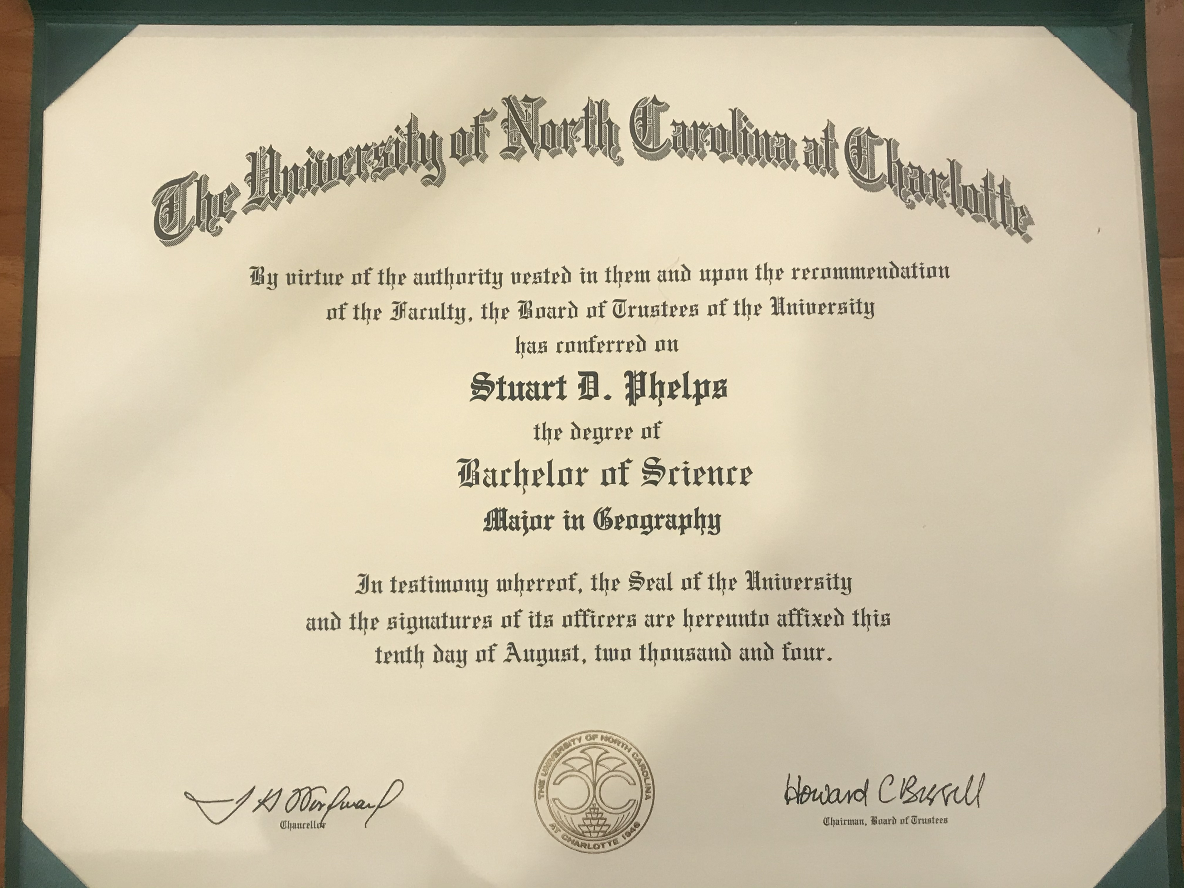
from UNC Charlotte with a 3.7 GPA and made the deans list one year. 🤪🤪🤪

Until last summer, I had never spent the night in a tent outside! I always had a fear of what was going to happen to me out there, what sort of animal was going to eat me! I have since gotten over that and have camped outside many times and even did a 3 day backpacking trip all alone. Yay me! I was a shy bashful kid, like 75% of the population, I had Glossophobia, the fear of public speaking. For 15 years, starting around 1999, I performed in live theatre, even at one point playing a roll with 4 other actors, where I played 5 characters in one show!

So, WHY am I hiking the AT?

  1. To learn to overcome and embrace a challenge
  2. To see that I can overcome fear and accomplish what I set out to do even if its waaaaaaaay bigger than me
  3. To create a better Stuart
  4. To meet God in the wilderness
  5. The people/community
  6. To see that I can live life with less
  7. Though a late in life one… it checks a box on the bucket list.
  8. To share the beauty of God’s creation from a different perspective with those around me.

I am editing this into the post because it is too good not to mention as another why. I was going to talk about this at a later time, but, no time like the present. My friend Amy, called me this week to ask me if I could do something for her BFF. You see, several years ago Lucy’s husband, Derren, passed away with brain cancer, he had always wanted to hike the Appalachian Trail. She wanted to know if I would be willing to carry a golf ball with his name on it that she had made for his funeral. It was not a request to carry it all the way to Katadhin, but, I insisted on carrying that golf ball and his memory, even though I did not know him, all the way to the end!

What if I want to quit?

  1. Remember that, while I was acting on stage, I used my fears and nervousness to make me better.
  2. Remember that not many people my age get the chance to drop it all and set out to hike for 2,193.1 miles
  3. As much as I say this isn’t being done for the reader, I have people living vicariously through me and wanting me to go on. That fact is, I have told many people about this and have enjoyed the conversations it has led to and the wow! on their faces and I will push on because of them.
  4. There have been many situations in life that I have felt like giving up on but I didn’t and I’m still here and better for not giving up.
  5. I read on a post and will keep this with me, “…that deep down the temporary satisfaction of stopping would not be able to compete with the satisfaction of completing the hike.” -Heather “Anish” Anderson (Alexa Bonsai Shapiro 2019: Overcoming the Desire to Quit During a Thru-Hike. https://thetrek.co/overcoming-desire-quit-thru-hike/)
  6. I don’t want to live with the regret.
  7. I have bought all of this dehydrated food and don’t want to have to sit at home and eat it all! My girlfriend would probably not like date nights to included dehydrated backpacking meals, as good as they may be! 🙂
  8. See edit portion above this section. 🙂

Okay, so, I have went on about this more than was originally intended. Never knew how things would just start flowing if I sat down to write. I am going to push off what is in my food bag until next week.

What’s on my back!?

Howdy folks! I hope that your 2021 is off to a great start!
I thought, while I’m sitting here at 31,000 feet riding in a plane to Orlando, I’m going to write a blog post. It’s been a while so, here we go.
This is just a quick run down of what I am carrying on my thru-hike of the Appalachian Trial. What I have put together so far brings my base weight to 11 pounds 4 ounces. My current plan is to do mail drops with various dehydrated meals. Some of the ones I have tried and really like are, Evergreen Adventure Food, Good to-Go, Greenbelly Meal Bars, and Standard Process Possible bars.

The mail drop plan is a slow process and I will decide as I go along whether or not I want to continue this through the entire adventure. I have decided to do the mail drops in order to maintain eating as healthy as possible while on trail. I just can’t bring myself to eat ramen and pepperoni with cheese on tortillas the whole time. My body just will not like that at all, its taken me a while to figure out what I can and cant it and how much it will affect my body. Congestion and inflammation are the biggest things, as well as just over all low energy. Low energy is not what I need for a 6 month hike north!

I am sure there are a few small things I might be leaving out of this list but not many.

Nemo 2PShelter System2 person tent138.5ounce
FootPrintShelter SystemNemo 2P FootPrint16.9ounce
MSR/NEMOShelter SystemTent Stakes1177gram
FuelCook SystemFuel for cooking 113.4ounce
BRS 3000-TCook SystemBRS ultralight cook stove10.9ounce
PotCook SystemTOAKS Titanium 75013.6ounce
SpoonCook SystemTOAKS Titanium Long Spork10.65ounce
LighterCook SystemBIC Mini10.5ounce
UGQSleep SystemBandit top quilt122ounce
Big Agnes PadSleep SystemInsulated AXL114ounce
Big Agnes PumphouseSleep SystemSleep Pad Inflator/stuff sack 12.9ounce
Sea to SummitSleep SystemAeros Ultralight Pillow12.1ounce
ULA CircuitBackpack SetupBackpack141ounce
ZPacksBackpack SetupPack Liner11.8ounce
Garmin Misc InReach Mini13.5ounce
KatadynMisc BeFree 3L Water Filtration13.5ounce
Smart Water BottleMisc Empty Smart Water Bottle11.2ounce
Pack Rain CoverMisc ULA Rain Cover13ounce
Trekking PolesMisc Black Diamond Alpine Carbon Cork117ounce
BatteryMisc ANKER PowerCore Essential 20000112.2ounce
Rain JacketWearablesOutdoor Research Helium II16.4ounce
SocksWearablesDarn Tough113gram
Winter PantsWearablesColumbia Silver Stretch Conv. Pants10gram
Camp ShoesWearablesEarth Runner Circadian Lifestyle111.8ounce
ShoesWearablesAltra Olympus 4111.6ounce
-33 leggingsWearablesKANCAMAGUS19.6ounce
ArcteryxWearablesCerium LT110.8ounce

Hiking. Why?

When I was growing up in southwest Louisiana hiking was not really something we did as a hobby. My dad owned a large surveying and mapping firm though, and with that came a lot of travel with MAPPS, a national association of mapping firms. Because of those travels I was able to visit forty five of the fifty states, and with that came some great outdoor adventures, some of which included hiking. The hiking I did then was little short hikes to some amazing views and sites that were special to the area. My longest hike was a seven mile hike I did with my sister and her husband as well as my then wife. This hike was on the Phelps Lake loop in Grand Teton National Park, and it had some amazing views.

Fast forward to August 19, 2018, I had been in a two year relationship that came to an end that day, and with that, of course, came sadness and hurt. During that relationship I did a lot of Instagram posts for my girlfriends wellness business, and one of those posts was about how the outdoors can be a place to heal the mind. On August 21, 2018, my birthday, I decided that instead of sitting around the house with all sorts of thoughts running through my head, I decided to get out of the house and do a hike. It was going to be a beautiful North Carolina weekend and I was going to take advantage of the beautiful state in which I live. I asked around for some good hiking ideas and was told of a place in the Mortimer, N.C., Wilsons Creek, that I should try. I arrived at the Wilson Creek Welcome Center and was greeted by a nice woman who was very informative. I told her I wanted to hike a trail that was longer than seven miles, since that was the longest I had hiked to date, and she guided me towards a loop that would be a little over eight miles. The hike started on the six mile, “most difficult”, Harper Creek trail. The trail started out as a fairly simple hike, passing the Harper Creek falls and following along Harper Creek. I say fairly simple and I say following along but this changed quickly as I approached another group of hikers leaning against a rock taking their shoes off as their black lab played in the creek. I thought, “awe, how sweet, they are going to play in the creek with their doggo.” Well, I soon found out my thought was incorrect when they told me they were taking their shoes off to cross the creek. I said, ” wait, this wasn’t in the brochure.” I followed suit, and took my Salomon hiking boots off and carried them across the knee deep flowing water to the other side where I sat down and put them back on to begin hiking again. Hiking along and there the trail came to the creek again and it was again time to take my boots off to cross the creek. This happened four more times at which point I decided that taking my boots off was a waste of time and as I came to the fifth crossing I went on through with my boots on and my phone held high over my head so I could cross the thigh deep water. After this fifth crossing it came to me, God was trying to show me how I need to live my life. I felt Him saying, “if you lived your life like you hiked this trail it would be a little easier for you to deal with, don’t think about every obstacle that you come to and just keep moving, you’re going to be okay.” I later realized that it would also be better off if I lived life in the moment like I do on a hike. Don’t worry about what’s behind you or what may be coming up ahead, look at what’s right around you and enjoy that moment fully.

The trail continued on and I continued to follow the folks I had met at the first crossing, and at one point, following them got me off of the trail I was supposed to take a left following the Harper Creek trail, where I would then turn on the Raider Camp Trail, but I missed the tiny sign! From the Raider Camp Trail there is a great view, and hammock hanging spot over looking the South Harper Creek Falls. I followed this trail for about 1.8 miles without a single creek crossing and I was super excited about that fact! About the time my boots had started to dry out, you guess it, another creek crossing. This time is was not only deep but it was also wide. I have to admit, my first thoughts were, I see no trail on the other side so I must have really messed up. I walked up and down the creek blazing a trail trying to find any sign of the trail on the other side. Looking at my AllTrails app and it showing I was in the right spot, I decided to jump in and cross and see what happened. It was the hardest crossing that I did on the trail. It was a little over my waist and had slick rocks and a good flow to the water. I made stumbled my way across and found a familiar campsite that I had seen when I started and knew I must have been on the right track. I made it back to my Jeep and stopped my trail recording at 10.2 miles. I know, you are probably thinking those numbers I gave earlier do not add up to 10.2 miles and you are right, but that is where following the crowd in a direction you shouldn’t be going will lead you. See, another life lesson there, you follow the wrong crowd and get out of sorts in the wrong direction it may take you some time to get back on your path in life.

Who is Stuart Phelps?

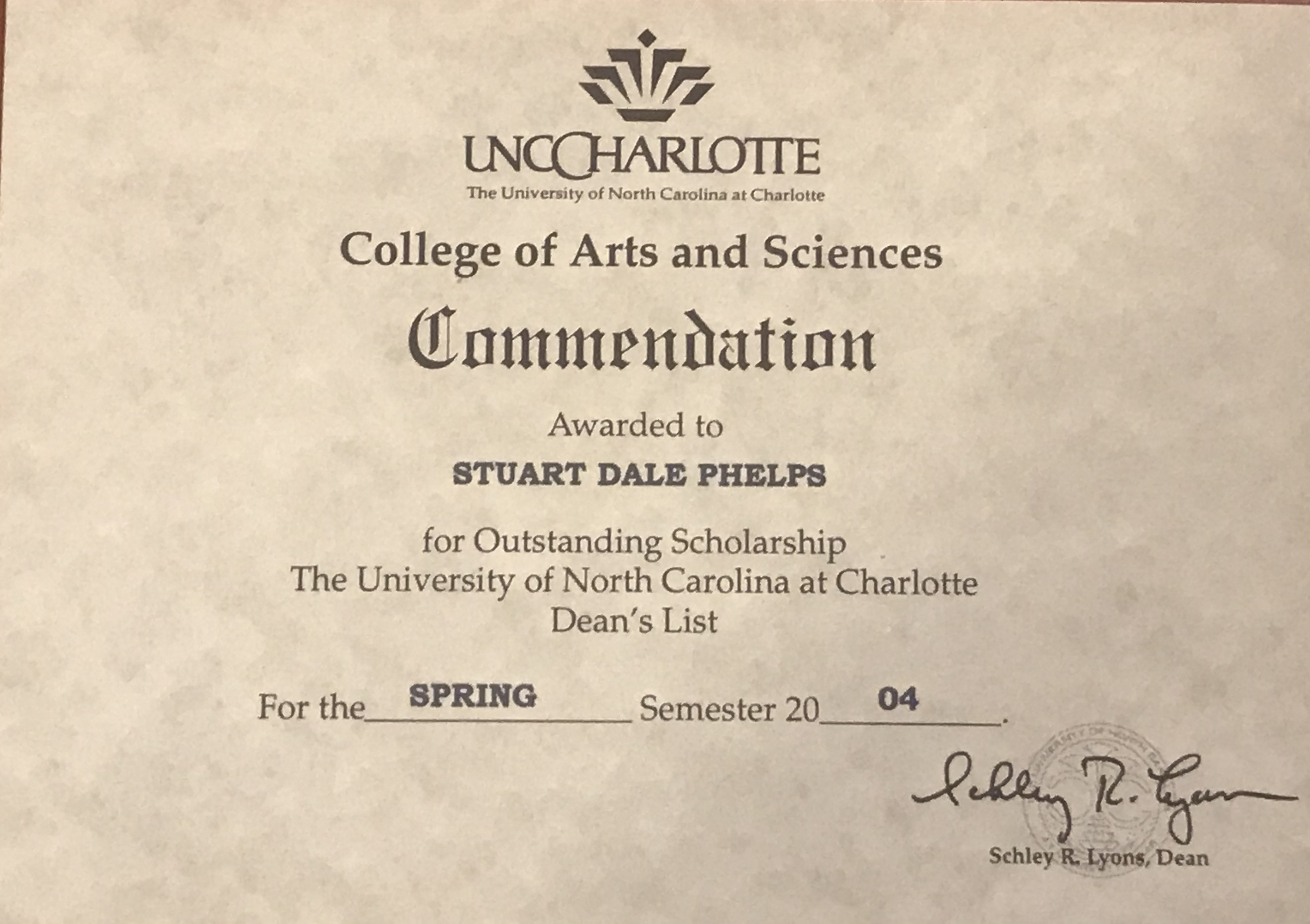
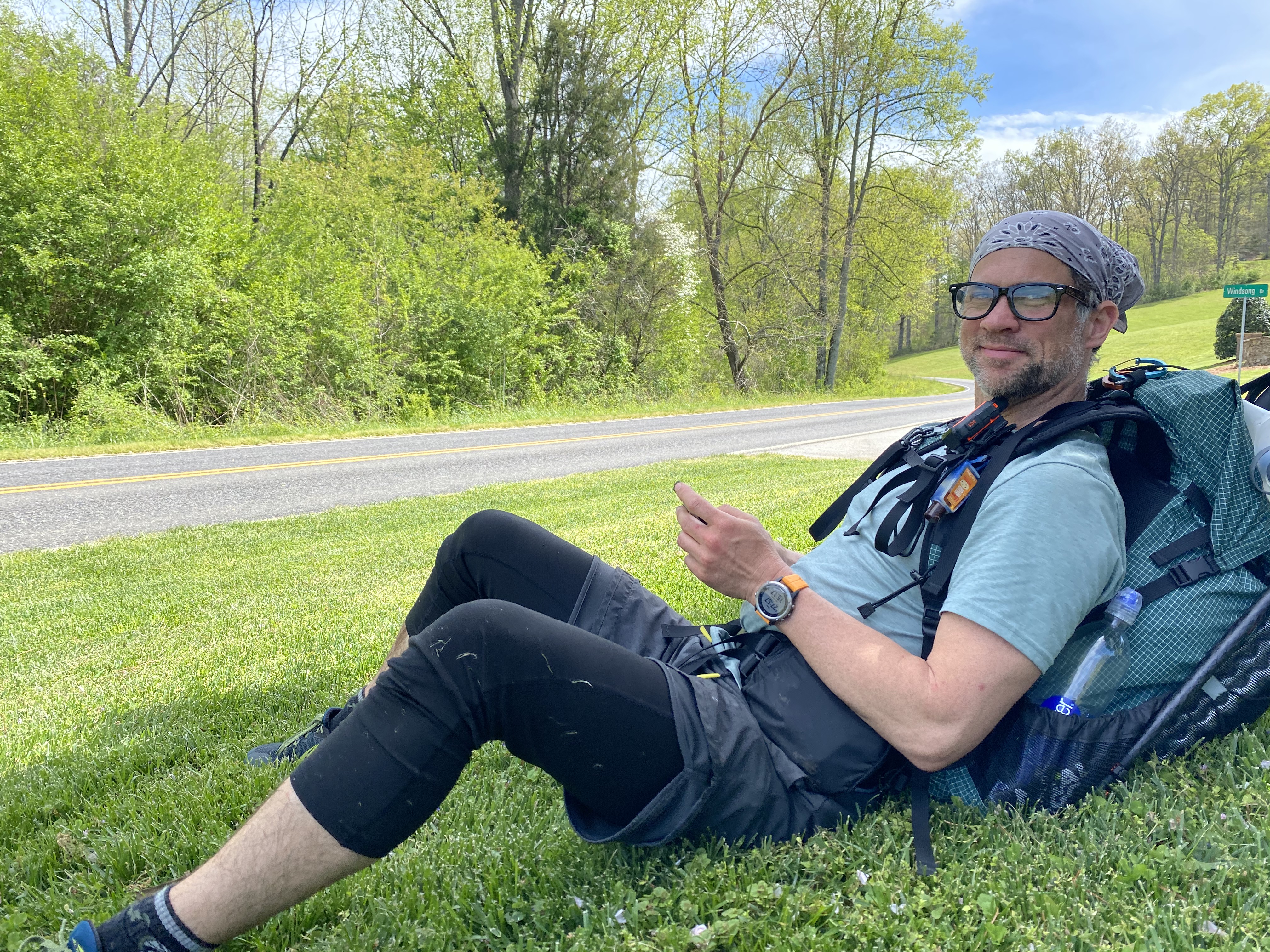
I am a 47 year old Louisiana native who has been living in Charlotte, NC for 23 years. I still can not believe I have lived here half of my life! I have a 15 year old and a 19 year old son, who on occasion will join me on short hikes. I was married for 15 years and currently have been divorce for 6.

I moved here in 1997 after traveling the country doing GPS mapping for 3001, Inc. I had lived in hotels in Missouri and South Florida as well as 6 months in San Juan, Puerto Rico, all while calling Gainesville, Fl. my “home”. I started hiking just a few years ago and did my first long distance hike on the Bartram Trail through parts of Georgia up to Cheoa Bald on the Appalachian Trail.

I have currently done several day hikes on the AT for a total of about 70 miles here and there as well as many other hikes throughout NC. I just completed my first 10 mile hike in the snow up the Profile Trail at Grand Father Mountain.

I enjoy anything outdoors, some of the things are, golfing, hiking, mountain biking, rock climbing, bouldering, as well as dabbling in white water kayaking, stand up paddle boarding and flat water kayaking.