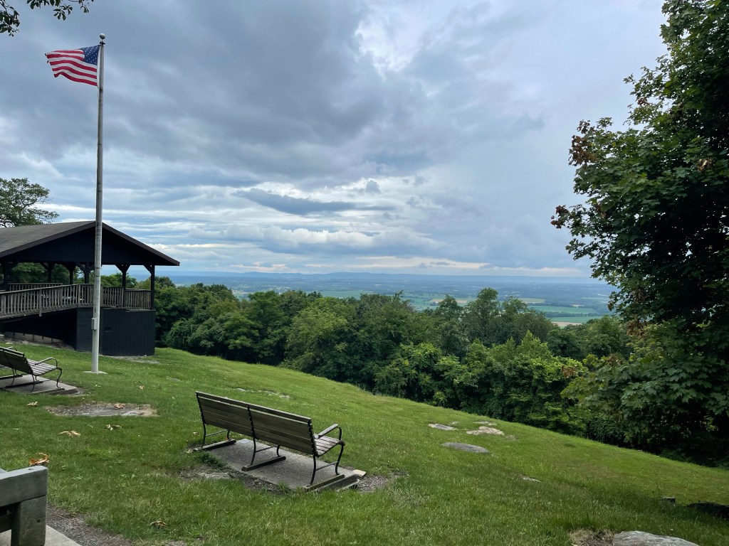
Grange Hall Rd (1,614 feet) mile 1569.6 to School St. (986 feet) mile 1581.3 for a 11.7 mile day.
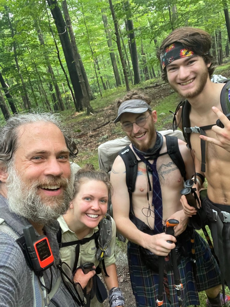
Back out here going at it again after the hospital, Campylobacter incident! It’s been quite the day.
My feet have felt great after being off of them for 5 days, and then I laced my shoes up and at about 10 miles they started hurting all over again. I decided that I would stop for lunch at a stream at mile 1576.9 and while there I would soak my feet and see if that helped them out. I think it helped the right one but the left one started hurting again shortly after. So, I’m going to roll my foot with my cork ball and stretch it some to see how it feels.
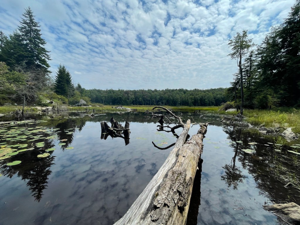
These northern states are super cool with their pond everywhere. This beaver pond is named Gore Pond.
Continuing north on the AT leads to the Cheshire Cobbles, it is a marble outcrop that over looks the town of Cheshire, MA. Below one can see the Cheshire reservoir which is feed by the Hoosic River which comes in from the north and will be crossed again on Tuesday through Williamstown as we head north into Vermont.
Coming into the town of Cheshire, Ma, is a large wheel of cheese. It is a replica of a cheese wheel that was presented to President Thomas Jefferson in 1802, it weighed 1,235 pounds, that’s pretty cheesy if you ask me! Ended the day just passed the giant cheese wheel with some trail magic, given by a 2021 thru-hikers mom. Every morning and afternoon she refills it with Gatorade and ice!! Great first day back on trail. Not too many miles which was good to come back to. And now, I think I’m ready to go!
School St. (986 feet) mile 1581.3 to MA Route 2 (629 feet) mile 1,595.5 for a 14.2 mile day.
Wrapping up the evening at a HOJO in Williamstown, MA, sitting in the balcony in a rocking chair watching the kids play in the parking lot.
It’s was a good second day back! Got to do a nice climb up Mt. Greylock, the highest point in Massachusetts at 3,489 feet.
Started the day at 986 feet and climbing straight from the start. 2,982 foot climb in 8.3 miles, so it wasn’t too bad, only 416 feet per mile, which is nothing compared to what is ahead of us in Vermont and the White mountains of New Hampshire.
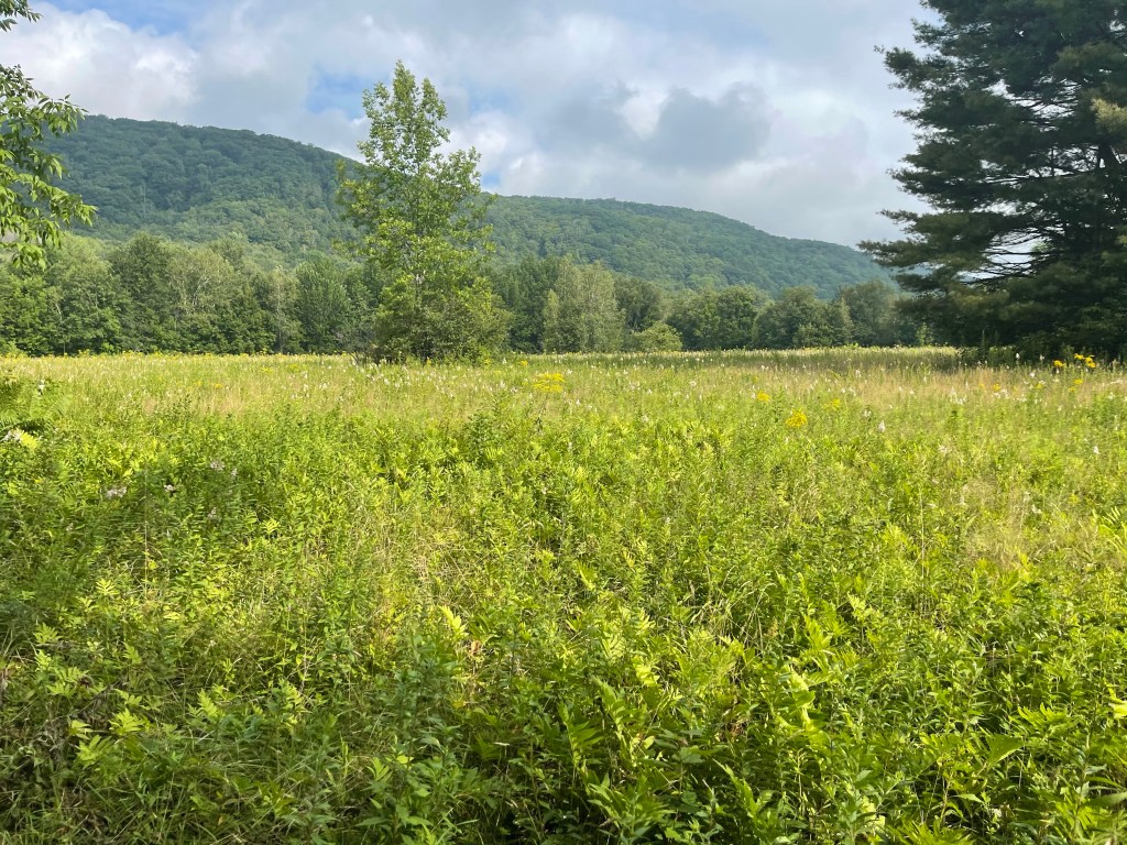
It’s always great to start the day walking by through meadow grass.
It was a rocky day but nothing like the past states and the rocks that they through our way.
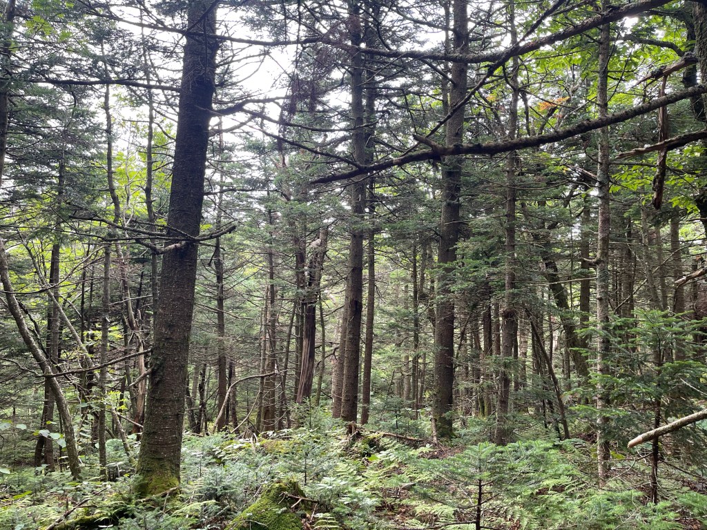
It’s always a great day when I walk through a balsam forest. The smells that it gives, think little green tree hanging from your rear view.
This climb lead us past a beautiful pond that, at one time, supplied the water to the Bascom Lodge at the top of Mount Greylock. There is a small “cabin”, or, pump house here that was unlocked, and a great place to wait out a rainstorm if such had happened, it today, it was just a beautiful partly cloudy day with cooler than normal temps in the 60’s.
I don’t know what your thoughts are about this picture, but, I’m thinking it would make a great print for the wall to remember the AT thru- hike by.
Not far up the mountain from the pond was the Mt. Greylock monument, built in dedication to those in the area that served in the World War.
Mt Greylock Monument
I found it interesting that the light that shines in the night from this tower is the brightest light in Massachusetts and in the spring and fall, during bird migration season is dimmed so the birds migrating don’t loose their way.
Along with the tower, one can find a lodge, that, when open, provides lunch, drinks, and snacks to visitors.
Making our way down the other side of the mountain to the town of Williamstown we had one nice view looking down on the town.
Just before we got into town to do a road walk on Phelps Ave, we came across a very nice clear stream that provided some nice clear and cold water to start the day into Vermont with tomorrow.
All in all, it was a great second day back on trail. At the end of the day, my feet are still feeling good! If I can keep this up with my feet, the remainder of the trail should be a nice one! I’m looking forward to the remaining
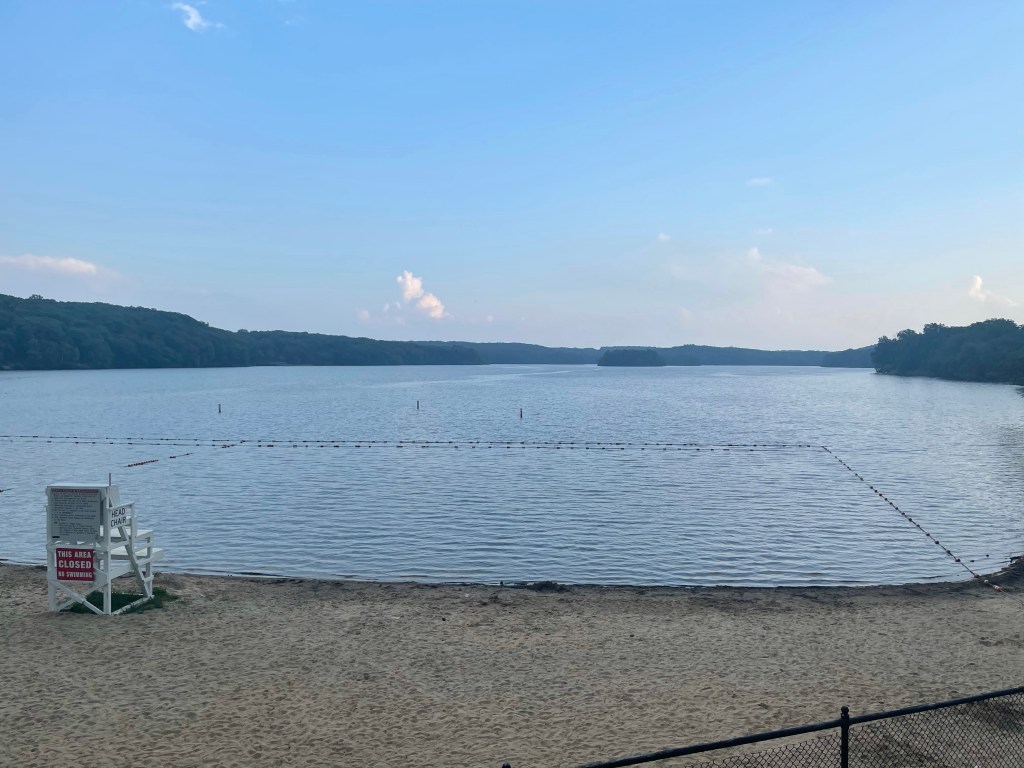
Canopus Lake Beach (916 feet) mile 1426.9 to Morgan Stewart Shelter (1,303 feet) mile 1,440.9 for a 14 mile day.
Canopus Lake is a beautiful lake that is located in Clarence Fahnestock State Park. It is a really long lake running north to south. Not real sure why, but, there is no swimming on the south end of the lake but at the north end there is a beach where locals come out to spend the day and swim. Near the beach is also an area that is designated for thru-hikers to set up a tent and camp, they have access to showers and such there too. The park is in the construction phase of a new shelter that hikers will also be able to use there. Another thing I can’t understand, why is there so much shoreline on this lake and the trail only walks by it for about 300 feet! It would be such a beautiful hike in an area that had only one view in fourteen miles!
We stayed in the campground area of the park with Kelly’s in laws, John and Lou. It was great to see them again and get some good food I. The evenings! New Jersey and New York have delis all along the trail and there is hiking here called deli blazing, and it has been a great treat and a great way to add calories in the day! Haha
We hiked back out the .7 miles blue blaze to meet back up with the white blazes of the AT, put our blinkers on and headed North!
We hiked for about 2.5 miles north and finally came to a wonderful view from atop Shenandoah Mountain that looked back over the lake and far beyond. At the top is painted this lovely tribute to the tragedy of September 11, 2001
We continued on the monotonous and boring hike through the lowlands of the state of New York. It felt like the trail designers had gotten some push back from the area for bringing hikers through their area so they said, fine, if you can’t figure out how to go around, you can come through this area with no views. Nonetheless, we pressed on and came to our shelter where we would setup camp. New York and Connecticut have wells drilled at some of the shelters, but there is now a problem. The National Park Service recently did a water test on the wells and it was determined that the water in the wells was not up to the standards to be drinkable.
The Appalachian Trail Conservancy gave this statement in a text message that came out today, “Hikers should take extra precautions and plan on carrying extra water through these sections, particularly in hot summer months when seasonal springs could run dry,” said Andrew Downs, Senior Regional Director for the ATC. Keep in mind, there are very few alternative sources for water in these areas due to surrounding farms, and highways and such. It may be 8-10 miles with no water, then you get to a shelter where you cook and do other camp chores needing water and the only water you have is the water you can carry in. So, the ATC accepted 19 million dollars from a pipeline company because the trail view was disturbed by the new pipeline, but they can’t get funding to update the well systems or dig new wells? Yes, the ATC, “oversees” the trail, but they do so without care for the hiking community. Politics suck as does political figures in non profit leadership positions. Oh, yes, I hand pumped my own water and it was delicious and cold!!
Sorry for the tangent there, I’m done.! Good night!
A super stealth site near mile 1392.5 to Hemlock Springs Campsite (485 feet) mile 1,408.9 for a 16.4 mile day.
Last night was such a rainy night!! It rained so much that the rain fly on my tent soaked up so much water it started falling through into my tent. It was enough to really drench me but I could feel it as I was trying to fall asleep. We got rained on by a few different storms passing by, the first one brought lots of lightning and one big bolt crackled not far from where we were, but luckily, we had a building sheltering us.
Today as we walked on we ran into Greazy, a fellow thru-hiker who was right near that lightening bolt when it struck. He said he wished they had just hung around the pavilion like we did.
About four miles into the hike, around mile 1,396.7, we ran into our second pair of SOBO (southbound) thru-hikers, Loco and Medicine Man. These two started on June 11 at Mt. Katahdin, these means they are currently 796.1 miles into their journey! They said their planned finish date was September 21, one day after our finish date! Hahah and we started April 3!!
L-R: Me, Birdie, Loco, Medicine Man
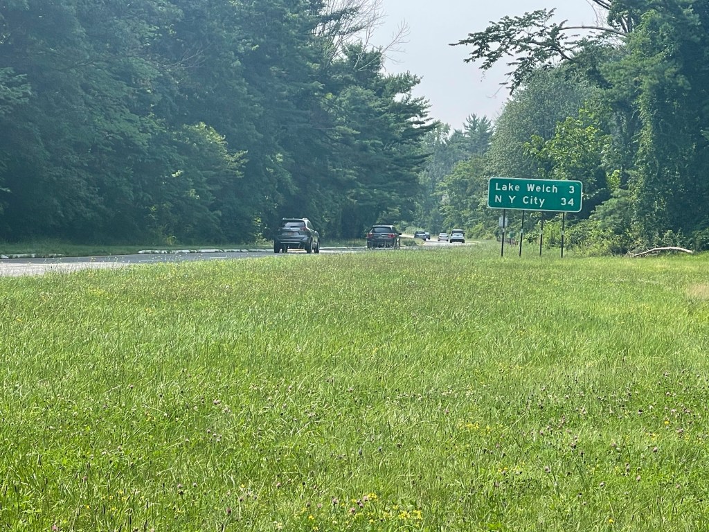
We left these SOBO hikers and continued north! There are a lot of road crossing along the AT, we probably cross at least four a day. Never, until now, have we crossed a road that is as busy as and interstate! Crossing the Palisades Parkway was like playing the old Atari game Frogger when I was a kid. I loved that game by the way. Nonetheless, we crossed the parkway, 34 miles from New York City, and we survived!
Palisades Parkway
Next up on this fine day of hiking through the ninth state on trail we crossed the 1,400 mile mark. So, it is still hard for me to believe that I have walked 1,400 miles and slept in a tent 95% of the time.
The climb up to this 1,400 mile mark was a depressing one! It was 618 feet of climbing in one mile, and it’s been a while since we have seen those types of numbers! There was still a moment of excitement crossing another 100 miles off, even if it was a brief fleeting moment. Why was this fleeting excitement you ask? Well, it’s because we then turned and went right back down hill to 581 feet from 1223, oh and then we headed back up again just after we crossed a road again.
This time, it wasn’t any easier but it was totally different than anything we have hiked so far, and we have hiked a lot of stuff! We started up this climb heading to the top of Bear Mountain and for a out half a mile it was on a steep trail with stairs made out of rocks, and then, it turned into an old road bed. This old road bed appeared to be loose gravel asphalt and later I figured out it was the old road for folks to drive up to the summit of Bear Mountain. Along the way I saw what appears to be large man made rock columns that were built to, “hold up the mountain”, maybe. They were like this for a good half mile and varied in, I guess you could say, height.
The past few weeks there has been a grayness about the sky and we wondered what this was all about. Several folks said humidity was off the charts and that was the cause, while others said it was from fires out on the west coast. When we got to this beautiful view before the top of Bear mountain, I googled the issue and it indeed said that it was smoke from 80 fires out on the west coast!
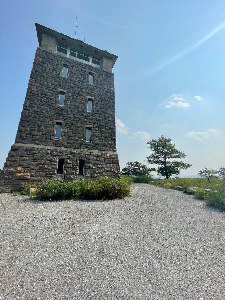
At the top of Bear Mountain is the Perkins Memorial Tower and it provides panoramic views of the Hudson Highlands, Palisades, and New York City.
Perkins Memorial Tower
After we missed our chance to walk through the Trail Zoo…
5:14pm 😦
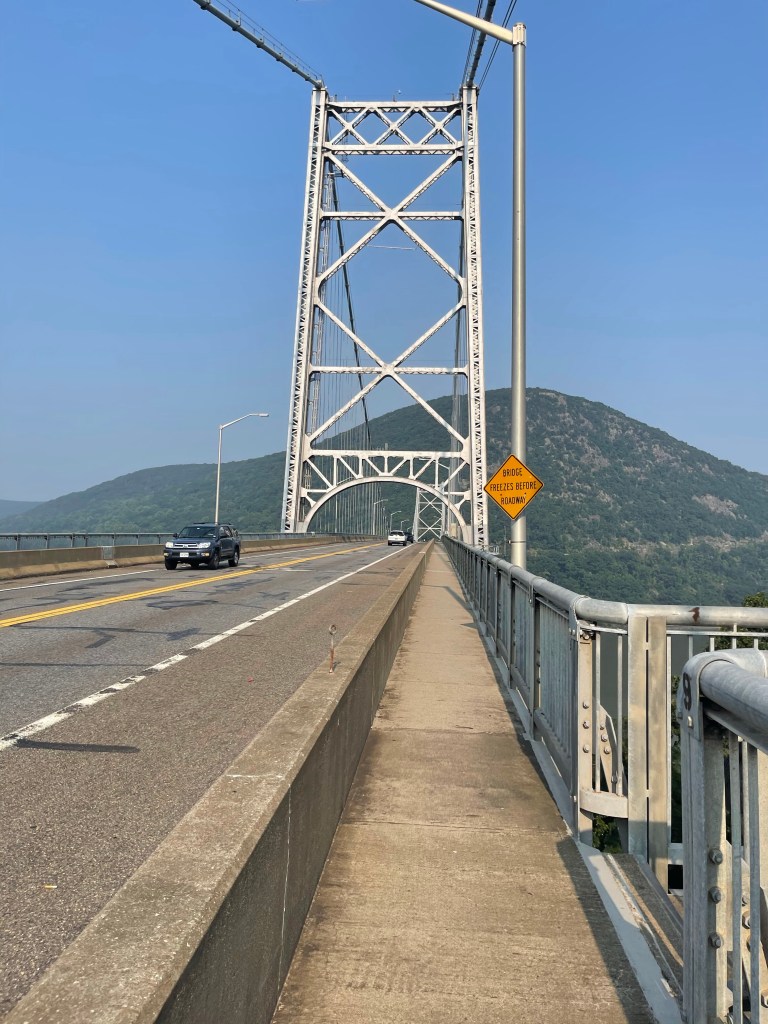
…yes, I said zoo, we came to the bridge over the Hudson River. A beautiful bridge built in a short period of time, from Mar. 1923 – Nov. 1924, the Bear Mountain Bridge is a parallel wire cable suspension bridge.
Something that I have always found interesting and I feel there is a life lesson inside of are the cables that hold things up. The cables are made up of thousands of smaller diameter steel cables, all working together to hold up the bridge. This creates a large surface area of steel that will be susceptible to rust, and as you know, rusted cables would mean snapping cables. The bridge authority uses monitors that can “hear” the energy that occurs if one of these tiny wires snaps, it then locates the snap to as close as a foot and then reports it back to authorities! The sign also says that there are less than one wire snap per year.
After crossing the Hudson, we began a final climb for the day. A note about this climb, it started from the lowest elevation on the AT, 126 feet and went up 800 feet in just over a mile!!
Barely surviving that climb we made it to camp and met two more SOBO thru-hikers, “Locomotive” and “Thumper”. John and Lou, Kelly’s in-laws met us there and camped with us for the night. With them came dinner and water!!
Hemlock Springs Campsite (485 feet) mile 1,408.9 to Canopus Lake Beach (916 feet) mile 1,426.9 for a 18 mile day.
I can not believe that in 18 miles we did not see one view, nor one animal, at all. There were a few birds chirping but not many. I’m not real sure why the layout of the trail does what it does in this area, but, that’s the way it is so that’s the way we have to walk. We even walked for 2 miles along Canopus Lake and not once did we walk in any proximity to the lake where we could enjoy the beauty of the lake.
Nonetheless, we completed an 18 mile day , which is 18 miles closer to Mt. Katahdin! We now have 766.2 miles left!!
First off, let me say, the days preceding this one, that are missing, rocks, late day hours long thunderstorms, and rocks with not views, that’s what you have been missing. Seriously though, there were some good days and those I’ll try to go back and hit, but later. Now as we are just about to cross 1,400 miles and less than 800 miles left, the climbs, the views and the excitement is building back up.
Wildcat shelter (1087 feet) mile 1376.8 to a super stealth site near mile 1392.5 for a 15.7 mile day.
We left camp a little late today, because one, I slept till 7:30, two, I got stung by some form of flying insect and that caused my hand to swell started hurting. It slowed things down a bit because it was inside my tent, and as I was packing my tent into its stuff sack the thing stung me on the hand. Therefore, I had to set my tent back up to try to get it out.
After the flying insect incident, we walked 1.8 miles to Fitzgerald Falls and when we arrived at Fitzgerald Falls it was actually dry, there is not a drop of water flowing over it.
Fitzgerald “Falls”
We continued on past the dry falls and found water just about 200 feet from the top of the falls, “upstream”. After filtering and refilling our water bottles we started up hill. Today was a day filled with climbs, and descents. In 16 miles, we ascended 3,796 feet and descended 3,643 feet. It’s these almost even days that are difficultp, heck they are all difficult. Haha
These weren’t just any climbs today though, most of them were rock scrambles, and the first one up, was this bad boy here! I know it sound crazy, but, it was a lot easier than I expected.
We continued on and just about when it was time to stop and eat, we came to a road crossing. At the road crossing was 7, 1 gallon jugs full of water!! A water cache is always a welcome sight when in the back country with dry streams all around you. So, we decided to stop there and have a sit and eat our lunch, and today, I decided to make some lunch time coffee. Cafe Bustelo, is my go to espresso coffee out here.
After lunch we walked on for a few miles, of course, up and down hills, and we came to Little Dam Lake.
Little Dam Lake
A few miles past the lake we came to mile 1386, and The Sapphire Trail, which leads about 2 miles north to Harriman Station, where you can catch a train or bus into New York City.
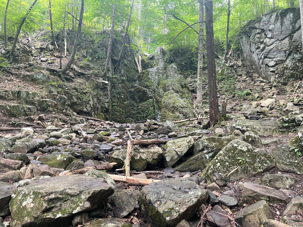
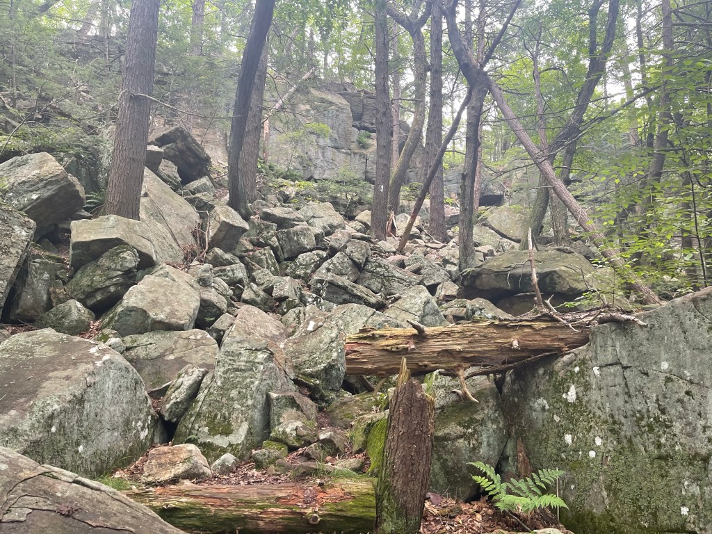
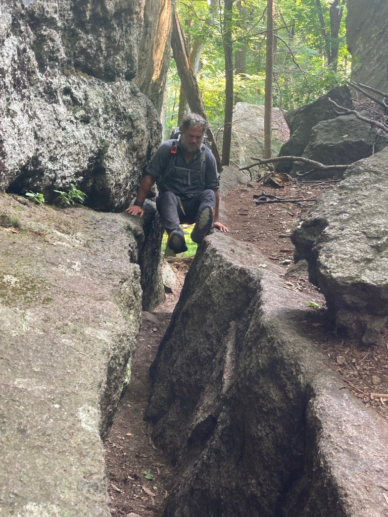
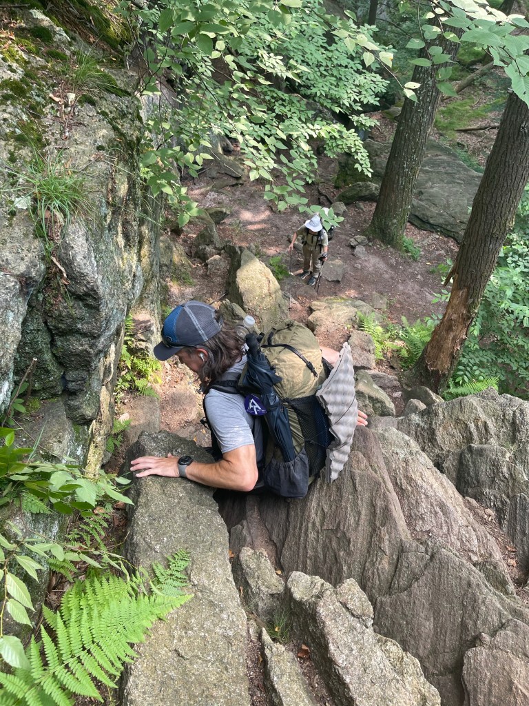
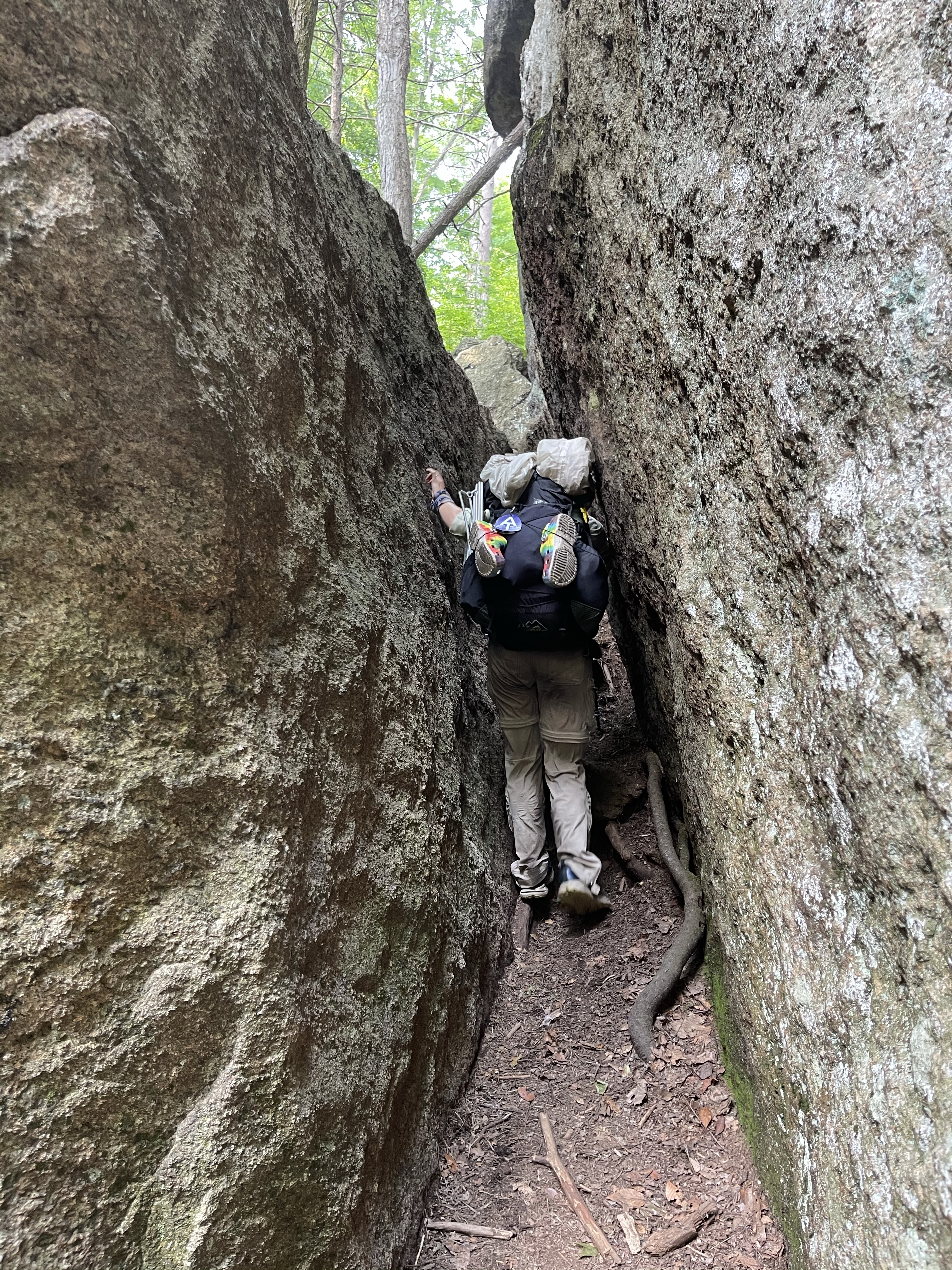
Next up for the day was the lemon squeezer! A sort of crevasse through broken boulders that may require removing your pack and a little bit of hand over hand climbing.
Lemon squeezer is nothing compared to the rock face that was waiting on the other side!! I will attach a photo but it does not do any justice and showing how difficult this was!!
Climb on!
The man you see standing at the top is, Magic Mike, who is a Sobo Thru Hiker who started June 1 at Katahdin!
Look at it from the top as I watch magic mike go down.
See Kelly down there, yeah, that’s how high it was!!! Nonetheless, we survived!!
We continued from there and finished off our 16 mile day at Lake Tiorati, where we barely escaped the rain before it started to fall!
Buena Vista Road (1,294 feet) mile 1,068.1 to US Route 30 (937 feet) mile 1,084.9 for a 16.8 mile day.
I’m not sure if I want to be happy or sad that the trail seems to be getting more flat the farther north we go. I want to be happy because the trail is getting more flat, but, with more flat comes less views, less views means more time in the woods staring at trees. I have no problem staring at trees, heck I’ve been in the woods for almost 1,100 miles at this point.
Bridge building
This was an amazing view though, it was a group of trail maintenance volunteers building a new bridge. There was another crew sawing the old bridge into pieces, so we had to go through the creek, on rocks of course, since the bridge was about to come tumbling down!
Today I finally remembered to grab a photo of this pretty mushroom. It is called Amanita and it is a fungi, no fun if you eat it though! This family of mushrooms is cause for more than half of the cases of mushroom poisoning! Some of their kind are edible and some are not, and therefore, I did not partake of this fungi!
Continuing on this day brought blowdown after blowdown!! Blowdowns are exactly what the sound like, tree limbs and sometimes trees blown down by a storm.
The big pine trees in this area that were blown down, they got hit by microbursts that were scattered through this area. Massive trees with massive limbs, and we aren’t talking dead ones! It was amazing to see the power of these winds! The same crews building this new bridge, also was responsible for cleaning up the blowdowns. Clean up is basically cutting the trees or the limbs and then dragging them to the side of the trail so they are out of the way where they then will rot away and decay into the black soil we see daily!
I ended this day with a short walk, off trail, to a grill and got myself a delicious vanilla malt and a hamburger! I waited here for Suzanna to come pick me up! We had a dinner date tonight!!! Always a good way to end a hike, knowing there is a dinner date with a beautiful girl waiting for you!! If you’re wondering, yes, I still ate on our date even though I just ate this burger and malt!
I don’t think she will care, but I took this photo of her on our date tonight. 🥰
Boonsboro Mountain Road (1,300 feet) mile 1,047.7 to Buena Vista Road (1,294 feet) mile 1,068.1 for a 20.4 mile day.
Today was not a good day, at the start at least. We left John by the him, make sure you bring towels when you come back to get us, we will be wet!!
We stepped out of the car into the pouring rain, we strapped on our day packs full of food and water and we headed north. So, these may get a little personal in the wrong area but, I’ll try to keep it light. My normal 💩 cycle is early morning, today we left the house early and the 💩 was on time but I was in the woods! Well, that means digging a cat hole, a 4-6 inch deep hole that then has to be roped. Remember now, it’s raining! The urge hits, I walk off trail “200 feet”, in the rain and dig my hole… now I’ve covered my hole and walk back to trail and head north again. Here is why this story is even being told, I get 100 yards up the trail, imagine a football field, and there is a privy!!!!!!!! A random privy in the woods!!!!! Well 💩!!! Haha
Nonetheless, I’m sure everyone of you reading this enjoyed that story, but it’s about all of the excitement for that day.
That is not totally true! There was other excitement! We had a few views today, one of which has, for some reason, become a graffiti haven for the locals.
High Rock
Oh and you know what else?? For many many miles, almost since I started this journey, hang gliding has not been allowed, but today, feel free to hang glide my friends!!!
We continued on with our day and came to not only a view but also another state line. Maryland consists of 41 miles of trail and today we completed that last mile and walked into and aptly named town, PenMar, Pennsylvania. If you still don’t get that one, Pennsylvania Maryland.
PenMar Park
Well, when you cross into Pennsylvania, you are entering the North, crossing the MasonDixon Line.
I learned why Pennsylvania is called the keystone state! If you know already, you can skip this part, although this is the end!The keystone is the center stone at the top of an arch.
Pennsylvania was said to be the center “stone” in between the North and the South.
Boonsboro Mountain Road (1,300 feet) mile 1,047.7 to the bridge over the Potomac River in Harpers Ferry, WV (246 feet) mile 1,026.1 for a 21.6 mile day.
It was a SOBO day, but it was also I high mileage day! Or at least high mileage for me!
Last night was my first night staying with the Jaworski’s. They are good people and went out of their way for us to slack pack as much as we could over the next few days.
John, Kelly’s father in law brought us to Boonsboro Mountain Road pretty early in the morning. We got there and headed south. There was a tiny spot there for us to park, but John managed to whip it in there and we were able to get out of the car right near the trail and didn’t have to walk down the road. A lot of time, that is what happens, there is no place to park so we have to get close and then walk down the road for a bit, it’s not all that bad, just like can get a little hairy at times with cra cra drivers, oh, and road walking kills my feet!! I know, it seems to all kill my feet, and that it does! Haha
This was a super cool stretch of trail today. After just two miles of SOBO hiking, we came to a monument. This was not just any monument though; it was the original Washington monument!
This Washington monument was started on July 4, 1827 by the folks of Boonsboro. They marched behind the Stars and Stripes to this site and built 15 feet of the tower.
Washington monument
September of that same year, they returned to finish the job. The tower was used by the Union Army during the War Between the States, as a signaling station.
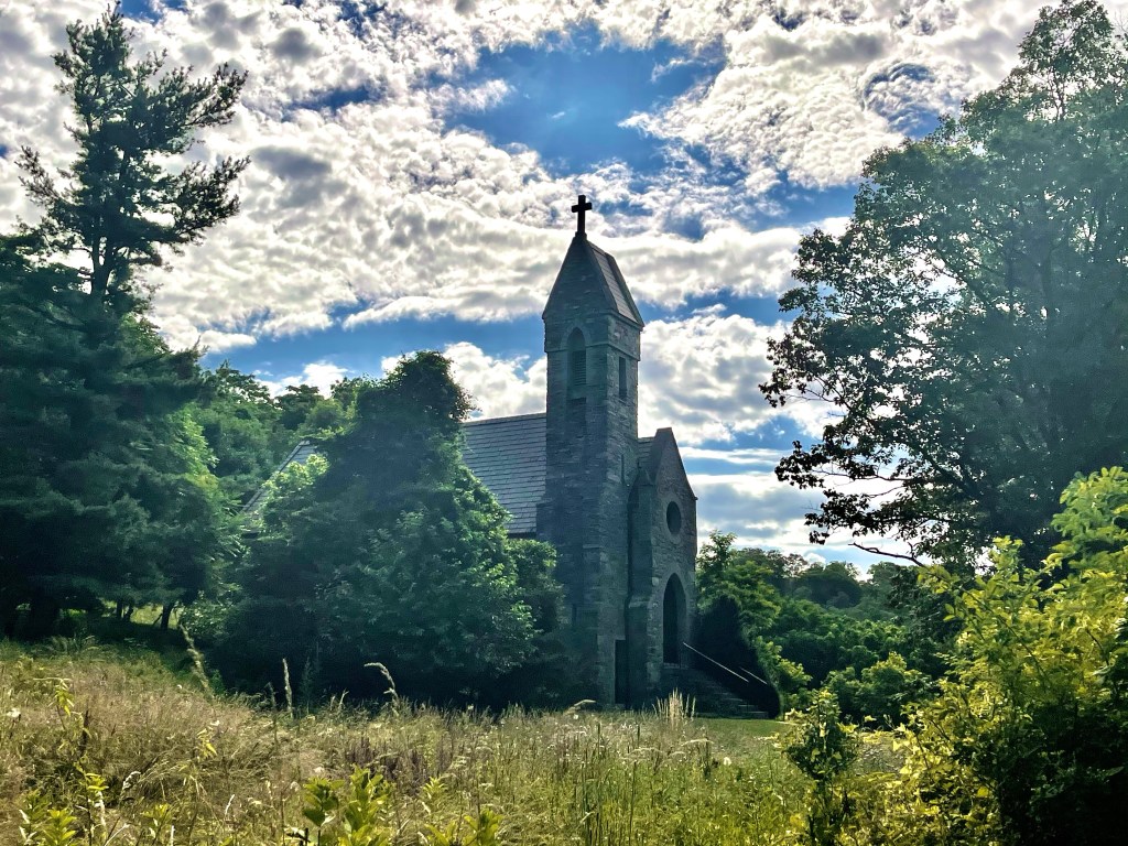
Continuing SOBO, we came up an amazing stone church.
The old world architecture, materials, and designs of the building around here just absolutely amaze me. Seeing these things on the daily make this so worth the journey! Right after we crossed highway 40A, Turners Gap, we walked down a small hill and there were two lawn chairs and a cooler. TRAIL MAGIC!!!! Cold drinks, pop tarts, and frozen watermelon.
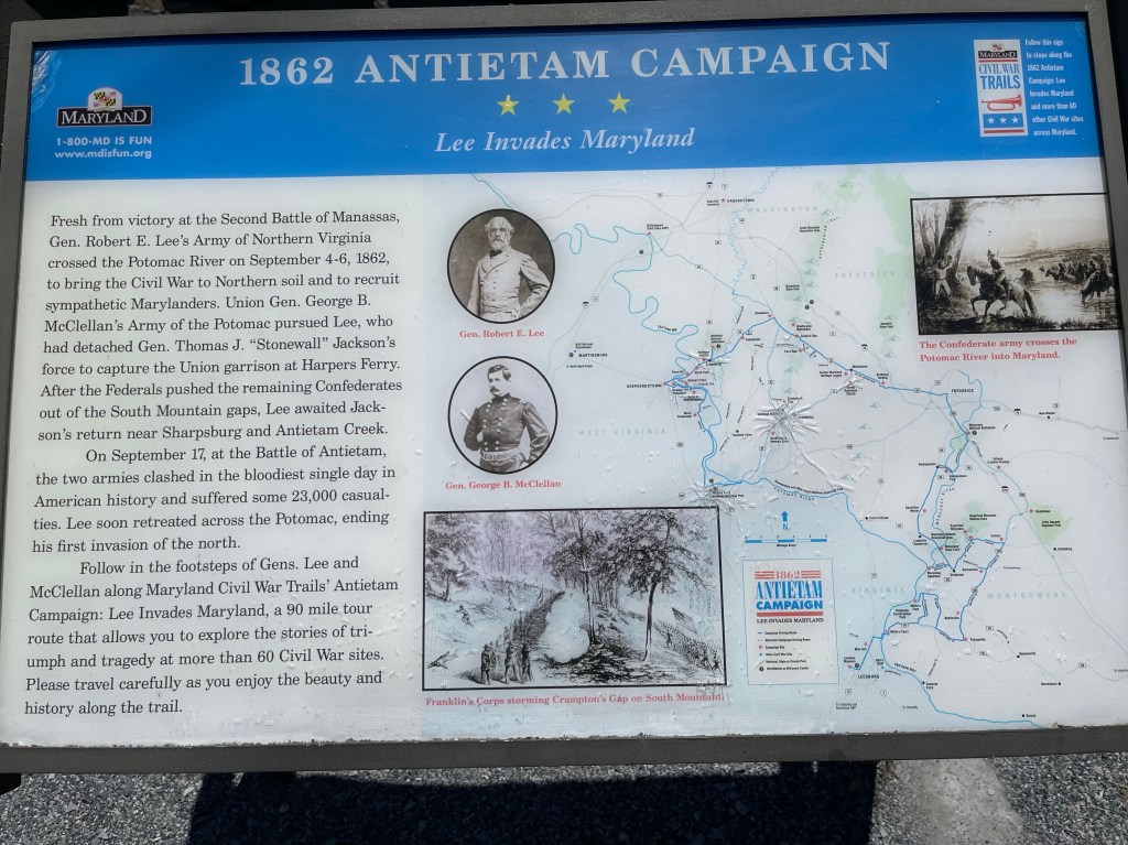
Farther into the hike, I came to the Gathland State Park, here could be found ruins of what was labeled as an old 19th Century estate.
This was a really nice park with lots of signs telling about the battles and groups that moved through this area as Union and Confederate troops fought.
Again, the architecture and even the colors and texture of this area are wonderfully amazing.
As we continued and got closer to the end of our day, we finally had a view that we stopped to enjoy. Here we are over looking the Potomac River as it comes out of Harpers Ferry after joining with the Shenandoah River.
From this amazing view, we headed down the mountain through a number of switch backs. These switch backs were taking us down to the C & O canal. I’m told it was at one time a canal that was used to move barges carrying materials from Washington, DC to Pittsburgh, Pa. the barges were drug along the canal by horses that would be up on the banks of the canal.
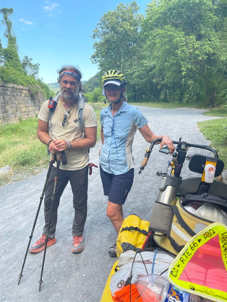
As we were walking the canal, which, it’s banks are now used as a bike path along the same route, we heard a bicycle riding up behind us and the rider yelled, “Birdie”, it was Birdies father in law, he had riding his bike down the canal to catch up to us. No, we were not riding the handle bars back home!
Just before we crossed the bridge back into West Virginia to meet John, he rode his bike back and drove to get us, we met a young lady who was riding her bike from California to Washington, DC. She heard about the canal path and decided to jump on it and ride it into DC.
We crossed the Potomac and sat as waited patently for John to come sweep us, and when he did arrive, he came bearing gifts, well, food at least!
From Harpers Ferry we headed back to Fredrick, Maryland to John and Lou’s house.
If you know of anyone who may also like to follow along on this journey, please, share it with them!!
Blue Ridge Parkway (3,880 feet) mile 772.2 to John’s Hollow Shelter (1,008 feet) mile 789.0 for a 16.8 mile day! We ascended 2,154 feet and descended 5,488 feet!
Damn storm! Damn rain! I could go on, but, you didn’t come here for anger, you came here for adventure!!
Well, here ya go!
The day started out as most days do, decent weather and getting warmer. Suzanna dropped us off at small pull off along the Blue Ridge Parkway and we took off hiking north.
Today was a day that we would come out of the Blue Ridge Parkway and head down toward the town of Glasgow, Va.
It was really a day with very little views and even less water. There were 5 water sources in the entire day, and the 5th one was at the shelter that we planned on staying.
I got a pretty decent close up of something I wanted to remember out here that I see quite often in my daily walks, a burl!
Just like when you get sick and your body freaks out and does weird things, a tree will do the same thing and when it does, burls form. Burls do not harm the tree in any way and has little to no effect on the lifespan of the tree and they grow bigger, obviously, as the tree grows bigger. The wood in burls can be high dollar and sought after by woodworkers and furniture builders. The value is based on the size of the burl and the type of tree.
We eventually came to Matt’s Creek Shelter (834 feet) mile785.1, and it was such a great place to get water and rest for a few minutes. We chatted with a couple while we were there and told them about our journey and invited them to follow along on Instagram at stuphelps to see all the fun we have and if we make it. The unfortunate thing here was, we had no phone service, so no way to check the weather, but we knew it would be along soon.
We headed toward the next shelter, which was only 4 miles away. Thankfully we were at the bottom of the descent and had some “flat” trail ahead of us because we were heading toward the James River. About a mile before we crossed the James River Foot Bridge there was a campsite that had a sign that said, “no camping for the next mile”, this meant we had to push on to the next shelter, even though the sky was growing darker by the minute.
We came to the James River Foot Bridge and it was here that I learned why this was its name. One would think it’s because hikers walk across it, but no.
It’s because the man who designed it, his last name was Foot!!
Nonetheless, we used Mr. Foots bridge to cross the James River, with a great swiftness, look back up in the bridge picture at the sky!! So, across the bridge it is now time to start hiking up some, and with the addition of rumbles it was even faster. Then, being down in this valley, the thunder started sounding so weird and it was so dark I almost stopped to put on my headlight, but I knew if I did I would be drenched. Well, it didn’t matter!! I even ran at some point, but, to no avail!! I was about a half a mile from the shelter when it came a sudden down pour, Kelly made it to about .3 before she was hit with the rain, I lost sight of her at some point in front of me! Ugh… my poor plantar fasciitis infested feet!! When I say sudden down pour, you know in a rain storm it usually starts slow as to kind of warm you of the impending doom that is about to be unleashed on you? That warning didn’t happen!!! The drops were huge and many!! And then just like that, it was gone and I set up my tent, hung clothes in hopes they’d dry then made dinner and went to bed.
Oh, if anyone knows the best way to live with wet feet, feel free to leave the method in the comments below.