AT Thru-Hike Day 77

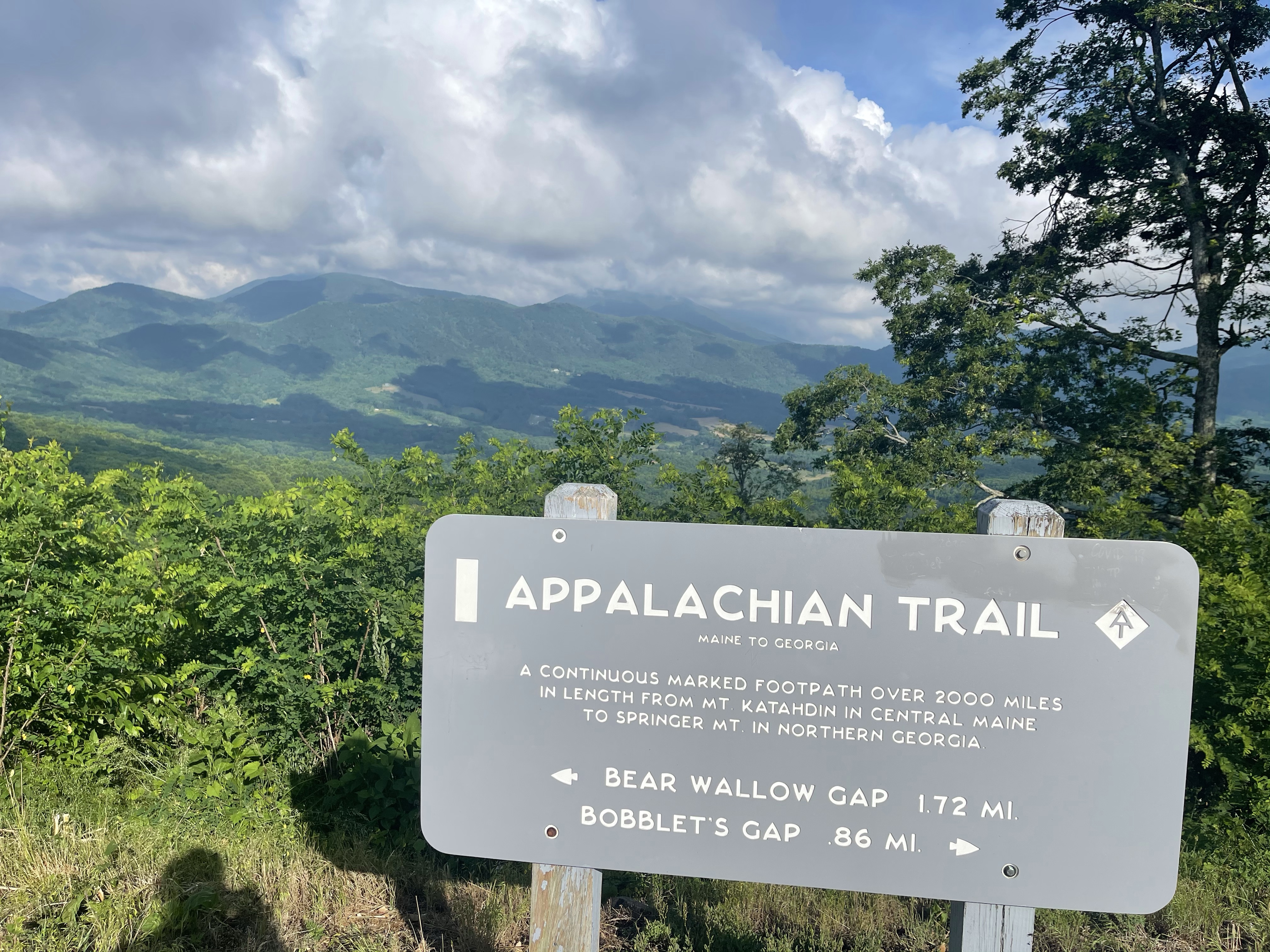
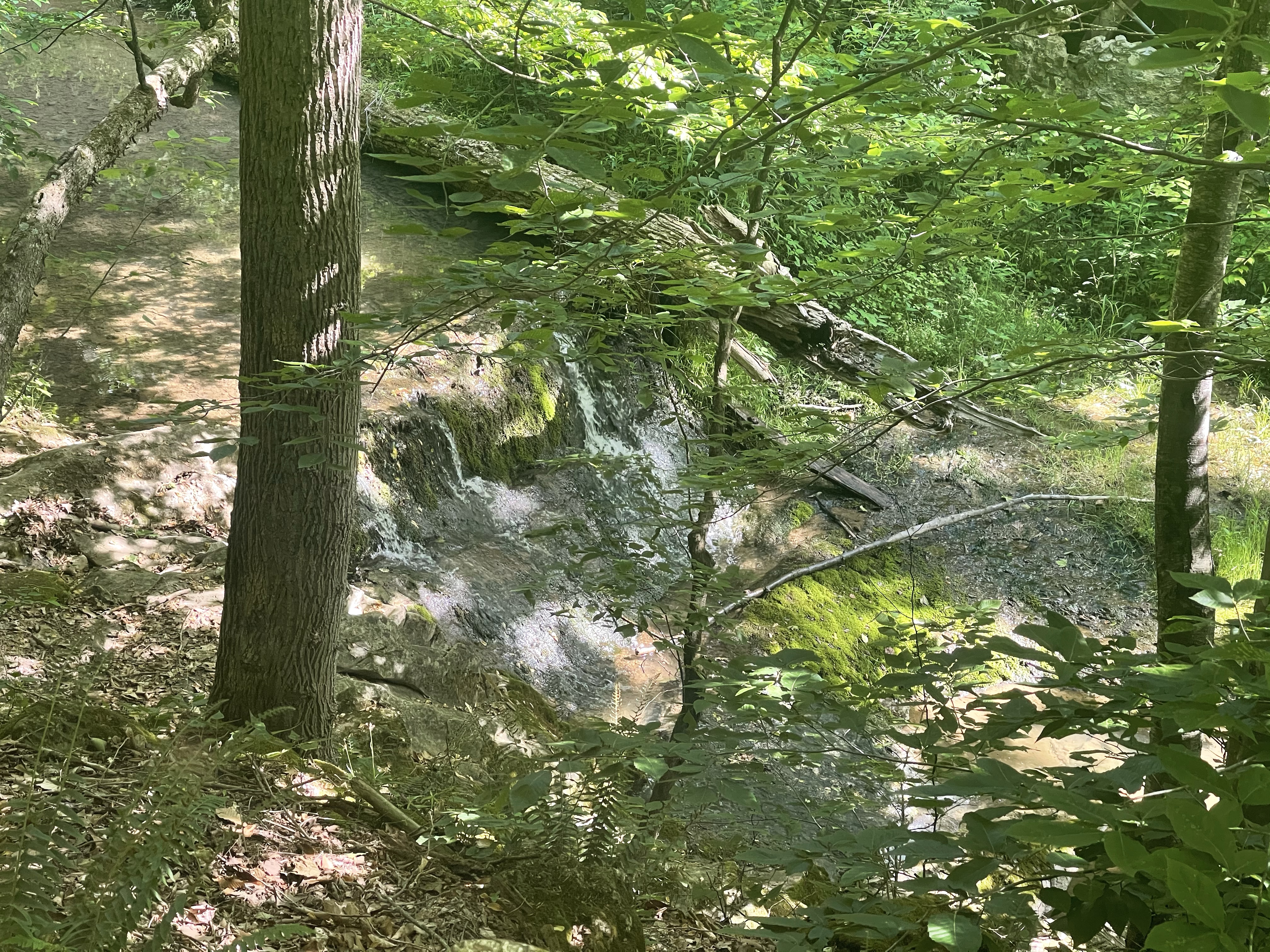
David Leeser Memorial Shelter (1,382 feet) mile 1,016.8 to the bridge over the Potomac River in Harpers Ferry, WV (246 feet) mile 1026.1 for a 9.3 mile day.

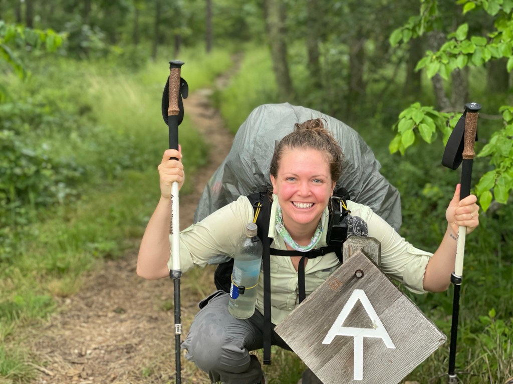
Super exciting day here because I was hiking into Harpers Ferry, WV.

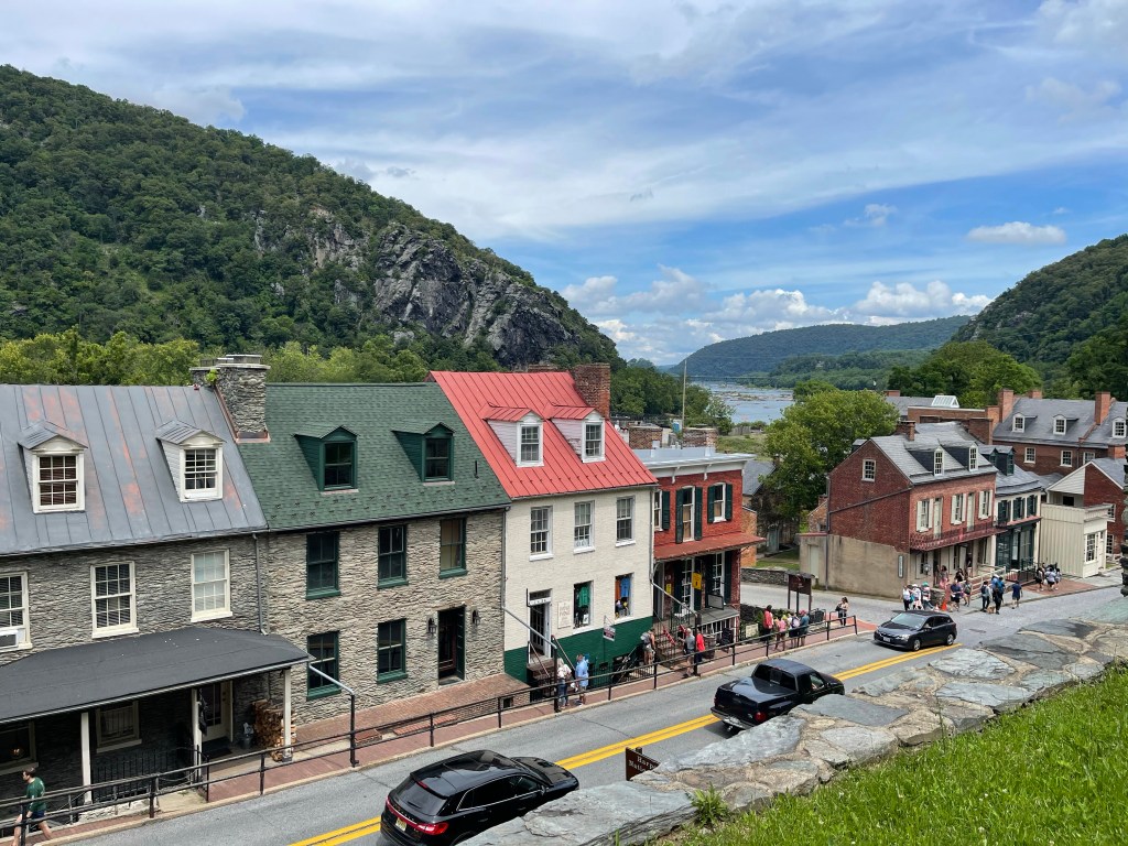
It’s a town, a point of land, at the intersection of the Potomac River and the Shenandoah River. It is home to the Appalachian Trail Visitor Center, John Browns fort, a civil war museum and many other historically significant buildings and places.

It is my kind of town, it’s all old!! Very little hotels though, only bed and breakfast type places and they aren’t cheap!!

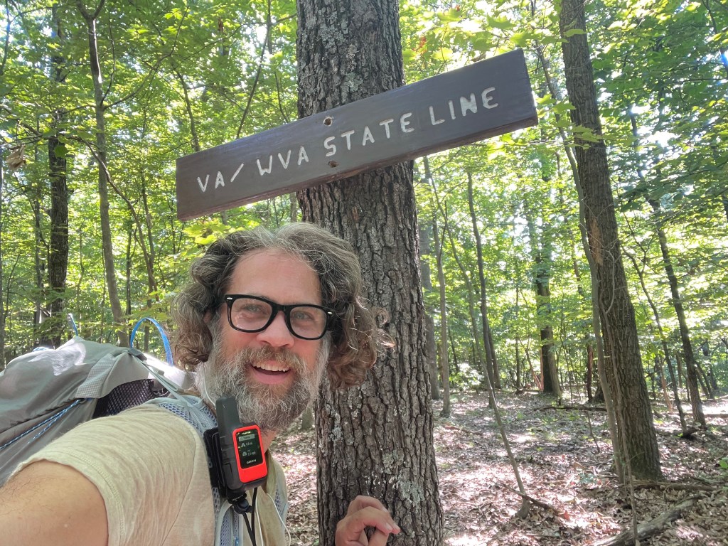
I went ahead and crossed the railroad/pedestrian bridge into Maryland so that I could finish one state in one day, but actually it took me about 2.5 hours to hike the whole state, well, at least the 3 miles of the AT that are in the state. Hahah West Virginia is the state with the least amount of miles.

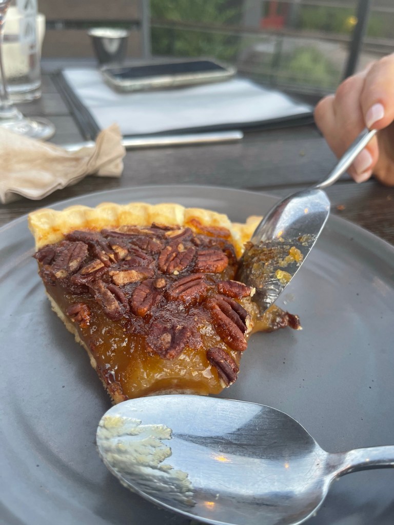
I then headed back into town to grab a bite to eat at one of the local restaurants that I could find that was open. Harpers ferry is a town of old and of new, I was in the old historical town today, and when it’s not the weekend, there is not much open because there really aren’t that many folks around.

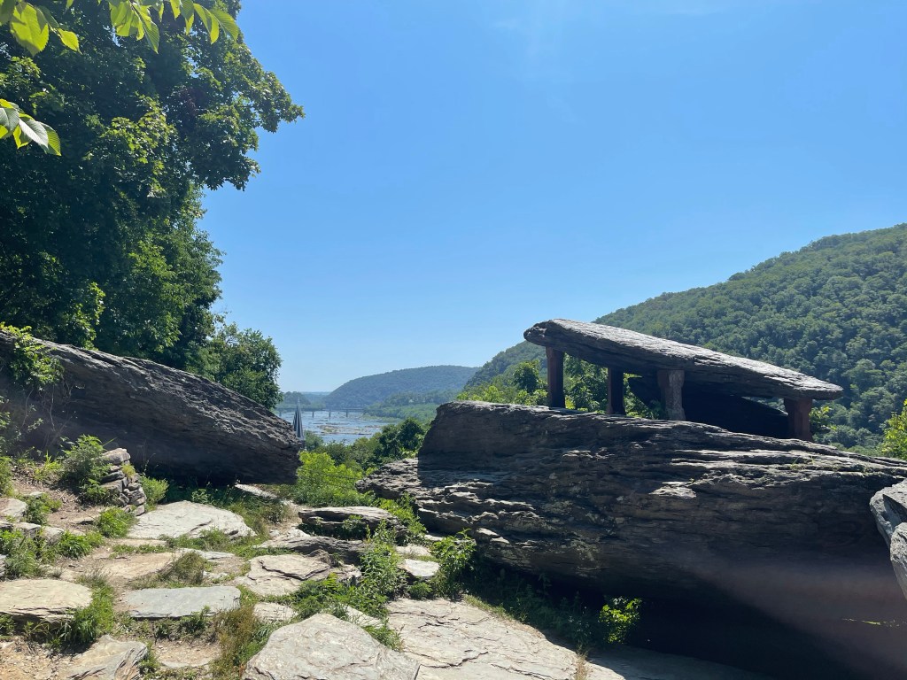
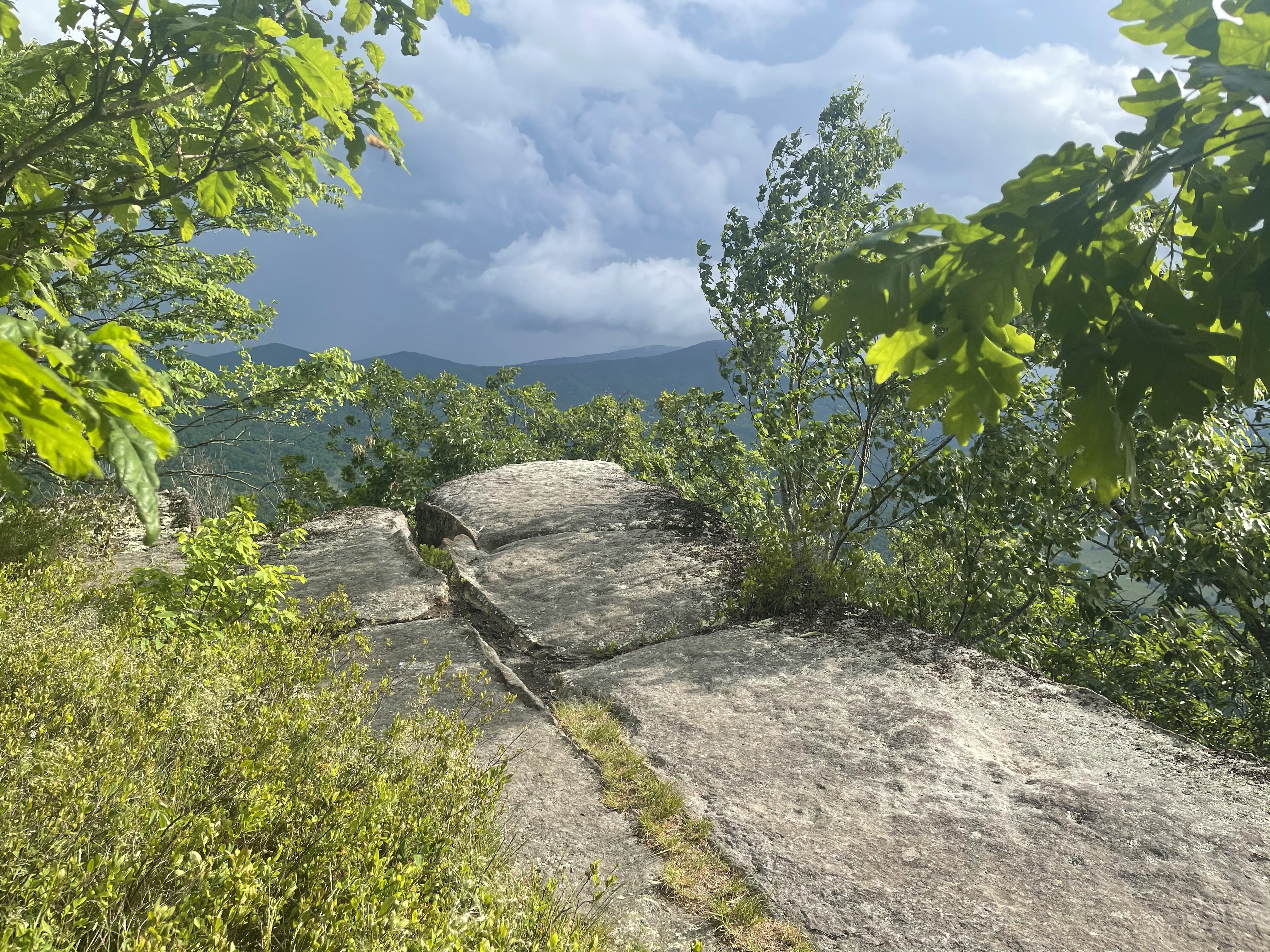
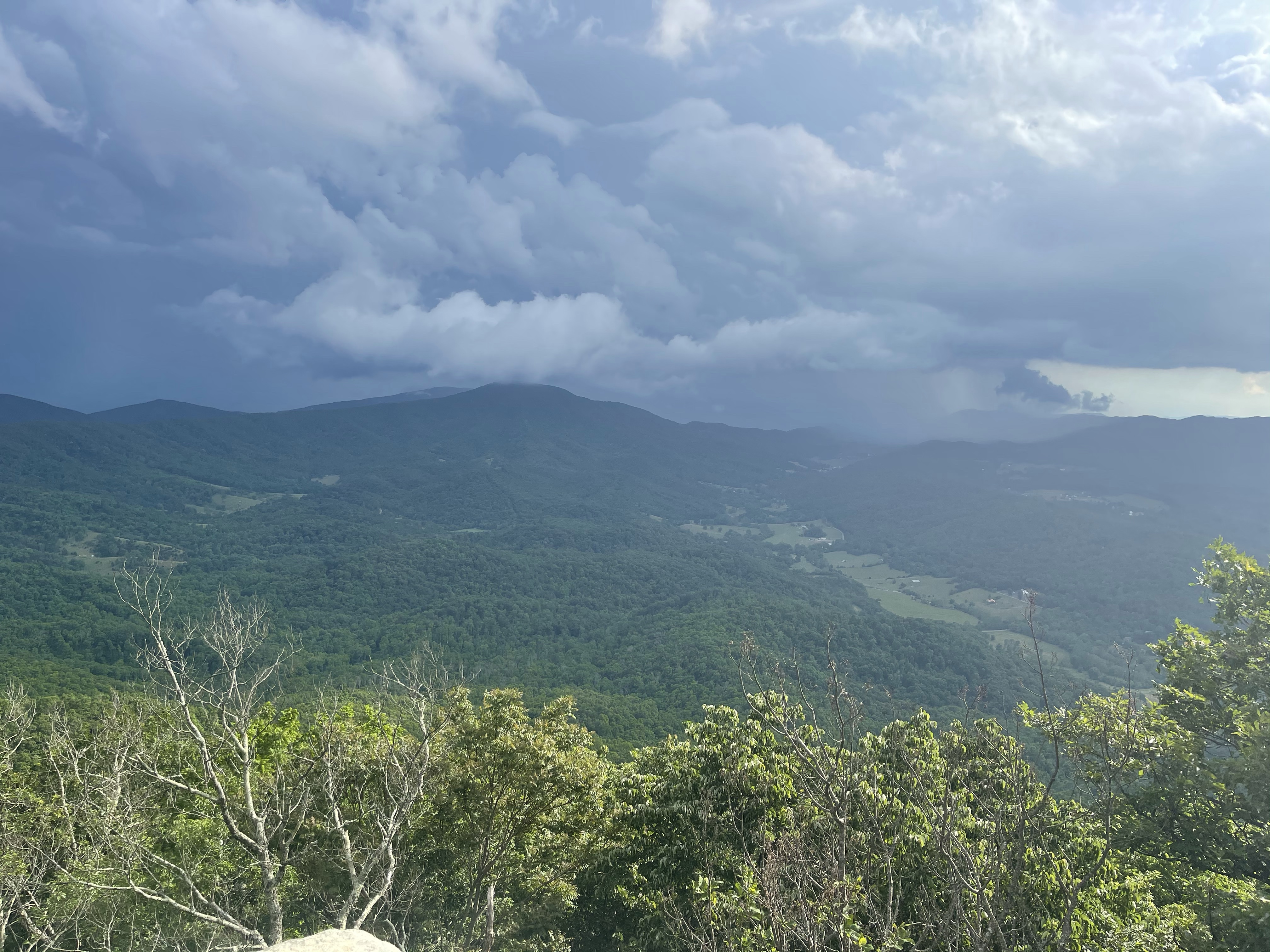
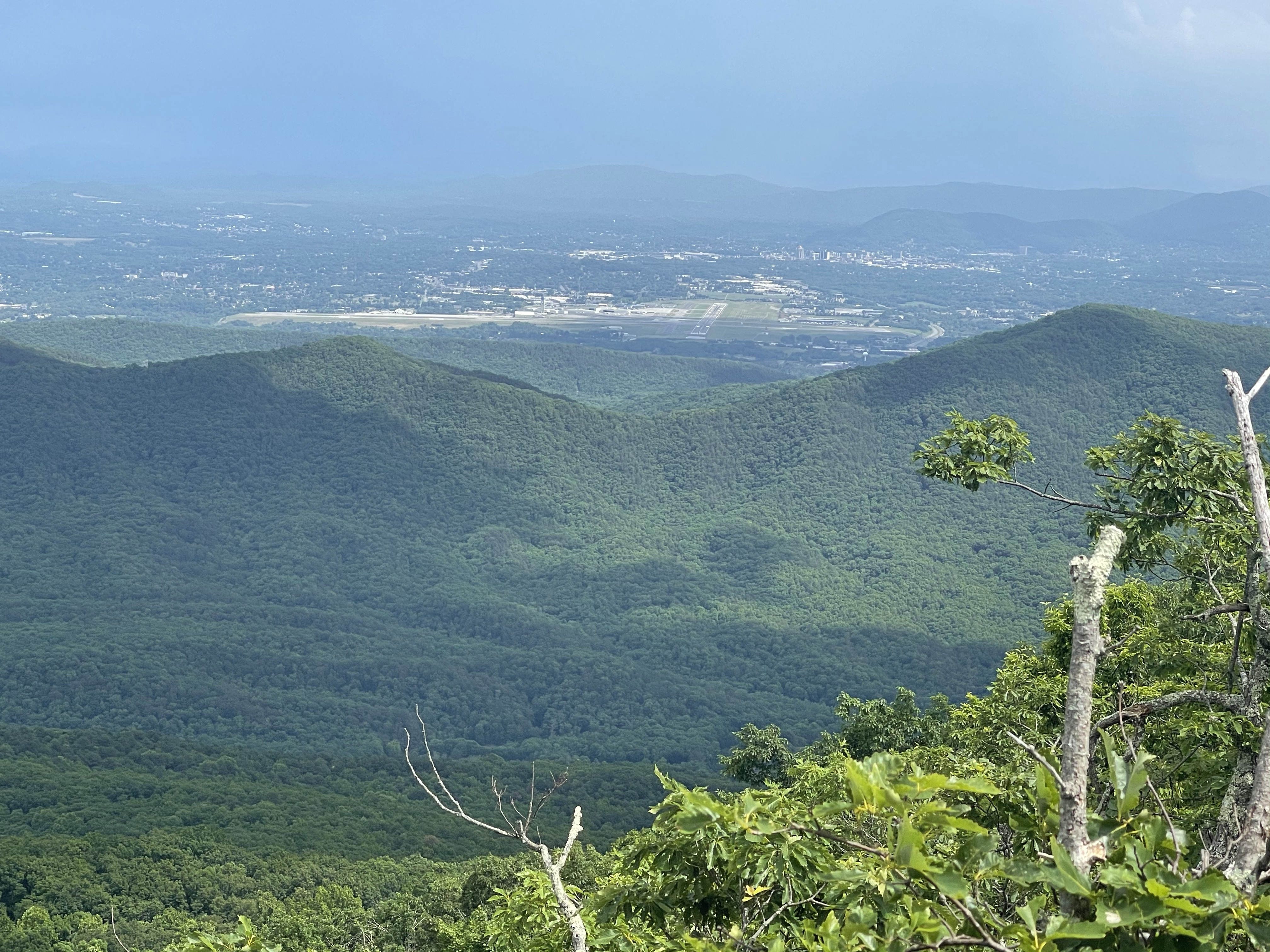
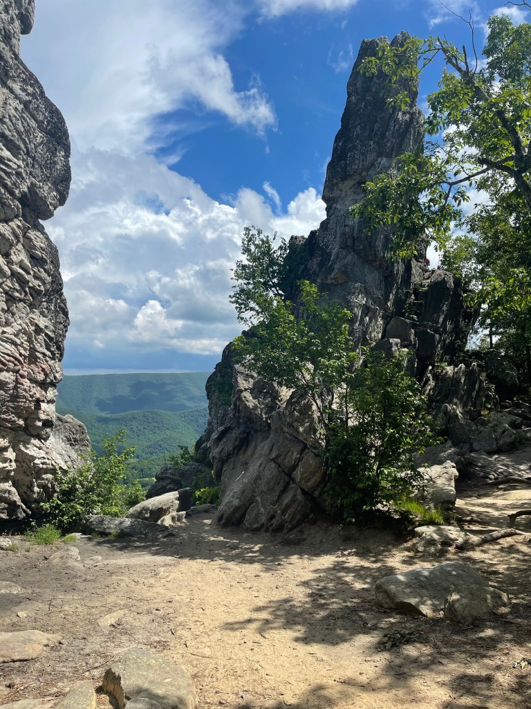
Above is Jefferson Rock, where in 1783 Thomas Jefferson stood over looking the town of Harpers Ferry on his visit here. Unfortunately, I was not able to see that view because the parks department says it is too unsafe and the balancing rock could fall since it isn’t as balanced as it once was.

Just passed the balanced Jefferson Rock, is the remains of the Episcopal Church. Before it was abandoned in 1895, it served as barracks and a hospital during the War between the North and the South, at which time it suffered considerable amounts of damage, but not the damage shown, this was all after it was abandoned.

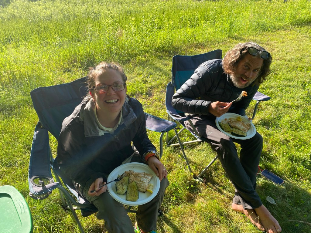
I sat with “Link” at the restaurant because the place was short staffed and it was going to be 30-40 minutes before they would seat me and I didn’t have that sort of time. The waiter brought us the bill, he told Link that his meal was covered by a couple that had been sitting next to him because they were impressed with the attempt he was trying to make and how far he had made it already. So nice of them, but, the waiter told me, sorry, they didn’t pay yours, you’re on your own.! Haha Well, Link turned around and paid it forward and paid for my meal. Just another example of how great humanity really is, the humanity that you don’t hear about out here.

There is so much to write about this town. But I’m tired and ready for bed!

Mad Scientist out!

AT Thru-Hike Day 74

Gravel Springs Gap (2,663 feet) mile 958.9 to Manassas Gap (791 feet) 980.3 for a 21.4 mile day. We ascended 3,876 feet and descended 5,491 feet.

Another day in the Shenandoah National Park, well almost a whole day. It was the last day and it disappointed, yet again, with its no views and continued pointless ups and downs, but, we had to do it to get to our final destination.

We stopped at two really nice shelters, first was Tom Floyd Wayside, it is the first shelter north of Shenandoah National Park, the second was, Tom and Molly Denton shelter. I took some time at the Tom Floyd shelter to put my feet up to get the blood flowing away from them for a bit.

This shelter as well as the Denton shelter had a deck off the front, the Floyd shelter had a picnic bench whereas the Denton shelter had a picnic bench under a pavilion as well as and Adirondack couch, flower gardens and a horseshoe game space.

After continuing down to our pick up location, actually not far from the location, we came to a sign talking about colonel John Mosby.

Later that night, Suzanna and I went by the outfitter in Front Royal on our way to dinner. There, we saw this whiteboard showing records for AT accomplishments.

Obviously, my name is nowhere on here, but, I’m going for completion not recognition! We walked next door and enjoyed a decent meal at the Front Royal brewery, where, all that mattered to me was this dessert!!! I have always had a think for a good pecan pie or bread pudding!

AT Thru-Hike Day 73

Panorama Parking Area (2,318 feet) mile 944.2 to Gravel Springs Gap (2,663 feet) mile 958.9 for a 13.9 mile day. We ascended 2,787 feet and descended 3,556 feet.

Descending is getting harder and harder for me to do. I am not sure if it is just the miles being put on my body or these new shoes but my left knee is starting to hurt mainly going down hill. I mention the shoes because the knee was not hurting before the Hoka Speedgoats got on my feet. The lower body as a whole takes a beating going down hill, so, I just slow down and take smaller steps in hopes it will carry me through the remaining 1,234.2 miles.

That was the only view we had all day during this 13.9 mile hike.

This was our second to last day in the Shenandoah National Park and it was, as the rest of the park, uneventful.

We got to Gravel Springs Gap and Kelly’s in-laws were there and she jumped in the car and took off after introductions. About 20 minutes later, Suzanna got there and we headed to Front Royal, Virginia.

Front Royal is the Northern entry point of Skyline Dr. and the Shenandoah National Park, home of the Battle of Front Royal, May 23, 1862. Two odd facts, it is the only incorporated city in Warren county, and it is also the Canoe Capital of Virginia. I guess the last one is because of the Shenandoah River passing through town.

AT Thru-Hike Day 72

Last night, we stayed at rock Spring shelter, where there was literally a spring coming out of the rocks. A nice shelter, and there was actually a cabin right there near the shelter that one can rent through the Potomac Appalachian Trail club. We took off this morning on our 14 1/2 mile hike for the day, it’s a short day, because my buddy Tom has driven up from Charlotte to tent with us tonight and cook us salmon and veggie.

This is one of the most amazing days today, the temperatures are probably in the 50s right now sunny clear blue skies not much wind but just enough to still stay cool while walking. The great thing was, it stayed like this all day long!! In fact, we stopped for “lunch” at Skyland Resort and while sitting outside at a little table, the only table I might add, I had to put my puffy jacket back on. We were joined by Emergency Protein, protein for short, this little dog and his owner, Grim. Grim had thru-hiked in 1986, I think it was.

We pressed on from here after relaxing for a bit. From here we had a few more climbs to make. The climbs here in the Shenandoah’s have not been nearly what they were the previous 900 miles.

We passed some amazing views along the way, it was nice to finally climb and get views instead of climbs with nothing in return!

As we continued our trek to Panorama parking where we were meeting Tom, things got a little rocky. By that I mean, things got a lot rocky!! For a mile and a half we tiptoed through the rocks, I wish it was tulips, down the 1,100 foot decent to get to our campsite and “restaurant” for the night. At this point, walking on these rocks are so painful, it is so tough on the feet and the ankles, but, it has to be done and it is gently preparing us for Pennsylvania and rocks there like we have never seen. You’ll have to continue following along for those.

We finally made it down off the mountain and met Tom where he has his tent setup and his grill and stove out ready to cook us some salmon and zucchini!! This has been a meal Tom and I have shared with others out on our camping trips, and we can’t wait to share it again when I return home in September!

Yummmmmmmm

Mad Scientist out!

AT Thru-Hike Day 70

Cliffs (3,296 feet) mile 893.6 to South River Picnic Area (2,965 feet) mile 912.8, for a 19.2 mile day! We ascended 4,363 feet and descended 4,668 feet!

Started the morning with breakfast from a beautiful view overlooking the valley below and mountains in the distance, the same view we watched the most beautiful sunset of the journey from.

Then within a few tenths of a mile we came to an amazing view to the east, in this view we were able to see cloud inversions. I am not sure what it is about the cloud inversion that makes me so happy, but I do feel like I’ve talked about it before. Cloud inversion, or temperature inversion, it is also called, is when the normal air temperatures are inverted, meaning cold air is down at lower altitude, or elevation, and the higher temperatures are above the cold air.

A mile or so later we came to our first water source, it was a beautiful stream that we met up with about .2 up trail that when we got to where it crossed the trail it was a bigger flowing creek with some cascading water making that calming sound that cascades make.

Bring that we are in the Shenandoah National Park we often come to parking areas where folks in cars stop to check out the views, and sometimes there are information signs so they know what is around them, or, what they are standing in the middle of. In this case, the sign read Appalachian Trail. Thought the mileage is a little off from what it is today, 2,193.1 miles, all of the other information is correct and accurate. Because of trees blown down (blow downs) and other things, from time to time the trail has to be rerouted causing the mileage to change.

And, speaking of mileage, we crossed the 900 mile mark today.

It was a hot day today.! The lack of water along the trail in this area makes it hard enough, but add in the heat and humidity, it makes for some rough days. At some point I got an alert on my phone saying there was a severe thunderstorm warning, it never came though!

We were about where we had planned to camp for the night when we realized there was another wayside ahead that we could hike to and grab food. Therefore, we pushed on a few more miles and ended up with a 19.2 mile day and only 13.5 to get to the wayside.

About the time we finally got into the picnic area, the sky darkened but we never saw any rain! We were able to eat, setup our home and relax a little before bed!

AT Thru-Hike Day 61

Blue Ridge Parkway (3,880 feet) mile 772.2 to Bearwallow Gap (2,214 feet) mile 751.9 for a 20.3 mile day! We ascended 4,730 feet and descended 6,343 feet!

That’s right, we ended at the same place we ended yesterday! It’s called SOBO, or south bound. Not only did we SOBO, we did it slack pack. Suzanna dropped us off farther north on the Blue Ridge Parkway and we walked the 20.3 miles back to where she picked us up the day before. You may be asking yourself why, well, I’ll tell you to go look at the descended portion of that opening paragraph, that would have been our ascent, you may also be saying to yourself, you still ascended 4,730 feet, and you would be right!! It was difficult too! Of course it was spread out over 20.3 miles but it was still a tough day and it was made tougher by the ending, more on that in a bit.

So, I have been having the hardest time this past week. My feet have been killing me and it has become so discouraging to me. It is made worse when we have these toad strangler rains and there is no way to stay dry from what to toe. There have been several days that I feel like throwing my pack and walking to the nearest road and getting a ride to the nearest town to wait on Suzanna to come get me. Those same days, when I finally made it to camp, I would set up my tent, eat and then get in my tent not wanting to be around anyone and all I could do not to cry! The worst part was, I have had very little phone service so could talk to no one about it at all. Today was not one of those days, but what it was was a day I talked to my buddy Rob at Outdoor 76 and found a possible solution. I had already changed my shoes and have worn them a week as of today, but now, all the rain with the new shoes brought me blisters on my toes!! So Rob taught me a tie that would allow my toes to have more movement and it has felt great as of this afternoon. It’s a double overhand knot on the second going into third eye.

We hiked on our my quick call and enjoyed some nice cloud covered skies along the trail. Going southbound, we were able to see lots of old friends who we have met along the way. We counted 69 different thru-hikers heading northbound!

For lunch, we stopped at, Bryant Ridge Shelter. It is one of the largest shelters on the Appalachian Trail. It is a towering, double-decker with space for around 20 people.

We arrived at the shelter and saw about 15 other hikers, most of them from one tramily (trail family), it was great to reconnect with friends we have met along the way to catch up on trail happenings.

Grabbing water from the nearby stream we made our way south again. We pushed another 7 miles to the Cove Mountain Shelter, it was not as “fancy” as the other shelter. Here, we sat for a brief foot break before heading back out on the trail. While there we met a guy from Rock Hill, SC, he was doing a LASH ( long ass section hike), basically pick 100 plus miles and take the time to hike it… that’s a LASH.

Now, back on trail for about 20 minutes and the sky was looking worse and worse and the thunder and lightning was getting closer and closer. By this time, we still had over 4 miles left to hike and most of that was uphill. Well, it wasn’t getting closer anymore, it was on top of us, and it was raining hard, sideways and all!! It rained for the next hour and a half that it took us to get back to the road, where Suzanna was to pick us up!

We finally made it down to the road and since Suzanna was not there yet, we went and waited under a Blue Ridge Parkway bridge for Suzanna to show up.

AT Through-Hike Day 60

Fullhardt Knob Shelter (2,657 feet) mile 735.3 to Bearwallow Gap (2,214 feet) mile 751.9 for a 16.6 mile day! We ascended 3,563 feet and descended 3,498 feet!

After a soaking wet day yesterday, we woke to fog and the uncertainty of what lay ahead as far as weather. I know it’s outdoors and technology is not all that welcome but it’s great to be able to look at a radar to have an idea of what’s ahead. But, we have had hardly any service along some of these Virginia mountains and ridges. The ridges are usually better since we aren’t going into the valleys, but as a whole, it’s all bad, especially for us with AT&T!!

Today was the day that Suzanna came to town, so that automatically made the day better, no matter what it had in store. Today was also the day that we hit the Blue Ridge Parkway, this meant we would definitely have some views. The views we had though would not go without clouds though, big, dark, puffy clouds!

As we approached the Parkway we came upon a blue Toyota Prius with the back hatch open. If ya don’t know, when the back hatch is open it’s usually a good sign of trail magic. This trail angel was called, Carson, and her boyfriend, who did the PCT already, was now doing a through hike of the AT. BBQ chips, snickers, starburst, Lance crackers, and topped it off with seaweed! Haha all of this was along side my regular lunch of Green Belly Bars and nuts and seeds!

As we sat here, a guy called Rambo, he carried a “big” knife, said Nimblewill Nomad told him for better views, walk the Parkway. So, if Nimblewill, we did it, and the views did not disappoint.

As we walked along, Kelly entertained herself by walking on the wooden guardrail that the Blue Ridge Parkway is “famous” for.

We decided, as the thunder and lightning was quickly approaching, to head back into the woods onto the trail. Let it be known, we really didn’t go to crazy with this walking off trail, the trail weaved back and forth over the Parkway. We came upon a great entrance to head back into the woods.

We continued weaving along the Parkway and ran I to our buddy Rambo again, just before we went back into this woods, we stopped to take a picture with him at one of the many overlooks along the Parkway.

We had to meet Suzanna around 6:30 so we stopped around 4:45 for a break and chatted with Rambo for a while, we met him close to the start of the trail back in April. Still 2 miles out, which for us is a little less than an hour, depending on terrain, we decided we better get back to walking so we weren’t late. Birdie and I decided to jump back on the Parkway to cut some time since we were a little behind, and it worked, we beat Suzanna to the parking area by about 7 minutes! Oh, if you’re wondering, yes we got rained on a little bit, but a little is still a lot when you’re walking in your wet clothes all day!!

After Suzanna picked us up, we went to Buchanan, Va, where we ate at a great little restaurant called, foot of the mountain. We then brought Birdie to the campground she was staying at and Suzanna and I headed to Roanoke, Va.

Mad Scientist, out!

AT Thru-Hike Day 59

Lamberts Meadow Campsite (2,060 feet) mile 721 to Fullhardt Knob Shelter (2,657 feet) mile 735.3 for a 14.3 mile day! We ascended 2,991 feet and 2,459feet descended feet! We got up this morning with excitement in our steps! We were heading into Daleville, Va. and there in town, not three tenths of a mile from the trail was Three Little Pigs BBQ, where we were stopping for lunch.

The hike into Daleville was a pretty one. There is one thing I have noticed about this area, and I’m not sure why, there are a lot of transmission towers/power lines going across these mountains.

We made it into Daleville and hit the Three Little Pigs BBQ, just as we had planned!!

After getting our fill on BBQ we headed back out onto the trail. While leaving the restaurant, we ran into a few hikers we had seen earlier. When we first saw them, they had found two dogs and were waiting around for their owners. They told us the owners finally showed up!

Just about 800 feet after getting onto the trail again, we hit another major milestone, this time it wasn’t a mileage marker, it was a sign telling us just how much of the trail we had finished at this point.

1/3 of the way to Katahdin, wow!!! I couldn’t believe it either! Well, the celebration came and went, the other 2/3 needed to be hiked and they weren’t doing it themselves, that is for sure!!

And in tru AT fashion, especially as of late, about 2 miles after this picture, it started pouring rain! We knew it was coming though, the weather was hot and humid for the morning and then around 3:30 thunderstorms!! It rained for the next three miles and then a while longer once in the shelter!

This was the first shelter, and the o oh shelter left, with a cistern for getting water, the cistern was filled by rainfall running off of the roof of the shelter.

Yeah, the water was brown!! Haha and had mosquitos in it, but, I needed to cook and there has been very little water lately. So, I used a fellow hikers chlorine tablets and then boiled it to cook and then I put punch flavored electrolytes in it to hide the color!

The rain finely stopped and I pitched my tent and now it’s time for bed!

Mad Scientist, out!

AT Thru-Hike Day 58

VA Route 624 (1,810 feet) mile 704.5 to Lamberts Meadow Campsite (2,060 feet) mile 721 for a 16.5 mile day! We ascended 4.012 feet and descended 3,792 feet!

We left the hostel, walking down the highway to get back on trail. We got about 5 miles in for the day when the sky decided to open and reveal how much rain the clouds could hold before letting go. I’m here to tell you, it was a lot of rain!!

Today we would be coming to the second crown in the Virginia Triple Crown, McAfee Knob. This is the most iconic photo on the Appalachian Trail, and because of this, lots of folks want to get there for the best photo ever, the sunrise! Well, there is no camping at the Knob so there are two shelters within a mile or so of each other, I believe to give more space for tenting and sleeping, to make that walk early in the morning! Because of this, we had our pick of shelters to go into to dry ourselves off. We chose, Johns Spring Shelter, the closest of the two to the highway we started from. Here, we were able to dry off and it had stopped raining so we could also hang our stuff out to dry, which all of mine did!

After drying off a little, we pressed on to McAfee Knob. I am not sure why I thought this would be an easy hike, I guess because there are a lot of signs for this place and parking, and day hikers, but it wasn’t as easy as I thought, but it was oh-so-rewarding!!

We marched on towards Tinker Cliffs in hopes to enjoy the views that we have heard so much about, and then the thunder started! Today was the second day that we heard the thunder roll and saw the lightening strike! We had roughly three miles left to hike until we got to the shelter so we could at least have somewhere to stay dry while we ate dinner. Well, we walked as fast as we could passed Tinker Cliffs but I managed to stop and grab a picture or two and what did I see, the big dark rain close pushing hard towards us!!

And ya know what, God was good to us, it did not rain on us at all!! This is a great thing because at the shelter earlier today, all of my clothes dried out! Haha

Mad Scientist, out!

AT Thru-Hike Day 57

VA Route 621 (1,538 feet) mile 689.3 to VA Route 624 (1,810 feet) mile 704.5 for a 15.2 mile day! We ascended 3,816 feet and descended 3,517 feet!

Today was a great day, we started into the Virginia Triple Crown!

But first, we climbed, of course, a 1,500 foot climb to the start of the Brush Mountain East Wilderness. We were greeted by the wilderness in the most beautiful way, Mountain Laurel!!!

A few tenths of a mile from the sign marking the Wilderness, we came to another sign, this one marking the Audie Murphy Monument.

Audie Murphy was America’s most decorated WWII veteran who died In a plane crash not far from this memorial site. He was a military hero, a actor, and worked for the Civil Air Patrol. He died here in 1971 and in 1974 they erected this monument along the AT near the crash site.

We headed back down hill to Trout Creek, once we arrived there, we sat and had a quick snack and drank some water. We also found a trash can here that was put out by a local man and emptied by him as well! We finished up our snack and headed across the bridge to start a climb up to Dragons Tooth! Just about the time we got going good up hill, I heard a truck coming, so I stopped to check it out, and wouldn’t you now it, it was exactly who I thought it would be, the Salty Express!!! We dropped our packs and went down to sit with them a bit and eat some of their snacks and donuts they had brought.

After loading up on calories, we climbed the mountain and burned them all immediately! This climb was a beast. Virginia has definitely got its share of climbs, all those that said it was flat and easy to get big miles, well, not for this guy!! We did manage to pass the 700 mile mark today! It’s always exciting to hit these milestones. We have gotten to where we can hit the next 100 mile mark every Monday, which we feel is a great accomplishment.

Finally getting to the top, I doubted myself multiple times climbing this, we enjoyed some views down the blue blaze which lead to the Dragons Tooth, the first of Triple Crown Sites.

We hung here for a little bit and then we started back down some of the hardest down hill terrain I think we have had so far.

Oh my! Because I am trying to block this place from my memory, I am it going into any details at all about this hostel!!

Mad scientist, out!