AT Thru-Hike Day 47

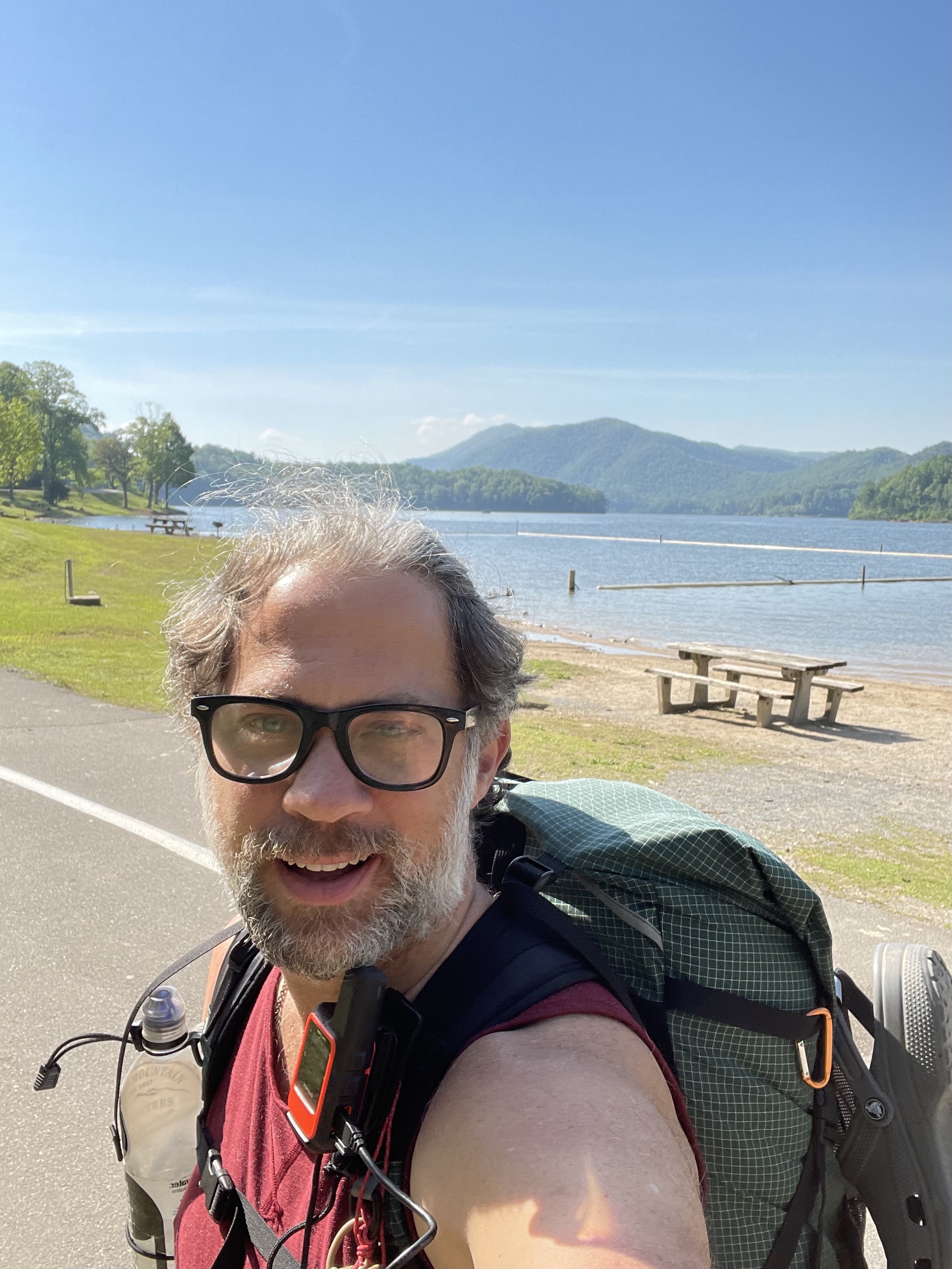
Long Neck Lair mile 545.9 to Lynn Camp Creek (2,373 feet) mile 561.5 for a 15.6 mile day! We ascended 3,730 feet and descended 3,660 feet!

We had boiled eggs and bananas for breakfast, with too many cups of coffee for me. After this, we got on the road to head back to the AT. On the road, because we had to walk .4 miles on the highway to get back to the trail, which also took about .3 miles of road walk before leaving the pavement.

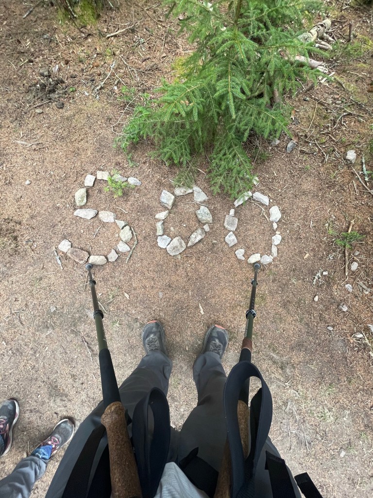
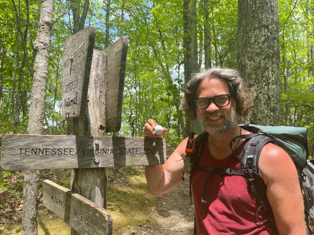
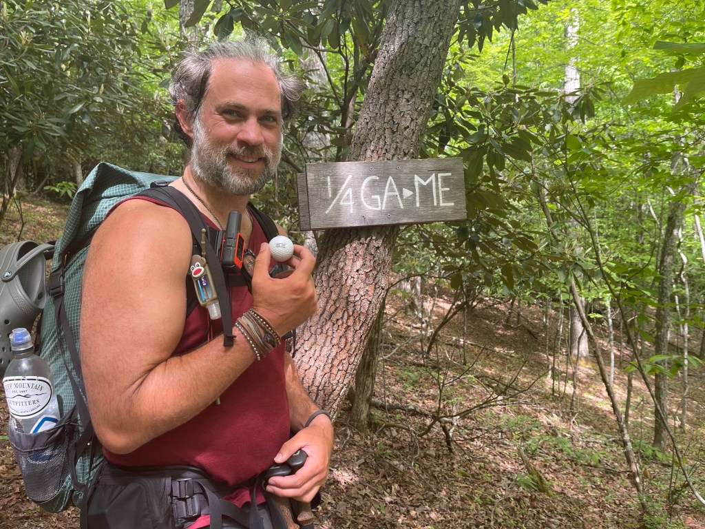
Not far into the hike today we hit a milestone! We have now walked 1/4 of the way to Maine!!

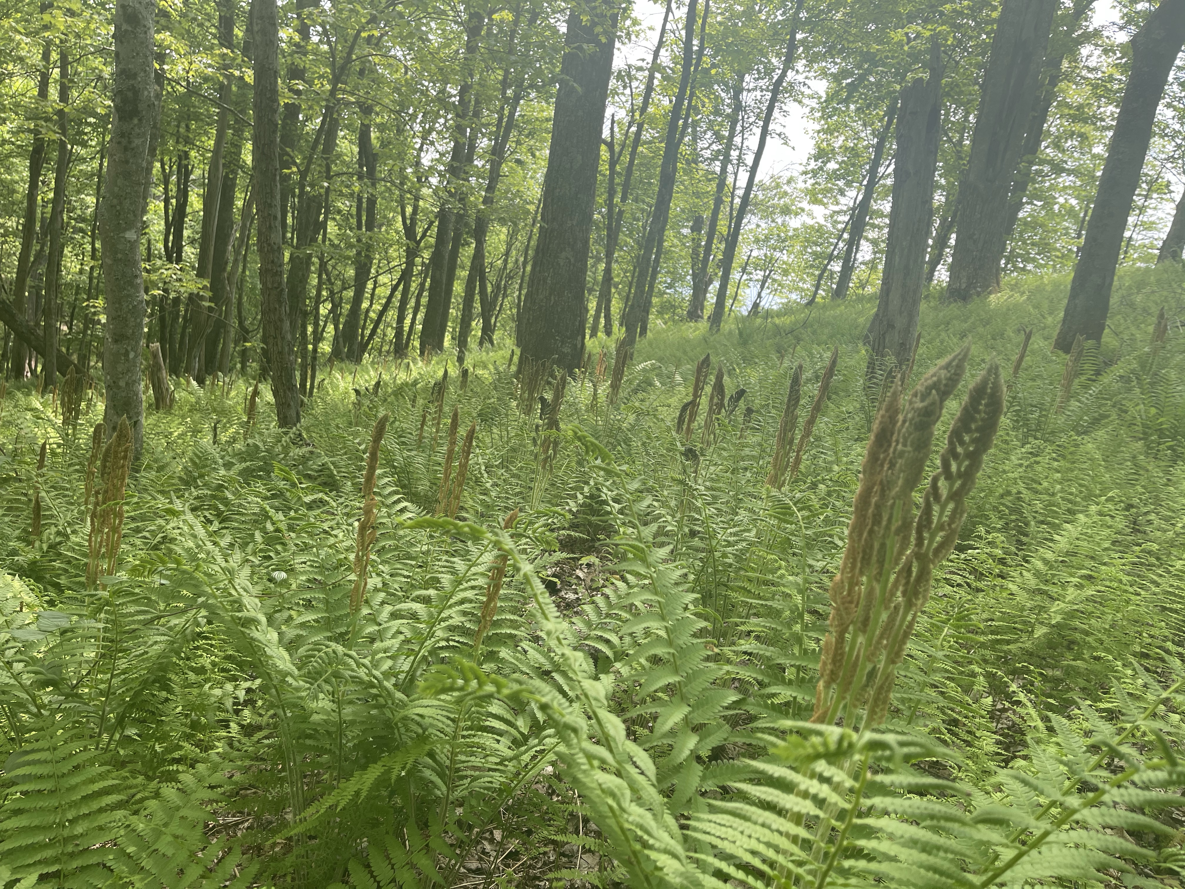
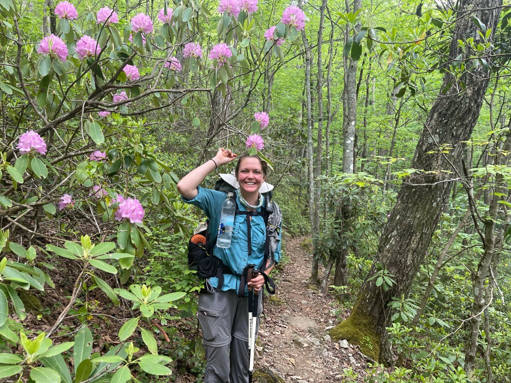
If I have not said it already, the Rhododendron and Mountain Laurel are really blooming now and showing off their wears!

Mountain Laurel

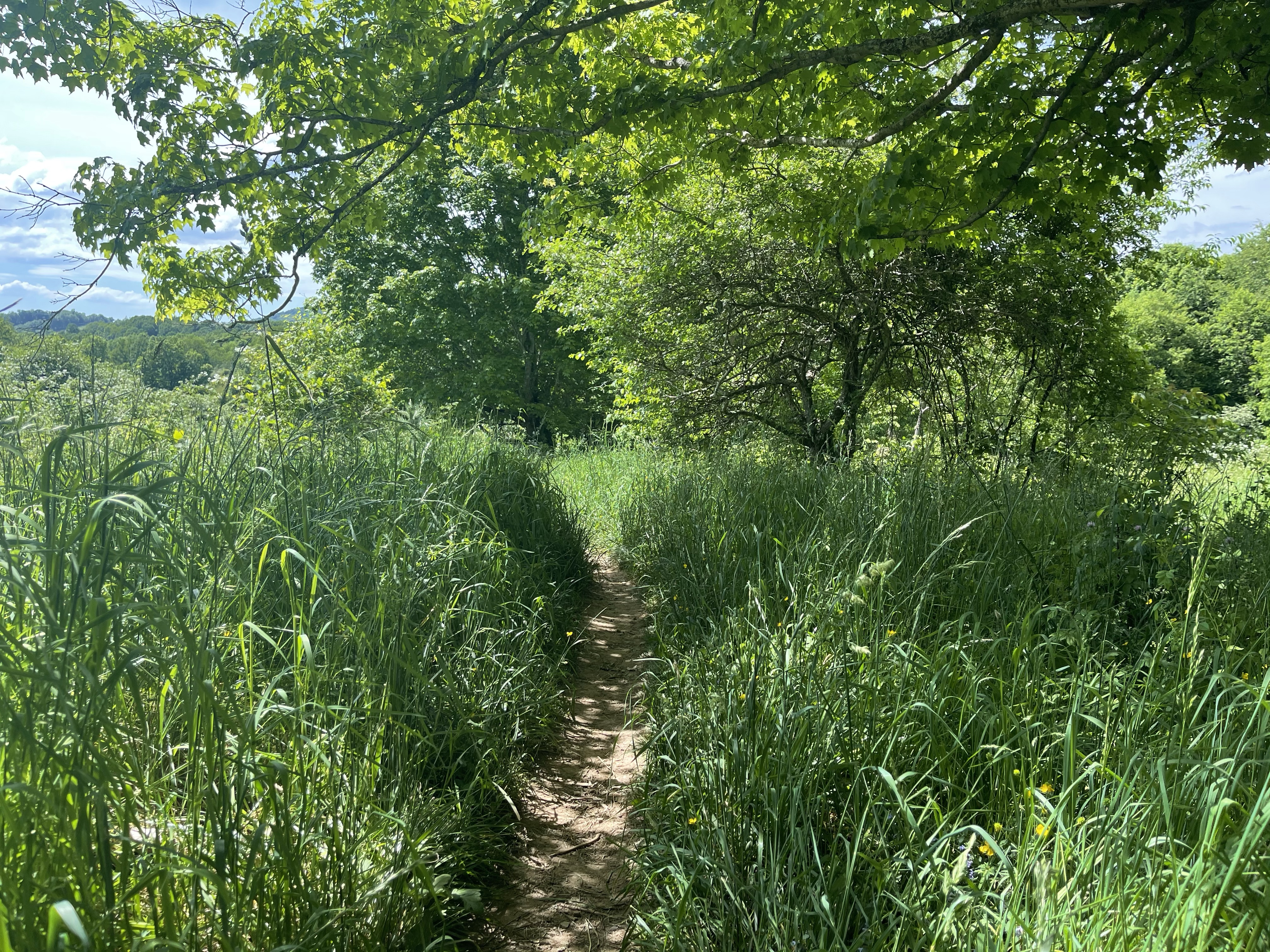
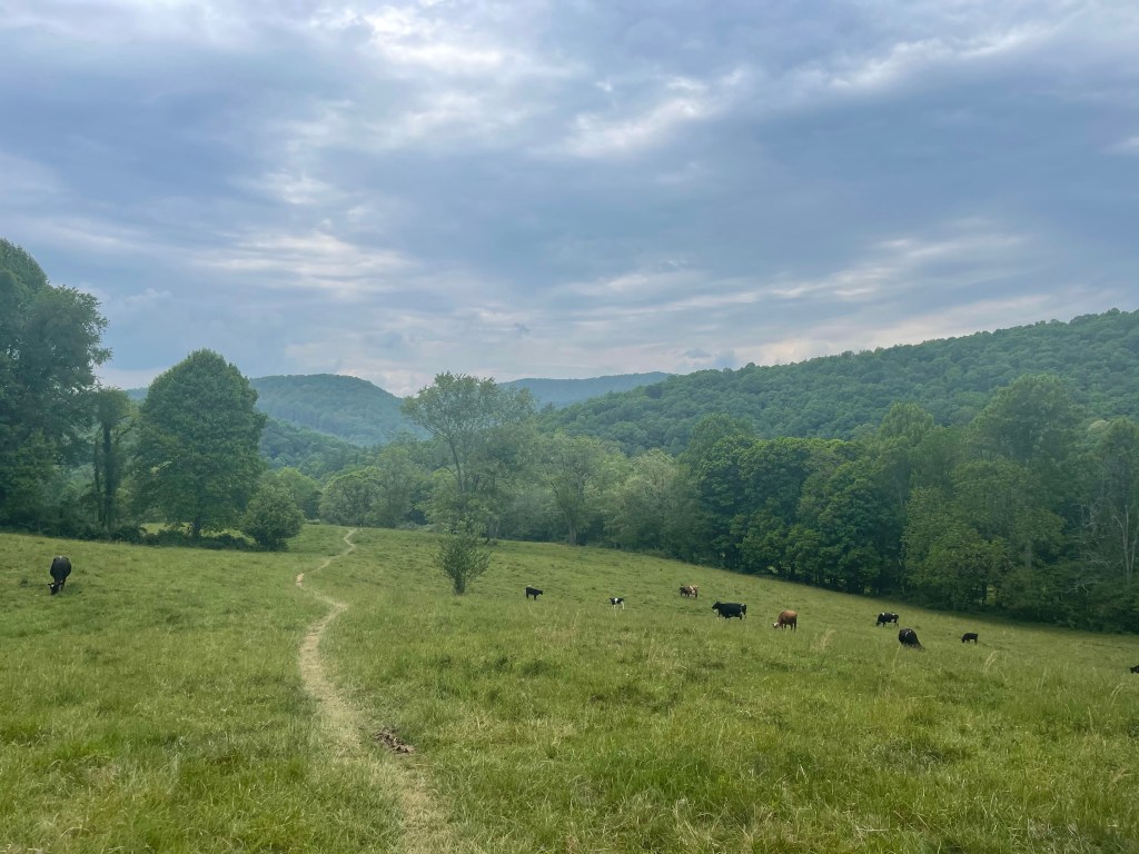
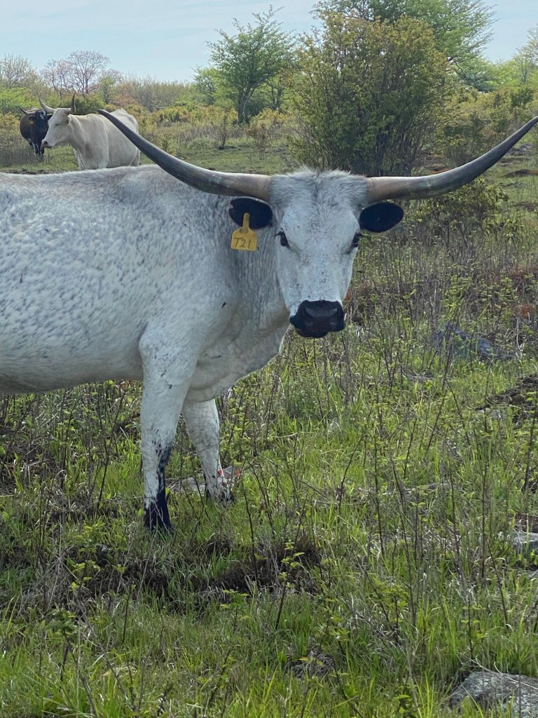
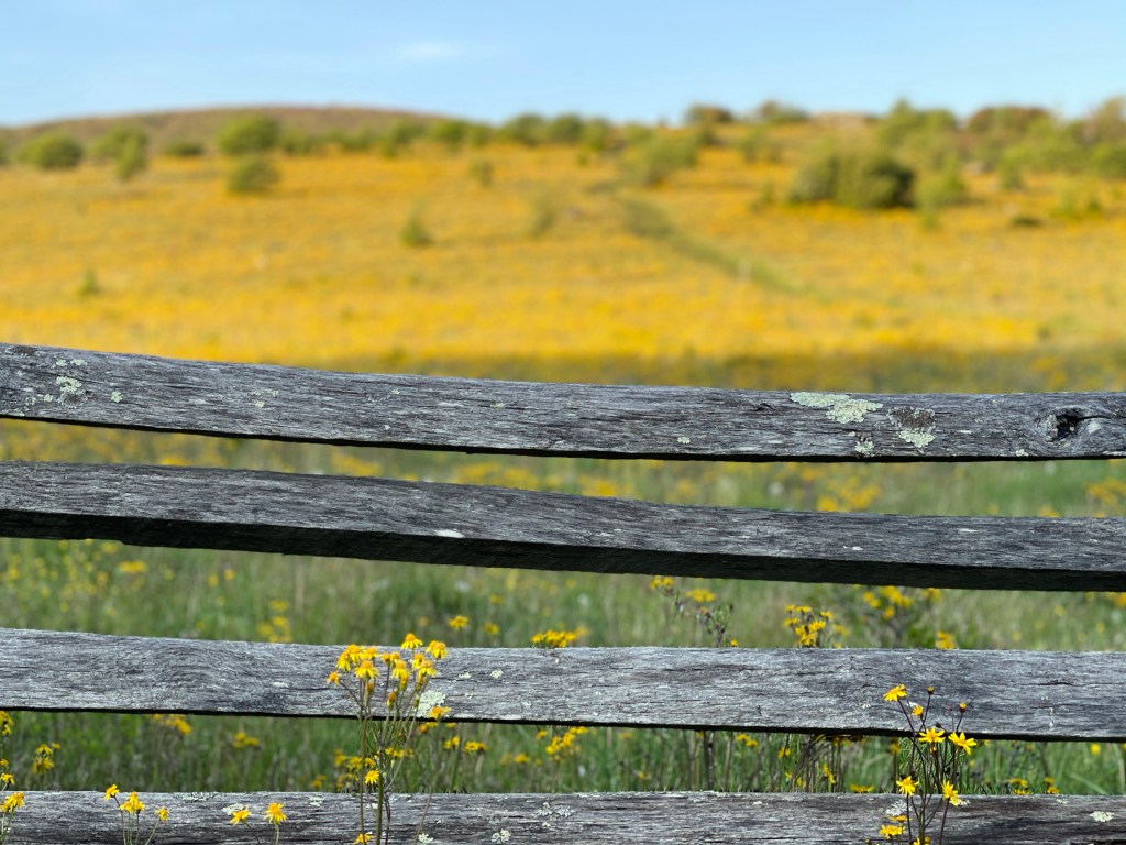
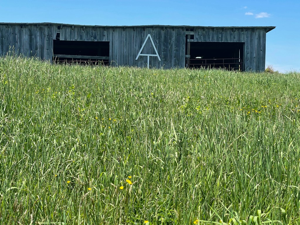
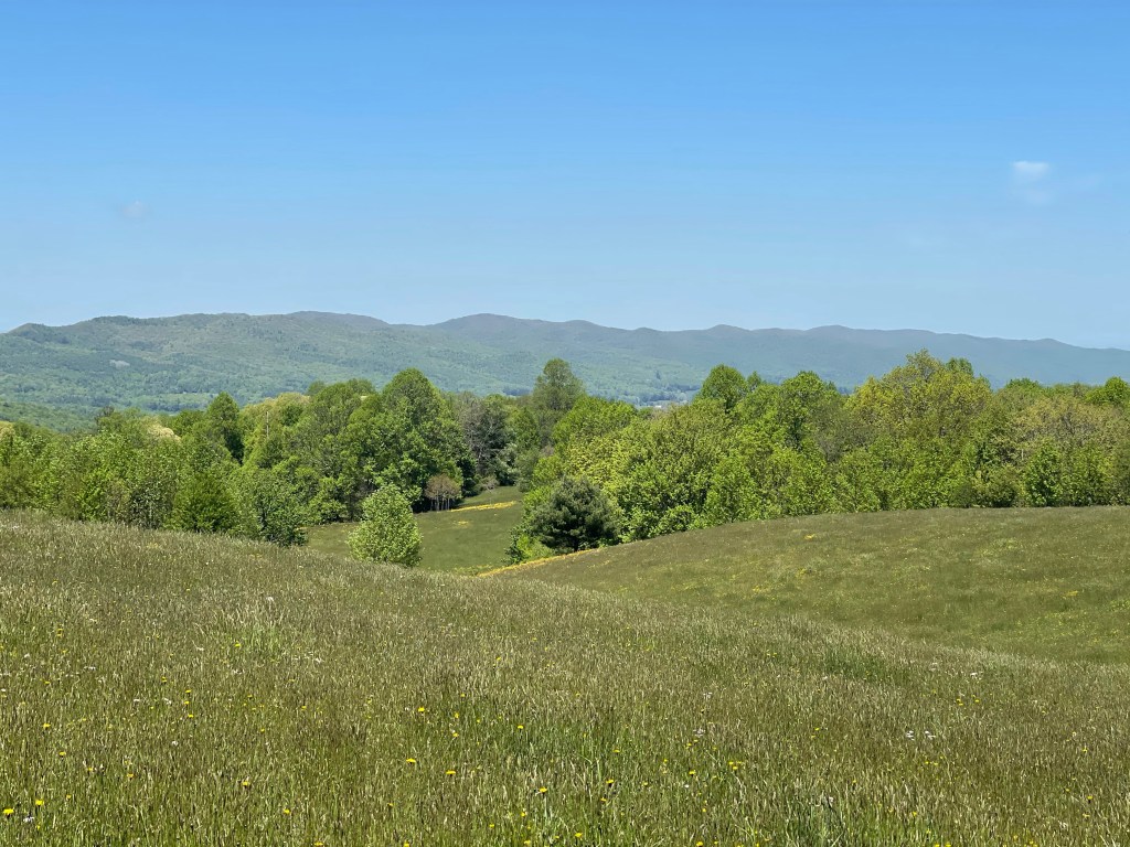
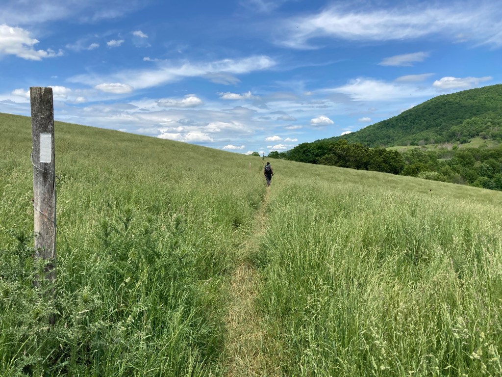
Other than the flowers, the day mostly consisted of open fields and meadows with cattle grazing in some and others just grass blowing in the wind. The sun was bright and hot in those meadows though. I can see why the cows always try to crowd under trees in the shade!

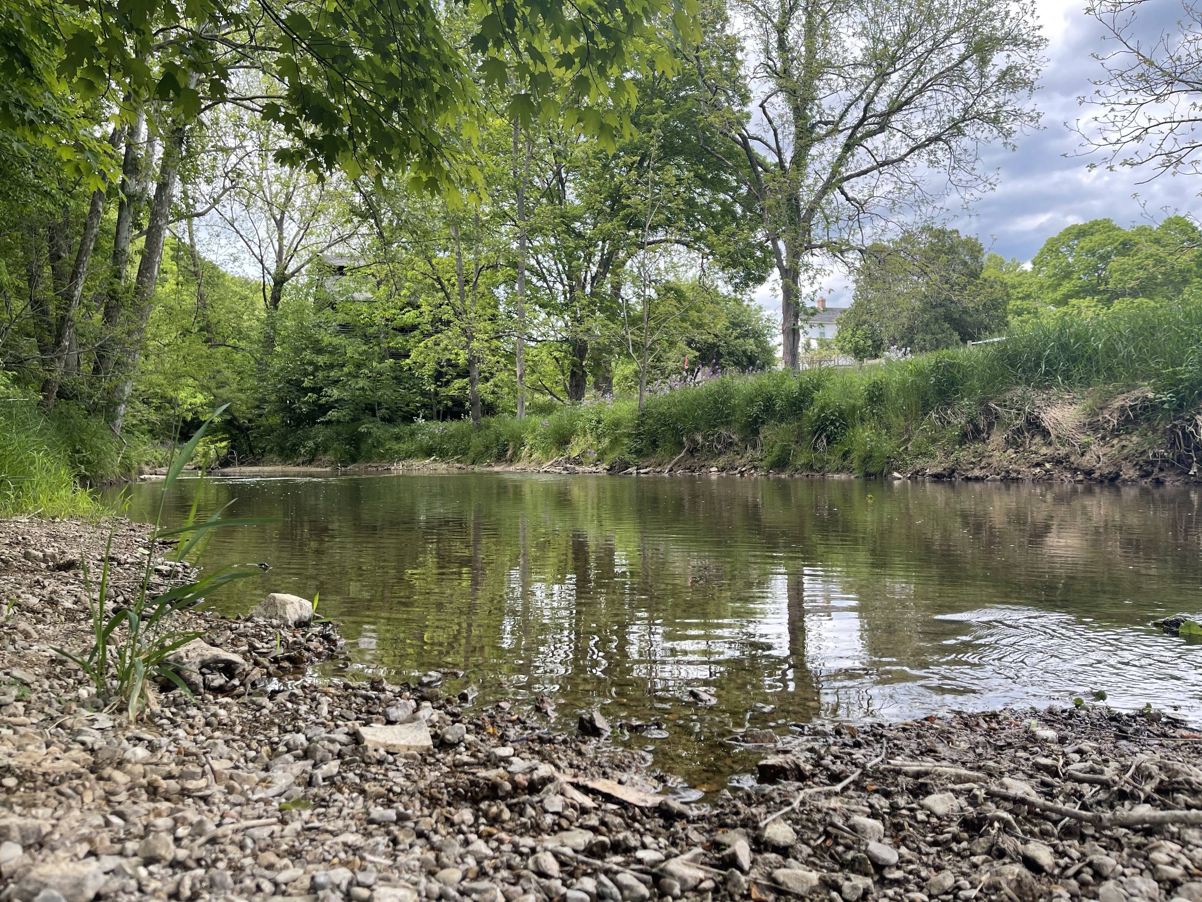
We hiked another 3 miles or so after the fields and stopped along a creek bank to rest and drink some water. We didn’t drink the water from this creek though because of all of the cattle near by, no amount of filtering can take some of that stuff out of that water! I decided to figure a way to prop my feet up for some rest! I think it worked well, other hikers were watching to see if I could keep my feet up there long enough for it to benefit, and I was!

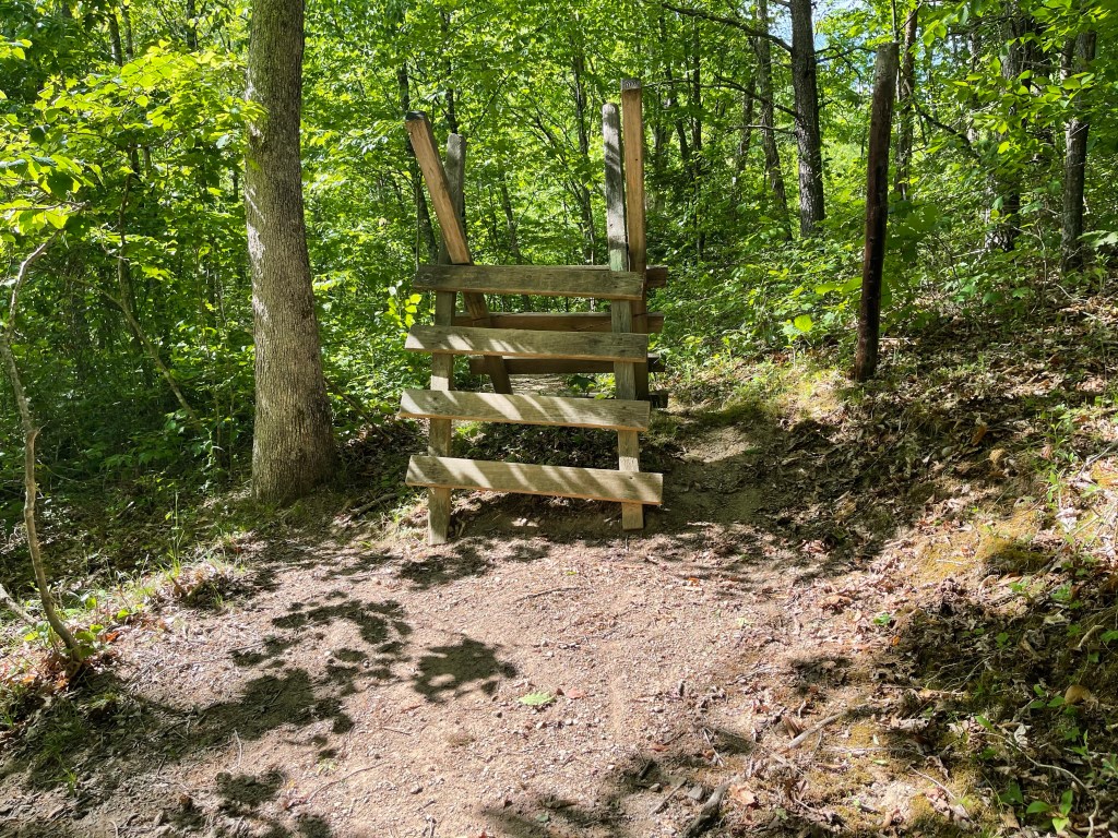
We finally decided that it was time to move on, we needed to hike 16 miles today so we could make it to Interstate 77 where we would meet up with Suzanna and James, Kelly’s husband. It wasn’t long before we had to cross another fence line, and what an interesting way to cross a fence they have out here.

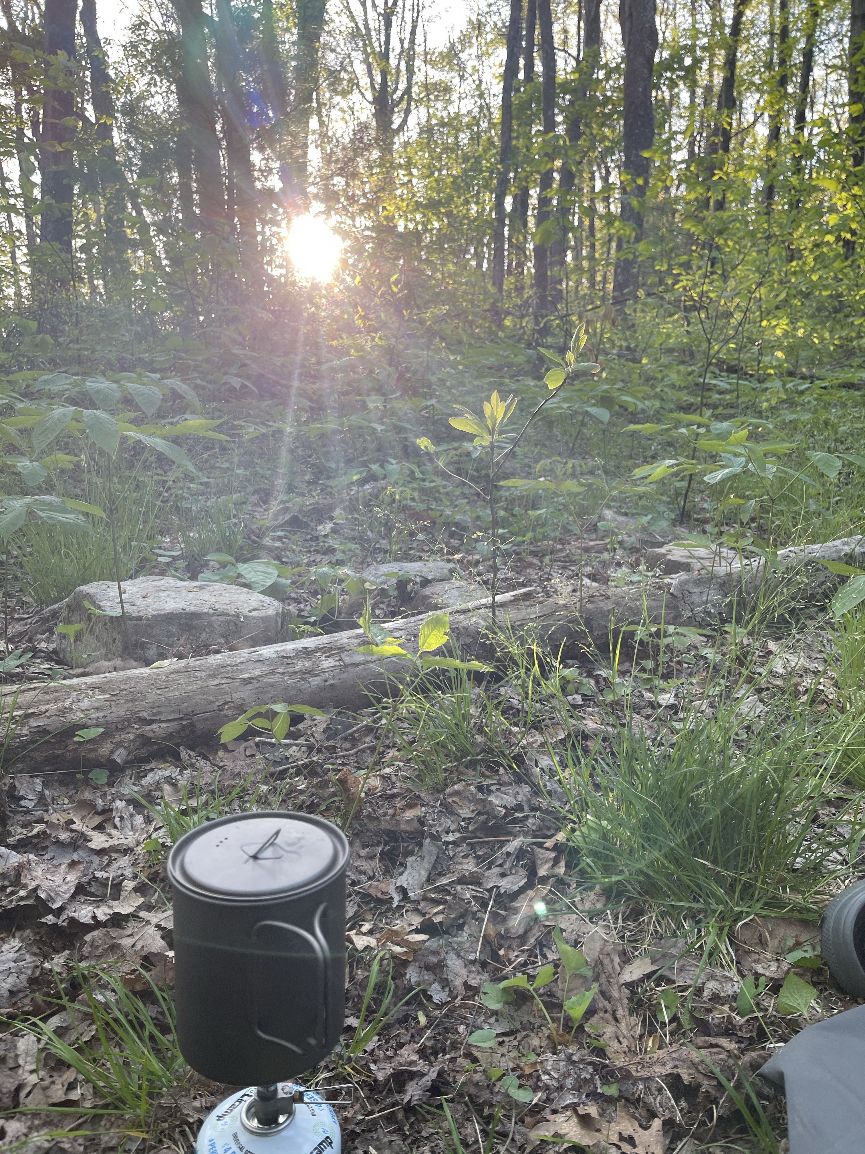
We were slowed down, though, when a group of our hiker friends got off and we saw them standing at a truck getting trail magic! We stopped in and grabbed a drink and I got a hand full of pistachios. We finally made it to our campsite, the latest yet, 7:30. At camp, the first thing that we do is setup our tent, if we don’t do that first, we will be too tired to do it after all of our other “camp chores”. After tent setup, if I have enough water, I start dinner, if not, I go grab water, filter it and then start dinner. After that it’s brush teeth then go hang my Ursack with all of my food in it. An Ursack is a Kevlar fiber bag that has a rope in it, and with a double overhand knot followed by a figure 8 onto a tree, you’re good to go for the night. I then climb in my tent, write in my journal and then go to sleep. I’m usually asleep by 9:15-9:30.

AT Thru-Hike Day 46

A campsite (3,299 feet) mile 530.7 to Atkins, Va. where we stayed at the Long Neck Lair mile 545.9 for a 15.2 mile day! We ascended 2,652 feet and descended 3,532 feet!

So, the original plan for today was to get up and hike for four miles to the Mt. Rogers National Recreational Head Quarters, there I would meet a local realtor who would have my box of food that Suzanna sent to her. That original plan didn’t happen and this was now the first logistical error in 534 miles, which is not bad. If you know me though, I don’t take well to my plan being messed up by someone else and I will work to try to fix the mix up so things still flow as best as possible. Well, yesterday, I got in touch with her, finally, and she had scheduled other things for when I had wanted to meet her. The whole idea here was to be able to meet the realtor in person to establish a “friendship” so of either of us needed anything in the future we had someone in their respective areas to call, and then we could do pictures and post them on social media. Nonetheless, I got her to drop the package at the hostel we would be staying at tonight, so, in the end, except not meeting in person, it all worked out.

We stopped briefly where we were to meet so we could use the bathroom and such with running water, but, being a National building, the dang thing was closed because of Covid-19, that is soooo last month! But in the process we got to see the “famed” Partnership Shelter. It used to have a shower in it, but not anymore. As of now the whole shelter is closed. You guessed it, COVID-19!

Partnership Shelter

We pressed on from here with not much to see really, except for some beautiful flame azaleas. One thing I have been amazed at is the number of different ferns growing out here!

As we continued hiking on we started to hear sounds of civilization creeping into our ears. It was the sound of Interstate 81.

Coming into Atkins, Va. we passed the settlers museum, it’s a small building that houses the history of those who settled the area as well as other early memorabilia. The museum was built across from an old, one room, school.

We hiked with excitement knowing that soon we would be able to sit at a table and have some delicious, at least we hard heard it was, Mexican food!

I could eat a lot before, but now, burning almost 7,000 calories a day, I can really eat a lot!

From here we walked .4 miles to the Long Neck Lair Hostel. A great place in a couples barndominium, and they raise Alpacas on top of housing hikers.

Settling in for the night, the owner told us how a chance encounter and the leading to sit and talk to some hikers at a McDonald’s lead to them opening a hostel that now sleeps around 400 hikers a season. Oh, and the hostel is on AirBnB

Good night, Mad Scientist out!

AT Thru-Hike Day 45

Brook Campsite (3,438 feet) mile 511.8 to a campsite (3,299 feet) mile 530.7 for a 18.9 mile day! We ascended 3,614 feet and descended 3,789 feet!

Today was, really, just one of those days. It was a day filled with long miles but not much else. It’s easier out here to get longer miles when there is not much to see as far as views and such goes. One thing for certain, horses are not allowed on the Appalachian Trail, at all! The AT is a continuous footpath stretching from Georgia to Maine, meaning, by a congressional order, it is only to be traveled by foot. No ATV, horses, bicycle, and there are to be no pack animals used on trail either.

The last 50 or so miles there are horse trails intermingled with the AT so signs such as this one are seen often so that the riders do not mistake the AT for one of their horse trails. Once we got away from this area and the Troutdale, Va area, the horse paths stopped.

Plants are starting to flower now and they are so beautiful! Birdie found a beautiful Rhododendron that she decided to make a crown out of.

Another thing there is plenty of out here recently are open meadows and cows grazing in them. Most of these fields are federal land for the AT but the farmers or ranchers are allowed to graze their cattle still on the property, sometimes it comes with the stipulation that they must maintain the trail as it crosses their property.

As we came closer to the end of our, basically, 19 mile day we did get one view that we stopped to take a look. Oh, and I finally got cell service again so I could call the hostel on owner back to confirm our stay tomorrow night. It’s an alpaca farm!!!!

Oh yeah, the view.

Not much but it’s there!

Ugh, we got to our planned campsite tonight, knowing it was super small, room for maybe two tents, and there was someone already there! I know what you’re thinking, oh man, now they have to keep hiking. Well, you’re wrong if that was your thought. Birdie and I managed to fit both of our tents on there with their big tent as well. Yes, we were all on top of each other but it was a few miles before another campsite, and it was late and we didn’t have it in us. They were nice folks though from south of Atlanta and were doing a two day section hike in to Damascus, Va. This hike would tie them together, from Springer Mountain to Atkins, Va.

All in all a good day, to prove that if you keep walking at a good pace and take few breaks, you can cover some miles.

Good night! Mad Scientist 🥼 out! 🤟🏽

AT Thru-Hike Day 44

Elk Garden (4,449 feet) mile 494.9 to Brook Campsite (3,438 feet) mile 511.8 for a 16.9 mile day!

Lots of things today, Grayson Highlands and the Ponies, Fat Mans Squeeze, 500 miles!!!

It was also a suck day, you see, the Grayson Highlands trails are mainly rocks, big rocks, little rocks, medium rocks, some move, and some don’t! This makes for slow hiking because you have to be very careful not to twist or blowout an ankle.

I started up through that beautiful meadow I saw from the campsite the night before, and it was just as pretty walking through it, but it didn’t go as far as I thought it would. From the Elk Garden parking lot, it was about a five mile hike to get back up to the highlands which were a Bald area where the ponies lived. I found out that there is a parking area called Massie Gap, so if I ever come back here, I can park there and not have to walk the 5 miles in to get to the ponies.

On the way north we passed the Mt. Rogers trail, which leads to the highest point in Virginia, we didn’t take it since it was a half a mile one way with no views at its “summit”.

It seems like to is was the point where the rocks really started, they only got worse from here though.

Just before we officially entered the state park, we crossed a major milestone, that happened to be made out of stones! We have officially walked 500 miles now.

Grayson Highlands State Park, is a series of balds with spruce pines spread here and there, it sits at 4,999 feet and is covered with huge rock boulders with a pinkish color and a volcanic rock looking texture. I will have to research later to see if they could be possible right here. The balds keep their highland look thanks to a band of ponies and long horn cows. These beautiful animals help to keep the grass short and a lot of the other vegetation trimmed down nicely. Oh, and they aren’t scared of humans much either, although signs said not to feed them… duh, and they would kick, again, duh!

There is a section in here, I think it’s just for fun, because I saw a perfectly clear and easy route around it, called “The Fat Mans Squeeze”. The AT trail goes through this small narrow rock outcropping to get out to the other side.

We continued for the rest of our day to see ponies and while eating lunch we saw a big herd of long horn cows. Calving season was recently, there were babies everywhere!

The rest of the day continued to be rocky, even after passing the highlands, and this just add for a miserable day. The rocky path is so hard on the feet and ankles and when it’s 12 miles or so worth of rocky walking, ugh, but, we gotta do what we gotta do, and so it was done! We rock!!!

Longhorn photo by Nimblewill Nomad

AT Thru-Hike Day 43

Campsite along Whitetop Laurel Creek (2,299) mile 477.6 to Elk Garden (4,449 feet) mile 494.9 for a 17.3 mile day!

Today was one of those days with an AT special, we call them “PUD” pointless up and down!!!

At one point we shared a trail with the Virginia Creeper Trail. Crossing one of the bridges for the creeper we saw a 4 foot long king snake, slithering his way around the edge of the bridge, looking for his next victim.

Once again, we turned and went back into the woods, leaving civilization and cell service behind! These last two days were the longest I had gone without cell service. It’s always good at night to end the day with a call back home to Suzanna or my two boys, or sometimes, both.

Now, it was time to go through these cool little “gates” into a field that I’m sure has livestock in it from time to time.

We crossed a meadow of green grass and beautiful yellow flowers that were all tall and being tossed about by the breeze that was also hitting our face.

Continuing on, it was time to start the climb up White Top Mountain and boy was it a tough one. I would not necessarily call this one a PUD because at the top there were some pretty extraordinary views.

Once we got to the top, Buzzard Rock (5,087 feet) I had cell service and was very thankful! I was thankful today because my oldest son turned 20 today and when you have managed to keep your first born child alive for 20 years, it deserves a FaceTime call from dad on top of a mountain!

After the call we made reservations for a hostel on Wednesday, May 26; it’s an alpaca farm!!

Knowing we had these reservations, we knew we had to start doing some bigger miles to get there in time. So, we pressed on, rounding white top mountain and the view kept coming! Wow!!!

Descending down, we came to state road 600/Elk Garden. The field across from it which will be tomorrow’s starting lineup is absolutely stunning!

For the first time in a while, if not ever, we sat by a fire and roasted hot dogs that were provided by, trail angel and 2018 Thru-hiker “Snorts”. We were joined by “vintage”, “quiver”, and Nick. Nick just randomly showed up in the parking lot and we invited him to join us. He brought his guitar and played and Snorts had her ukulele.

AT Thru-Hike Day 42

Damascus, Va, (1,927 feet) mile 470.7 to a campsite along Whitetop Laurel Creek (2,299) mile 477.6 for a 6.9 mile day!

Six point nine mile day, not much to say about that day. I said good bye to Suzanna after having breakfast with her at the Damascus Diner, nice big breakfast! Then we went into a local guys shop and found some super cool wood work that he does himself. Then we went into one of the local outfitters to find a good summer hiking shirt, and, can you believe, they had no such shirts!!! All the had was cotton shirts which are horrible for hiking, especially when it’s for months and no shower for days!! We went from there to try a different outfitter, and just about the same luck, but I settle on a “moisture wicking” shirt, so let see how that does over the next few days. I tried to get a short sleeve alpaca shirt but, since it’s summer, they have no short sleeve shirts, I have still yet to figure that company out. I hate it because they are a Charlotte based company and their hoodie/long sleeve that I managed to get, all be it a women’s, it was winter so they were sold out of the long sleeve.

Anyway, we climbed our way out of Damascus and ran into a mom and daughter set of hikers, they had started about 41.1 miles away from town and hiked back to their car.

We kept going and crossed the Virginia Creeper Trail and walked along the beautiful Laurel Creek before coming to a nice little camp site.

AT Thru-Hike Day 41

A stealth campsite at mile 457.7 into Damascus, Va, (1,927 feet) and mile 470.7 for a 13 mile day!

Meet Virginia!!

Today we went into our fourth state! That means we have ten more to go before we are done. Virginia is the longest state on the entire Appalachian Trail at 550 miles. It may be long, so long that through hikers for generations have said that you will get the,”Virginia Blues”, by the time you’re done with this state. The cool thing about Va. is that it has some pretty cool sections to hike. The southern section is about 250 miles and there’s, Grayson Highlands, McAfee Knob, Dragons Tooth, Tinker Cliffs, and Peter Mountain.

Along the way we passed one of the original AT shelters, it was built in 1934, McQueens Knob Shelter (3,849 feet) mile 459.1.

This is an abandoned shelter that is not to be used except in the case of an absolute emergency, and even then, Abingdon Gap Shelter is a short walk away, at mile 460.5.

We stopped for a bit at Abingdon Gap Shelter to load up on water since it was about 8 more miles to town with no more water sources. I sat and drank a liter of water, loaded my 1 liter bottle and then filled my 1 liter water filter as well, so, basically carrying 3 liters of water out of there!

Three miles outside of Damascus, Virginia we came to the state line!

We walked down hill the next three miles into Damascus and then from there, I went to meet Suzanna and Kelly went to the hostel where she was staying.

AT Thru-Hike Day 40

A tent site and spring (3,854 feet) mile 441.5 to a stealth campsite at mile 457.7 for a 16.1 mile day!

Started out with another slow day to see if Kelly would catch up to me, and eventually, she did! Good job Birdy, that’s her trail name.

So, almost all of the readers of this blog have no idea who Kelly “Birdy” is, so, I’m going to tell you. I met Kelly around January of 2020, I guess, in Charlotte, at Blue Blaze Brewery. Every Monday we meet at 6:30 pm for Trail Talk. It is exactly what it sounds like, a bunch of hikers/backpackers and want to be hiker/backpackers getting together to talk all things hiking/backpacking. In late February a group of us decided to hike the Bartram Trail, a 115 mile trail through Ga and NC. April, a few weeks after COVID-19 started we started out on the Bartram hike, Kelly was one of the hikers. Her and I had already mentioned we were hiking the AT in 2021, and as we hiked together on the Bartram, we realized we hiked about the same pace and got along pretty well, so, we decided to start the trail together!

Back to today, before I lose some of you!

I noticed today that spring is nearly fully upon us in the mountains at elevation. The grass has gotten longer and is such a beautiful bright green color. The flowers and the trees are almost all in bloom, there are a few species that have passed their blooms on for bright green leaves.

Another way to tell spring has spring, signs the birds have started hatching their young have been found!

Along the way, at mile 445.8 and sitting at 4,086 feet elevation, sits Nick Grindstaff’s grave site. The grave site where is plot of land was and his cabin sat just feet away from where is stone grave marker sits. The marker resembles a chimney made out of stone from Uncle Nick the Hermit’s cabin. He was given the nickname Hermit because he moved up to Iron mountain, alone, after returning from California to seek his opportunity in the Gold Rush. On his headstone are written these words, “lived alone, suffered alone, died alone.” He was said to have had a pet rattle snake that lived in the rafters of the cabin, along with he and Panter, his trusty companion dog. Look at Uncle Nick now, visited by thousands of through hikers a year and tens of thousands of hikers since the trail opened in the early 1930’s.

Pushing on, and stopping often for water, since the rain has been a little scarcer than in the past few weeks. This new process helped me to slow down some more and about the time I stopped for lunch at a highway parking lot, Birdy walked up behind me. The team was back together again!!! Go team!!

After taking in some calories, we put our shoes back on and hit the dusty trail. Not a half mile into the hike as a team again, we came to a beautiful field of tall grass blowing in the wind. I don’t know why, but there is just something about tall grasses blowing in the wind that just makes me happy inside!

The views from these, at times, active cow pastures are splendid! We sat with a local, who happened to be a trail maintainer, and he showed us around the Appalachian range off in the distance. One of the spots he showed us was White Top Mountain. Now, if you have ever rode the creeper trail, in Damascus, Va. you have already been to White Top Mountain.

Just left of center in this photo, off in the far distant range, one can see White Top Mountain. After walking over these pastures for about .8 miles we came to a final fence crossing and were then back into the woods again. We continued on until we found a great flowing spring, we filled up our liter water bottles and then filled up with another liter so we could cook our dinner!

Found a not so flat campsite and bedded down for the night after dinner and hanging our bear bags. In the morning, I realized that my night time guess was right, I did not set up flat at all!! I had slid all the way to the edge of my tent and was actually bending the polls I was so far to one side.

AT Thru-Hike Day 39

Boots Off Hostel (2,081 feet) mile 428.4 to a tent site and spring (3,854 feet) mile 441.5 for a 13.1 mile day!

I decided to do a short day to give Kelly a better chance of catching up tomorrow, I have missed hiking with her since she has been staying at her sisters and slack packing.

One thing I have learned out here with this life, don’t get in a hurry! Yesterday I was in such a hurry to get to the hostel because I heard they had real food, not dehydrated! Not that I don’t enjoy my dehydrated meals, please, don’t get me wrong there. I have never had an MRE but I hear they are horrible! These meals, they are not horrible! Maybe the military should look into these meals instead! Anyway, I digress! So I hurry and get my feet and legs absolutely worn out and then I get there and all they have, frozen pizza! Ugh!!! I could have stopped at a higher tent site and eaten a dehydrated meal, have I mentioned the dehydrated meals? Yes! Yes I have! Okay, back to today.

Annnnnd were back!

I was texting with Holly Dede today, she is the creator and leader of [Dedeluxe living.](https://www.facebook.com/DedeLuxeLiving/)

Holly, even though I was open and honest with her about my lack of presence after just starting a new career in real estate because of this hike, took me in on her team so that while I was away, she and other members of the team could nurture and love on my sphere of influence.

This was her text to me today, “The market has been absolutely brutal here and your hike keeps me going some moments because I am thinking about how pushing through and continually uncovering new ways to get through obstacles means we are blazing a trail for people to just do the damn thing and make no excuses, nor take any excuses!” This came after a day that you may or may not have read about, if not, shame on you! Go back to day 38 and read it, please! Any who, every time I looked at my gps, it seemed as though I wasn’t moving! Many times yesterday, I didn’t want to go on. I wanted to sit down and, even though I had no water to cook with, I wanted to set up my tent and just quit for the day! When I got into the hostel last night, I could hardly walk from the work my feet, calves, front and backs of my quads had done the hours before. I felt like crying, but I knew that that would do me absolutely no good, but what would do me good, push through this and continue on with my day. So I showered and went to bed, and woke this morning rejuvenated.

I didn’t come here to quit, I didn’t come here to give up. I came here to walk every single day and push myself to limits I never knew were possible and to overcome challenges that would face me almost daily. Yesterday was just that, and you know what? Today, I am perfectly fine and had an amazing hike looking down on Watauga Lake.

The coolest part about all of this, while I’m out here hiking the Appalachian Trail, I am also selling real estate with an awesome team that’s “…blazing a trail for people to just do the damn thing and make no excuses, nor take any excuses!”

AT Thru-Hike Day 38

Moreland Gap Shelter (3,823 feet) mile 413.7 to Boots Off Hostel (2,081 feet) mile 428.4 mile for a 14.7 mile day!

Oh my, where do I start. When I set out on this adventure, I knew days like today would happen and I’m going to be open and honest about it all.

I left the shelter this morning around 9:00, and it started with a short climb, followed by a few more but really nothing big!

Around mile 420 I walked .2 miles to Kincora Hostel. I did not go there to stay, but to sit on the porch and talk with Bob Peoples, trail maintainer for 25 years or more now. In fact, Bob told me that this old barn I passed used to be a tobacco barn many many years ago. It’s actually an old primitive barn, he said it is now infested with giant rat snakes that used to eat the chickens that were raised in the area. He also said that the house hat was with it was torn down by the forest service so hikers didn’t try to get into it to stay the night, they knew the snakes would keep them out of the barn!

Bob had so much wisdom about the AT as well as the, Jesus Trail in Israel, the Camino de Santiago, Scottish highland way among other international trails. I ended up staying there for an hour and a half and I think it really hurt my mojo I had going on.

From there I went into the Laurel Fork Gorge and man was it beautiful!

Here is where the wheels fell apart and the mountain got the best of me.

Walking up a stone staircase into the first of 22 switchbacks going up the mountain with no name! Why they took the hiker up and over a mountain with no published name on our maps and no views, I don’t know, would have been just as easy to hold an elevation and go around the mountain, although maybe then it would have been a longer hike!

Climbing and climbing I finally stopped to catch my breath and get a drink of water before going on. Many many time today I asked when this climb would be over and why am I doing this anyway. I wanted a zip line to get down so I could call Suzanna to come get me, even though I knew she wouldn’t have done it, she would have encouraged me and I would have pressed on. How do I know this, because, I texted her and told her today is one of those days I’m not supposed to quit on, she encouraged me to go on and push through it, and so I did.

Then I came to the top, I loaded up with water and drank a liter, then I started down. Here we go, all over again, down and down and down. Oh, so, it was up 1,816 feet and down 1,795 feet in 5.8 miles! That’s a grade of 622 feet/mile!!

Again, I just felt like I wanted to stop and out my tent up and go to sleep, but I wouldn’t have enough water and there was absolutely no flat spots!! I was literally on the side of this mountain with no name! Oh, but I saw the lake a knew that meant at least I was on the right trail and the right down hill!!!

Honestly, the last 6 miles I felt like someone put rocks in my bag. This bag has been hurting me every afternoon since I started this adventure. I’m always having to adjust it on my shoulders and it’s driving me nuts, oh, and it’s hurting! I may try to find another one or talk with the guy that sold it to me in Damascus!

I finally made it down to Boots Off Hostel and got some food and more water in me! Now to get some sleep and let the recovery begin!