AT Thru-Hike Day 25

Tri-Corner Knob Shelter (5,887 feet), mile 223.4, to a cascade and tent stealth site, mile 240 for a 16 mile day. We ascended 2,851 feet and descended 2,953 feet.

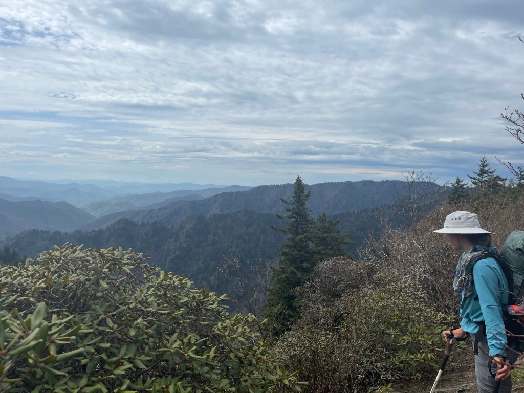
This was our first 16 mile together, Kelly and I, and it was an eventful 16!!

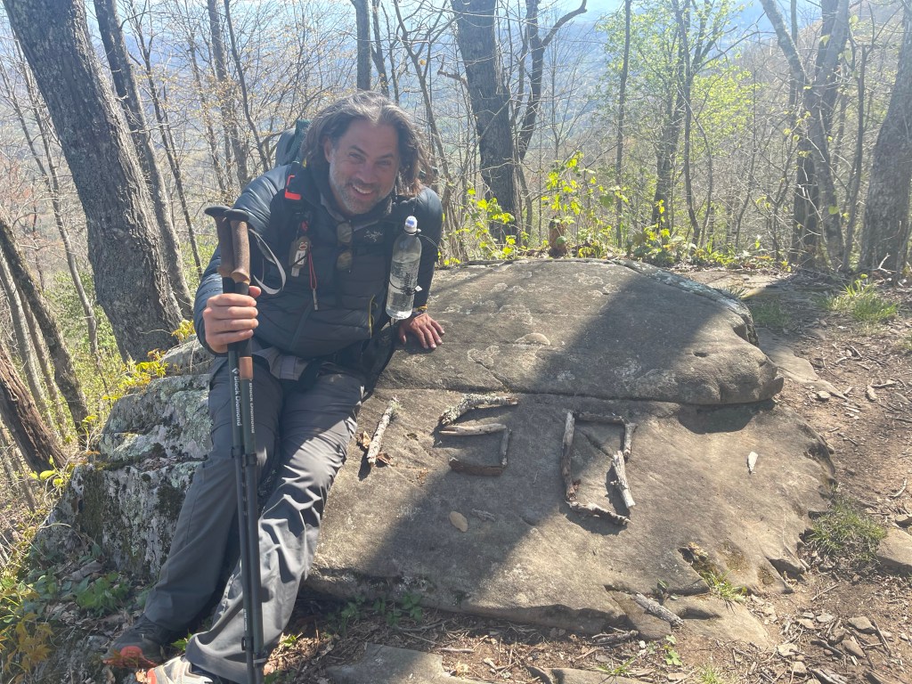
Today is our 1 month anniversary of starting our hike. We woke to rain, and hiked in rain for a majority of the day. We learned today that our bodies were ready to make a jump up in mileage.

Kelly, packing up in the rain

You see, someone decided to sleep with their food instead of hanging it or putting it in a bear box, this may not always cause trouble, but at some point recently, it did, and all hikers are having to pay. Mile 231.0 sits the Cosby Knob Shelter, and on April 8, 2021 a bear ripped into someone’s tent trying to get to their food. When this happens in the Smoky Mountain National Park, the bear is usually trapped and relocated. I’m not certain as to the where abouts now of the bear that welcomed itself into a hikers tent, but, there is currently a decoy tent setup with a trail camera watching to see if any other bears show up to rip another tent open. Oh, and the shelter get shut down until there is no bear activity at the shelter.

The decoy tent seen in the distance on the left

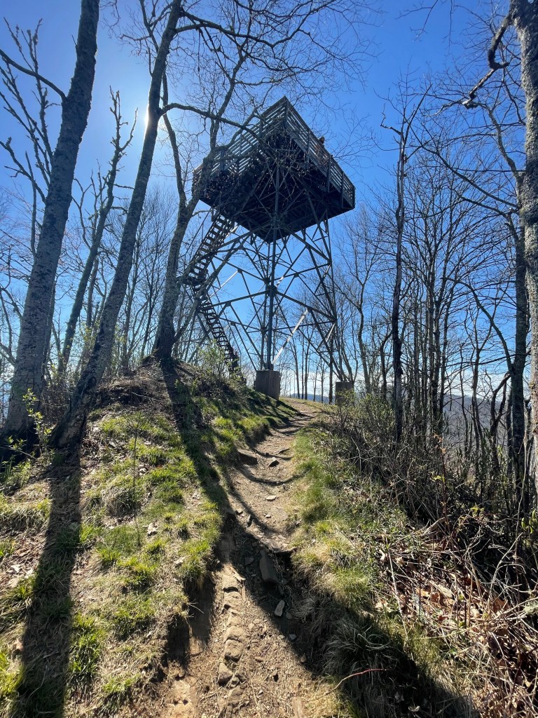
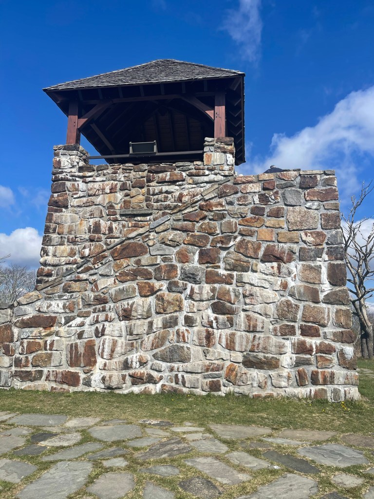
So, we had to hike past the shelter to find shelter, and in the GSMNP, the only place to sleep, is a shelter. So, here is the math and our decision, it was 7.7 miles to the Cosby Knob Shelter, which, at this point, is too short of a day anyway, it was 6.1 miles to the next shelter, Davenport Gap Shelter. We knew if we went there, because of the closed shelter, Davenport shelter would be jam packed, our next option was another two miles to, what Guthook labeled as, “cascade and tenting”. We continued on, and came to a blue blaze trail that lead to Mt Cammerer fire tower, and by this time, we didn’t want to go the extra 1.2 miles, out and back to the tower, because in the distance was thunder, with rain in the forecast, and we still had 6.1 miles to go.

Move along, nothing to see here

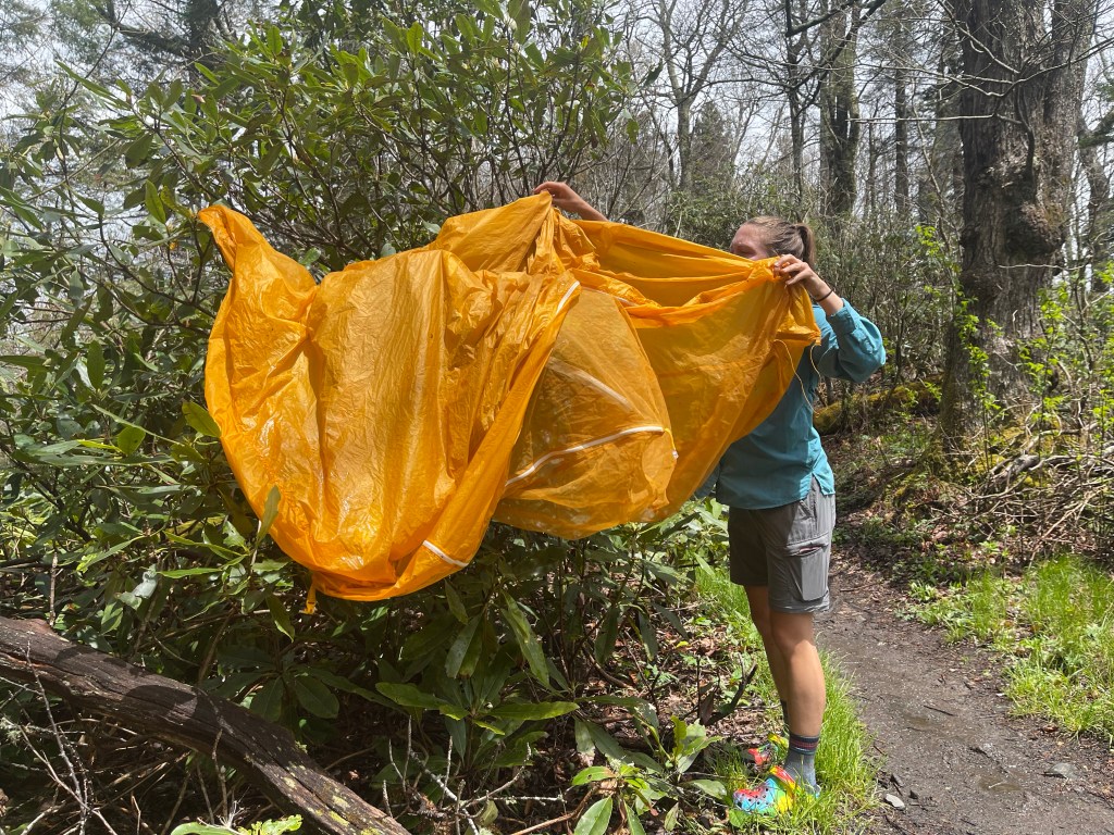
The rain had started slacking off though so we took the time to dry our some gear and eat some lunch before pressing on.

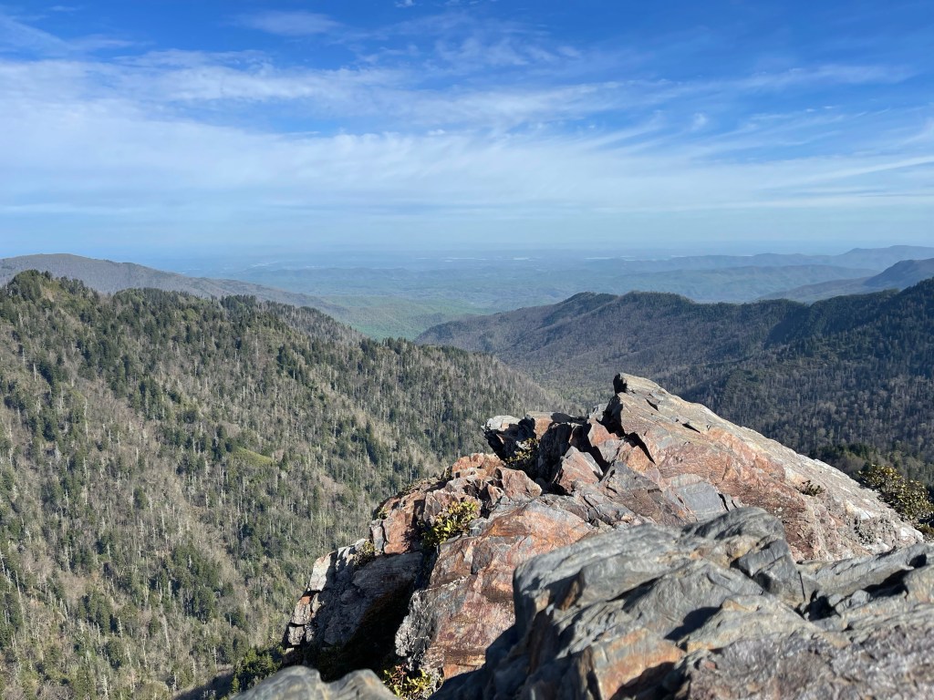
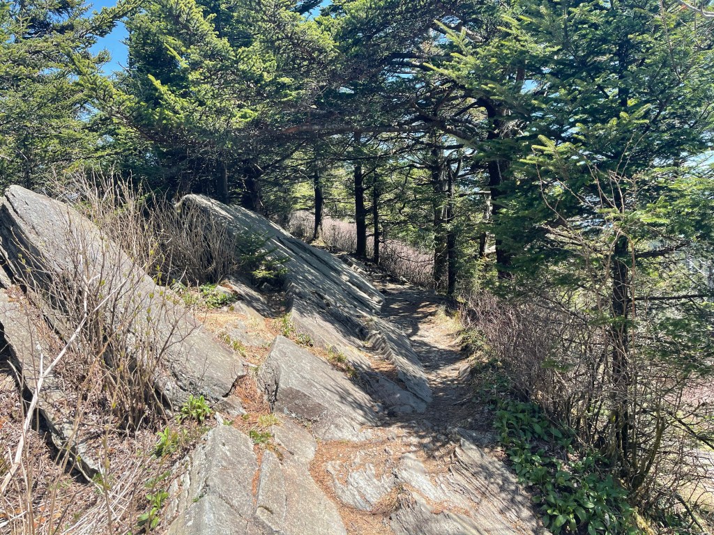
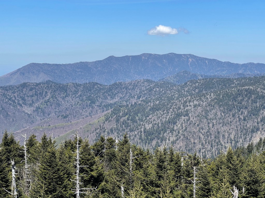
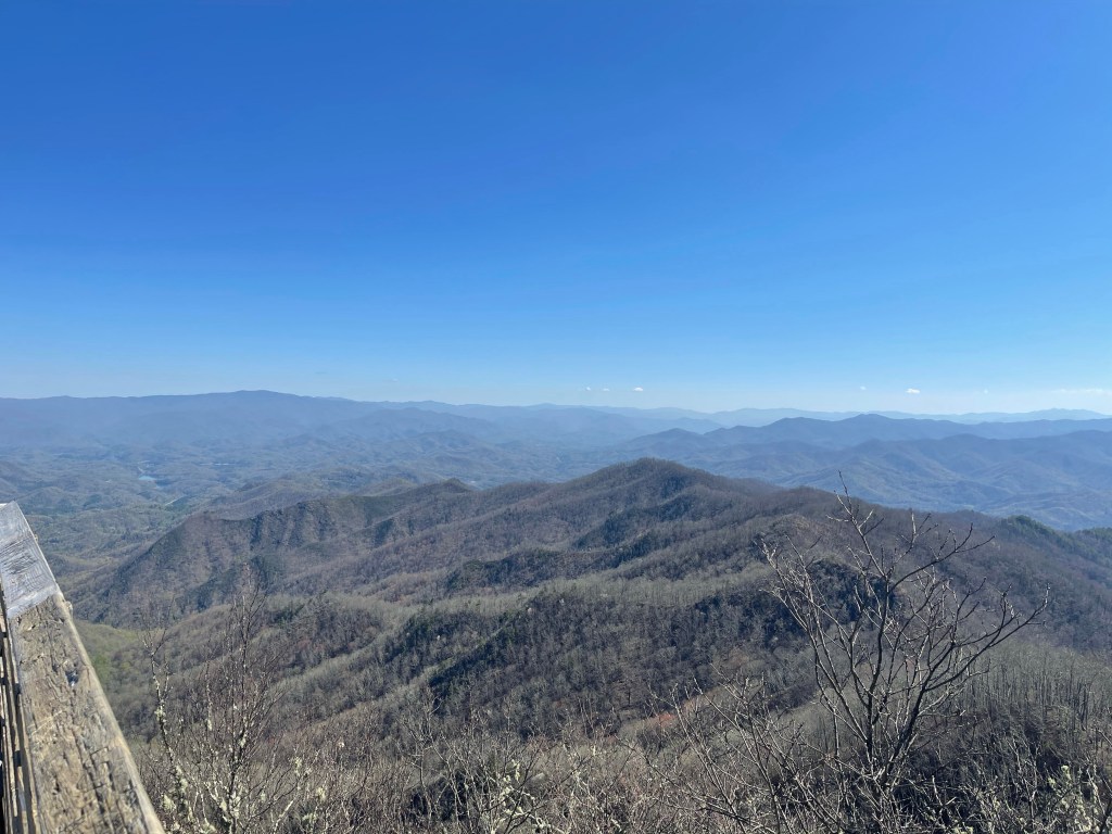
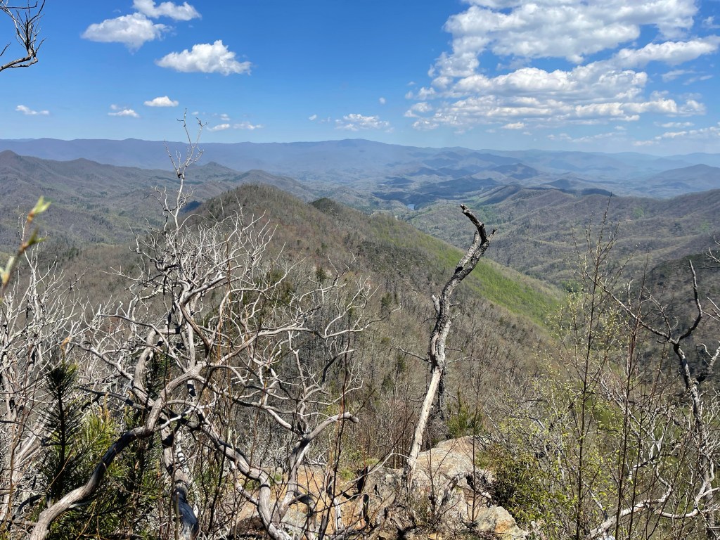
As we continued on and the rain had let up still, we were able to enjoy some amazing views from a rock outcropping!

Wow!!!

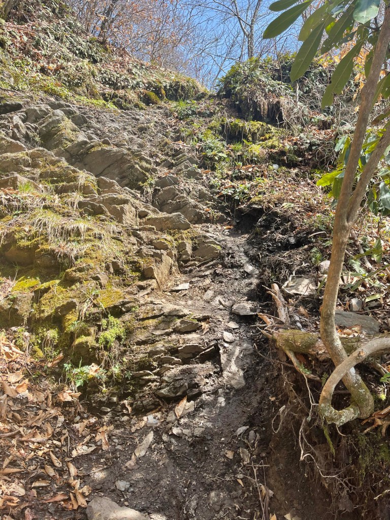
And just around the corner from this view was a super cool section of trail that was obviously built to impress the weary hiker, at least it impressed me! This beautiful rock wall supports the trail for several hundred feet and is bordered on the other side by boulders the size of a small car and a natural rock wall!

We continued down the trail and made another milestone, it was time for us to leave the Great Smoky Mountain National Park!! The AT treks 71.5 miles through the GSMNP and ascends and descends, 18,819.2 feet and 18,829.1 feet respectively! I’m tired just writing that!!

As we approached the shelter we knew that we were going to be cutting it close moving on but the weather seemed to be working in our favor. We looked at the radar and decided to press on to the cascade and tenting spot, I prayed hard and asked God to show us favor without rain to finish the evening, and save it for the night!

Passing the shelter, and pushing on, we approached Davenport Gap (2,000 feet) mile 238.9, deposited our “Thru-hiker permit” into the box and moved on!

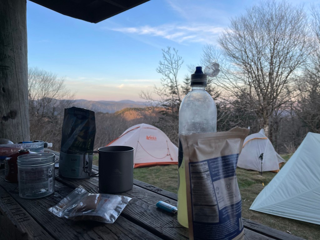
1.1 miles left for the day, and we made it in to the, “cascade and tenting” site, which I imagined is sort of what The Garden of Eden looked like, we were surrounded by two streams and lots of greenery, and I imagine the only thing missing here was thousands of different types of flowers.

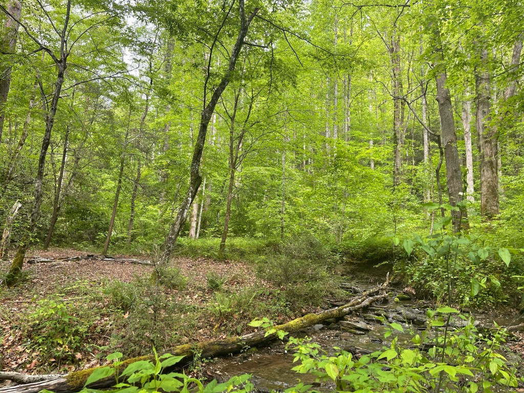
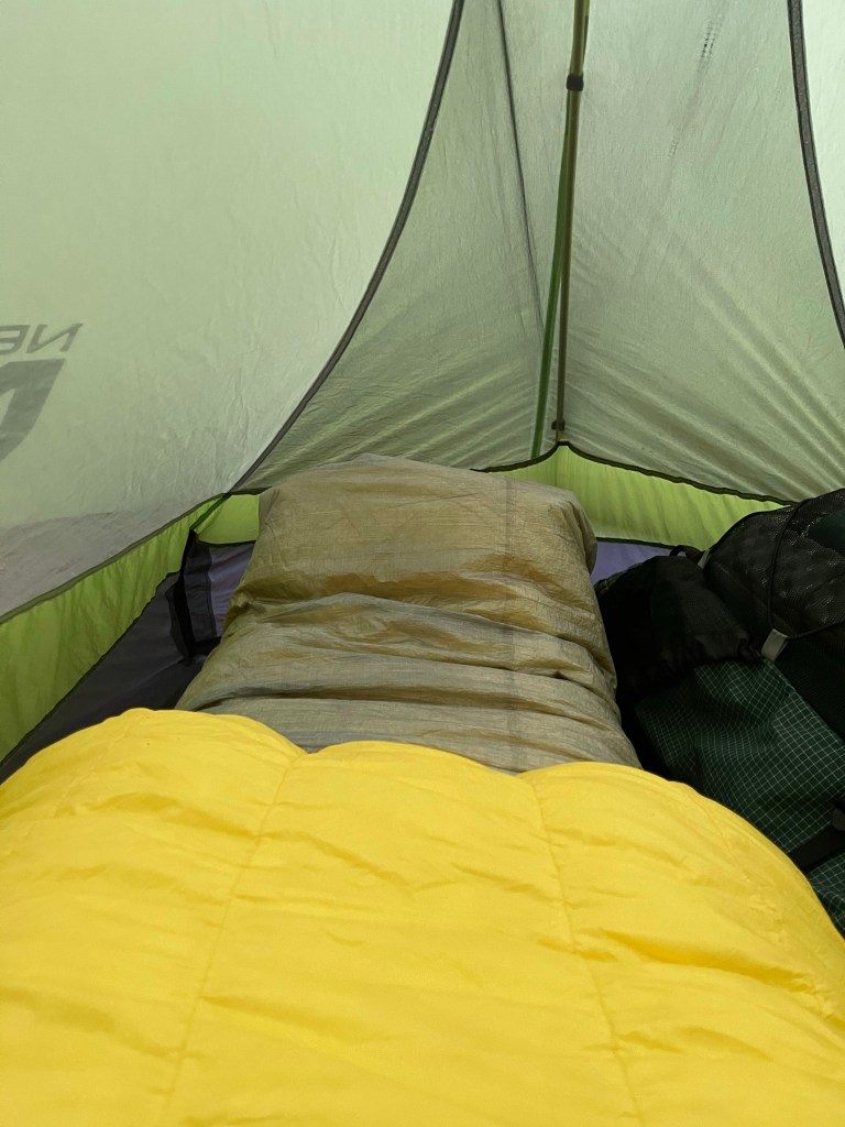
A tent site, next to a flowing stream, with cascading water, and the sounds that come from that, were my home for the night, it was my kitchen for the night and my dining room.

AT Thru-Hike Day 24

Ice Water Spring Shelter (5,917 feet),mile 210.8 to Tri-Corner Knob Shelter (5,887 feet), mile 223.4, for a 12.6 mile day. We ascended 2,851 feet and descended 2,953 feet.

Those ascending and descending numbers are the story of this trail every single day. Go up just to go right back down. Our days normally consist of going up and over a mountain to get to anywhere! And the views and challenge make it all worth it, slow and steady.

We took off down hill to start the day, we went for about 1 mile to a super popular day hike spot, Charlie’s Bunion. The view from here was amazing! From here, we could see Gatlinburg and Douglas Lake off in the distance.

Charlie’s bunion

The wind has been blowing a lot today, and the forecast calls for rain. I am praying that it will rain during the night and not on us tomorrow, but either way, I am grateful to God to be out here in His creation spending time with him, walking and talking with Him, when Kelly is too far ahead of me to talk!

Through the wind, we pressed on along the edge of the mountains the trail ran, at times there is the fear of falling off we are so close. We walked on, and a few miles passed Charlie’s Bunion was a great view towards the other side of the ridge we were walking along.

There are a lot of ridge walks, look to the left and it’s down the mountain, look to the right, and it’s down the mountain, it’s super cool and we enjoy it!! We walked along the ridges today to a spot called Eagle Rocks, this is the spot that marks 1/10 of the trail for us, it was mile 219.3! We stopped here and ate lunch quickly because we felt a few rain drops but it never rained. Not far from there I found this survey monument in great shape. I am trying to take pictures of all of these I see, from Georgia to Maine!

We got to the shelter, and it was crowded!!! We wandered around looking for a flat spot to put our tents, but they were all on a slope and with the rain coming, we didn’t want that! So we walked back up the trail to a spot where folks park their horses, and found some great spots there!!

Now, I am laying in my tent as the wind baffles the side of my tent into my head. The rain should be starting in the next 6-8 hours but the wind is whipping good! I’m fairly confident in my tent space choice that there were no widow makers above me. These are trees or tree limbs that could easily come down on your tent ending your hike and possibly everything else in your life.

In order to keep my goose down quilt from getting wet, I have my quilt and feet stuffed into my water proof pack liner. I hope it works! I’ll tell you tomorrow!

Trying something new… next day… it didn’t work!!

AT Thru-Hike Day 23

Newfound Gap (4,996 feet) mile 207.7 mile to Ice Water Spring Shelter (5,917 feet, mile 210.8 for 3.1 miles for today. We ascended 1,241 feet and descended 374 feet. The sign today read, Katahdin, Maine, 1,972 miles!!!

Newfound Gap heading out again

Today, Kelly and I came off of a few zero days. We got to Newfound Gap sooner than expected originally and I chose to go to Denver with Suzanna for a few days. This put us Thursday and Friday off trail and a nero day today.

Around 4:45 we arrived back at Newfound Gap. Thank you so so much to Mrs. Lawler, Suzanna’s mom for picking us up at Newfound Gap, taking me to Knoxville airport and then picking us back up in Knoxville and bringing us back to the Gap. We obviously, could not have done all of this without her!

It was a typical up hill hike into camp today, not a whole lot to talk about but I did have a small issue with getting water today. At mile 208.5 there is a water source, and on Guthook it showed a solid water droplet. Guthook is an app on your phone that you can purchase the AT as a whole or in sections, as well as a few other trails! On Gut hook it shows different symbols for different things, there are shelters, towns, views, mountain tops, water droplets, etc. the water droplet is either full of water, good flow, or half full of water, not so good flow. This source showed a full droplet, good flow, and that was far from the truth!! They must have mapped this section during a rainy season!

On the other hand, we got to the shelter and it had a solid droplet and it was a great flow, straight out of the spring!

The shelter has a great view of the mountains ahead of us! One thing I love about this journey, the breakfast, lunch, and dinner views, they are wonderful!

Dinner with a view

Looking forward to a great full say back on trail tomorrow heading for Maine, with a few stops in between!

AT Thru-Hike Day 22

Mt Collins Shelter (5,830 feet) mile 202.8 to Newfound Gap (4,996 feet) mile 207.7 for a whopping 4.9 mile day!!!

Today was a big stopping point for a lot of other through hikers.

Hiker trash

Not really for any other reason than to go into Gatlinburg to resupply. You see, most of us out here carry about five days worth of food, anymore than that and it gets too heavy, plus, there is access to a town every 3 to 5 days so it’s fairly easy to resupply. Some towns, like Gatlinburg, are more of a pain because they are pretty far off and have lots of traffic, but so far, this is the worst. Like all national parks it seems, there is construction on the roads, and then the tourist town of Gatlinburg as a whole makes it difficult to get in and out quickly.

Most of today was a downhill hike, but it was rocky and it was littered with roots. A large majority of the trail is this way though, and while listening to a podcast on trail, I learned that it has not always been this way, you see, over time the dirt that covers these roots and rocks gets hiked on and loosened up, then it rains and all of that loose dirt washes away exposing these tripping hazards which in turn make the trail what it is. From time to time one will see a new path being created around these nasty, ankle twisting, knee buckling, “land mines”, just waiting to try to throw you to the ground. There, the process starts all over again and widens the out even more.

Rooty tooty!!

Today, I saw a super cool water source! It was at mile 204.4 and it was literally coming right out of a rock. Of course this rock was probably sitting over a spring and the water has just made it’s way through over time, but it was still cool!!

Just 1.9 miles from Newfound gap was a parking area for Indian Grave Gap, one of the many hiking trails through the GSMNP, at this parking lot was some trail magic!! If I haven’t talked about trail magic before, it is not a disappearing act, no one gets sawed in half, and no rabbits appear out of a hat, it is when trail angels take time out of their day to go to a trail crossing and do a selfless act of giving tired weary hikers, a cold drink, or even better, some form of food, or a place to put their trash (hikers hate carrying trash, it’s stupid weight we don’t need!). Talking to the trail angels, they told us that they had to pay to get a permit to provide trail magic, and they could not prep any food. This meant that they could only provide fruit and other snacks, no burgers, not even a salad!

Trail Magic

Making it up the last little climb and in to Newfound Gap I noticed a North Carolina/Tennessee state line sign,

My tourist pic

I think it is because there are so many tourist here looking at the amazing views and people congregate here at a big parking area.

View from Newfound Gap looking East

I say this because if you look at a map of the Appalachian Trail, it winds back and forth, time and time again, mile after mile, and there is not a sign at each and every crossing like the sign at North Carolina and Georgia. In fact, it does this from Doe Knob which is on the NC/TN line all the way up to Roan Mountain, TN, a 229.2 mile stretch!

AT Thru-Hike Day 20

Russell Field Shelter (4,344 feet) mile 180.8 to Derrick Knob Shelter ( 4,830 feet) mile 189.8 for a total, for me, of 9 miles. Ascended 2,817 feet and descended 2,305 feet for a grade of 565 feet per mile.

Today was probably, or at least seemed like, the hardest 9 miles and the hardest day I had since I started. It may have been because I went 16 miles yesterday, I don’t know. Kelly, my hiking partner, went 13 miles yesterday and today she went 12, so I know it was harder for her.

The trail had very few flat walking miles, I would bet there was not more than a 3/4 mile stretch of flat at one point on trail today. It was up and down all day long, the ups and the downs were both long and steep! It made for a difficult day and everyone at the shelter tonight was saying they thought it was just them.

Today, part of our hike went up and over Rocky Top (5,422 feet) which is a sub peak of Thunderhead Mountain (5,520 feet), and is also the theme song for the Tennessee Volunteers, “Good ole rocky top, rocky top Tennessee”.

Good ole Rocky Top

It was an absolutely amazing view, the picture does it no justice at all. From here, we could see, Lake Fontana, Shuckstack fire tower which we crossed yesterday, we could also see Clingmans Dome, which we will climb tomorrow, the highest point on the AT and the third highest peak east of the Mississippi River, preceded by (2) Mt Washington, New Hampshire (1) Mt. Mitchell, North Carolina.

From here we had a very steep and rocky descent and then we went up and right back down another steep rocky descent. The rocks were not big giant rocks that would be easy to bounce to and from on, no, they were small to medium pieces of flat limestone rocks that would slid and move at will. Heard of a few people behind us that rolled and twisted ankles, most of them, as one has to do out here, pressed on slowly and made it into camp.

We went down another steep descent into Starky Gap (4,473 feet), this was up 203 feet and then down 612 feet, all in a mile with a grade of 890 feet per mile.

It’s all about the climb

We went up and back down into another gap and then from there we began our final climb for the day, up 501 feet in a mile! It was such a relief to come over the top, right into the Derrick Knob Shelter! There were several good tent sites left so I found myself one several hundred feet from the shelter pitched my tent and started the wind down routine.

AT Thru-Hike Day 21

Derrick Knob Shelter ( 4,830 feet) mile 189.8 to Mt Collins Shelter (5,830 feet) mile 202.8 for a 13.3 mile day. We ascended 4,008 feet and descended 2,820 feet for a grade of 527 feet per mile.

Well, today, there were several monumental moments on trail. We climbed and crossed the highest elevation on the entire 2,193.1 mile Appalachian Trail and it is also the 200 mile mark! We have hiked 200 miles in 21 days. Those are actual on trail days, it does not take into account our zero and Nero days. A zero is a day of rest where we walk zero miles, a nero, on the other hand, is a day where we walk nearly zero miles.

We start a nero tomorrow and then a zero Thursday and Friday amid another nero Saturday. After this weekend we will be trying to up our miles and cut down the number of zero days to one.

We left the shelter today and started out on our hike, it was a nice climb, fairly steady up hill, remember, we are walking to the top of Clingmans Dome, the third highest point east of the Mississippi River! We stopped at the first shelter, Silers Bald Shelter (5,439 feet), mile 195.5 to refill water and eat a snack.

From here, we continued up hill for just two miles to the second shelter, I do not understand the spacing of these shelters in the National Park, nor the lack of privy’s at all the shelters. Double spring Gap shelter was the next one and it had a privy, we stopped there briefly and then carried on our way, up hill.

Today was a favorite day, because we went into one of my favorite forests, a fur pine forest!! It smelt heavenly, Kelly liked it because it hide my oder as we walked. I liked it because it reminds me of high school and the green pine tree air freshener hanging from my rear view!

As we continued to climb and got closer to the top of Clingmans Dome, the terrain got steeper and the climb got harder. There were some super cool rock formations at the too that looked like at some point they just shot up out of the earth!

Finally reaching the top, we took a break to eat and also to go up on the observation platform.

Mount LeConte

Saw a few of our hiker buddies as well and made our own 200 mile monument.

200 miles!!

I Now I am in camp and surrounded by spruce pines and fur trees and it is wonderful!

Fallen but still living from the dead

AT Thru-Hike Day 19

Fontana Marina (1,706 feet) mile 164.4 to Russell Field Shelter (4,344 feet) mile 180.8 for a 16.5 mile day, my longest mileage to date. Ascended 5,013 feet and descended 2,459 feet, for a grade of 457 feet per mile.

Today started early, we left the Hiker Inn at 8:00 so we could drop some other folks off at a different spot on trail, and then went to the Fontana Marina parking area where we got off trail to start out day. Thankfully, there was a restroom at the parking lot, early morning coffee. Haha after that was done, we hit the trail. It was a 2.2 mile hike with a little up hill followed by down hill to get to the Fontana Dam. What a dam site it was to see!!

Fontana dam looking over the back side

We walked the half mile or so across the top of the dam and then followed a road, first road walk of the hike, where we later entered back into the woods on trail.

Permit drop before continuing into the park

We put our permits in the box and hiked on. The Great Smoky Mountain National Park requires a $20 permit to thru-hike, and you have 8 days to make it through the park on trail. The permit only gives us the right to hike the AT and no other trails. Here our climb began, 3.5 miles and up 2,075 feet with the top of that first climb being to Shuckstack fire tower (3,993 feet).

Shuckstack fire tower

This shaky little fire tower provided some amazing views for our first views inside the park. At the base of the tower were the remains of a fire wardens cabin.

Wardens cabin remains

We continued from here for another 3.5 miles with a 1,121 foot climb to Doe Knob (4,493 feet). The grass is green and the flowers are making themselves known around these parts, but the leaves on the trees, why want nothing to do with it right now.

From mile here we continue on for another 3 miles to Mollies Ridge Shelter mile 177.7 (4,583 feet)

Mollies ridge shelter

and stop to make camp, even though I was feeling good! After looking for a tent spot, seeing a warning about heightened bear activity and having no cell service, I talked with Kelly and she said it was okay for me to go on to the next shelter without her if I wanted to, so I decided to press on. I went another 3.2 miles to Russell Field Shelter (4,344 feet) mile 180.8!

Russell field shelter

Currently my longest miles to date! It felt great. Now I’m in my tent doing my nightly leg and foot massage and texting with my amazing girlfriend, Suzanna, back home in Charlotte.

AT Thru-Hike Day 17

Locust Grove Gap (3651 feet) mile 147.4 to Cable Gap Shelter (2883 feet) mile 159.2 for a 11.8 mile day. We ascended 2,503 feet and descended 3,280 feet for a total grade of 503 feet per mile.

Today was an up and down day, literally! We went up and then we went down into Stecoah Gap and then started back up again, and this back up again is where the wheels started shaking! Hiked a nice little stroll up hill but it was really not that steep, it was a long gradual climb, roughly 385 feet in .7 miles and then down 111 feet to Sweetwater Gap. The walk down into the gap, I could see the trail, even with my eyeballs, on the other and I knew that that meant trouble was looming ahead.! Got down into the gap and sure enough, straight up, I don’t me horizontal straight up, I mean vertical straight up in front of me lay Jacobs Latter. It is an incline measuring 634 feet in .7 miles, that is a grade of 993 feet per mile!!!!

After drinking my liter of water and recovering from that climb, we made our way to Brown Fork Gap Shelter (3,761 feet), mile 152.9, for lunch. First we had to stop at that monumental mark of 150 miles and take a photo.

One of the many things that I was looking forward to on this hike was the chasing of spring time, the blooming flowers, the budding trees, and the bright green new leaves! The trail has not failed to provide the beauty of Gods magnificent hand.

We continued on for 6.3 miles to Cable Gap Shelter where we looked and looked for a flat spot to lay our tents for the night and finally settled for the most level spot we could find that hadn’t been taken.

Got our tents set up and made our way over to the shelter to cook dinner for the night. Everyone around had finished with dinner and some went to rest there little heads while others stood around the fire we made. If you don’t know, write this down, Vaseline on a cotton ball makes for a fantastic fire starter, and it’s light weight in your pack.

Folks started making themselves at home in the shelter, and I passed around my cork ball for folks to roll their calves and feet with, and those that weren’t rolling had their feet up on the wall letting the blood flow out of their feet.

Hiker midnight (9:00 pm) had approached, this is basically “lights out” and bedtime around the Thru-hiker community and I headed home for the night. First though, I snapped this cool shot of the waxing gibbous moon, which will turn full our second night in the Great Smoky Mountain National park.

AT Thru-Hike Day 18

Cable Gap Shelter (2883 feet) mile 159.2 Fontana Marina (1,706 feet) mile 164.4 for a 5.2 mile day. We ascended a measly 922 feet and descended 2,252 feet, for a grade of 625 feet per mile.

One of the many AT signs along the way

The day was really uneventful, we just walked up a little and down a lot to the beautiful Lake Fontana.

Lake Fontana was created by damming the Little Tennessee River as it run through Fontana, North Carolina. It is a Tennessee Valley Authority (TVA) lake created to help the greater Tennessee River Valley alleviate flooding and to provide power during the war effort to a nearby Tennessee town. The largest dam east of the Mississippi River, it stands at 480 feet tall and over 2300 feet across and the Appalachian Trail goes right across the top of it as the Northbound (NOBO) Thru-hiker enters the Great Smoky Mountain National Park and the Southbound (SOBO) exits the park. Families, graves, and roads had to be relocated because of the creation of the dam. Towns, were flooded when the lake was formed and the water rose, and I was told by a local that when the water is low, in certain areas, one can see some of the remains of these towns. On the north side used to lay NC highway 288 and when the lake was created, the road was flooded. In the 70’s construction was begun on a replacement road, in the end, only a little over 7 miles of the road was completed, if I’m not mistaken there is a tunnel involved with this “road to nowhere”. It has been on my list to visit in NC and now that I know where it is and the area a little better, I’ll be moving it up on my adventure list.

AT Thru-Hike Day 15

I’m falling behind here! Haha

Stealth campsite, mile 127.3 (4,600 feet) to a stealth site around mile 137.8 (1,900 feet), for a 10.5 mile day. No, that is not a typo, we descended 4,200 feet today! It was an unbelievable journey! The crazy part of it was that we descended down to the Nantahala Outdoor Center just to cross the river and march right back up another 3,630 feet the next day!

In all, it was a good day, my body is feeling so much better, my feet are holding up, and I feel I am getting stronger by the day.

We started the morning right off descending 1,032 feet, often times, I’m not sure which is harder, walking down hill or walking up. My legs get tired and I sort of zone out on these huge descent days, climbs, I feel like my heart and lungs are screaming at me to stop, my legs are strong and say keep going, so I press on. Then my mouth kicks in and says, stop!!!!, I need water, so I take a few seconds to give it what it wants so it will stop screaming, then continue up. At the end of the down hill lay Tellico Gap (3,895 feet), a gravel road with transmission towers crossing it and parking for several cars.

Tellico Gap

Why, you might ask, would anyone want to come park in the middle of the forest? Well, you see, from Tellico Gap, one marches up 710 feet to Wesser Bald (4,618 feet), a open top fire tower with an absolutely amazing view.

Wesser Bald Fire Tower

From here, you can see The Smokies, Mt Mitchell, and a whole lot of other mountains. Something I find interesting about this tower, one can see miles and miles around them but the way it sits, you are in a hole even though you are up high above the earth, you are surrounded by mountains taller than you all the way around.

View from the top or Wesser Bald looking NNE

From Wesser Bald Fire Tower the descent began, but only for a short distance, for 500 feet. Then back up again for about a quarter of a mile. Next came the down hill into Nantahala Outdoor Center, and this is where it got nasty! For the next four and a half miles we hiked 2,600 feet down to the Nantahala River. The lower we went the greener the trees became and the views did not disappoint!

The climb was rocky at times and the footing was far from stable. The legs, the knees and the ankles screamed with each step. At one point we walked through an area that had a creepy feel to it, like death had taken hold of everything around.

Then it was like we had walked down into a lush forest thriving with growth.

The NOC eventually came into view and we knew we were closer to ending our day. All the while knowing there was going to be some good, hot, non dehydrated food seating us. Then it happened, we walked up to the restaurant and it was closed, Monday and Tuesday, and this was Tuesday! So depressing and such a let down, but thankfully the general store was open and it had some delicious chicken Caesar wraps! I ate two, and a bag of jalapeño ruffles! As we stood in front of the store to walk in, a girl came out, and she called out Kelly’s name. Kelly looked at her and they both let out a, “no way”! They grew up in the same neighborhood and went to the same school, it was sort of a small two person reunion.

We sat eating our food and Kelly texted a picture of herself sitting in front of the River at the NOC to one of her current neighbors, he wrote back with, “ hey, I have a cabin near there with a stocked fridge if you want to go stay there”. Yes!!! A shower and a bed, it would have been the first in four days! The only problem, we found a ride there but were not able to confirm a ride back out the next morning, so, we walked up hill for another mile and found a stealth (unmarked on maps) campsite and stayed the night there.

Tonight, we heard our first Whipporwill calling out in the distance.

AT Thru-Hike Day 16

Stealth campsite (1,900 feet) mile 137.8 to Locust Grove Gap (3,651 feet) mile 147.4 for a 9.6 mile day. We ascended 3,539 feet and descended 2,009 feet with a grade of 558.2 feet per mile.

After finally getting to sleep and enjoying a decent nights sleep and some decent weather, we woke up and started to head out. Just as I got out of my tent and started to slowly pack up, it started to rain. Now it’s time to speed up the packing, and then it stopped raining. I sat down to eat my 550 calorie, Standard Process, Possible bar, then, it started raining again! I put my rain gear on and got finished packing and then, it stopped again!

This time it stopped, for what I thought, looking at the radar, was for good. Hiking to, “The Jump Up”, which is an amazing view of the mountains and the Nantahala River and the train track running along side the river, I was breathing and pushing myself to get up the 3,000 foot climb.

View from “The Jump Up”

As we put our shoes back on to start heading up for another layer of the climb to 5,052 feet, it started to SLEET!!! Needless to say, this was absolutely not expected, which, I had anticipated to expect the unexpected, so I carried on like it was nothing. Although it was cold!!!

As we approached the Sassafras Gap Shelter (4,382 feet) mile 143.8, it started to snow, so we huddle in to take a break and down eat some lunch. It was so cold, and I knew I had an extra day of food, I ate my Good to Go dehydrated chicken pho, and did it hit the spot on this cold day.

After our lunch break we continued on to our final destination for the day, Locust Grove Gap (3,651 feet), mile 147.4. Finally topping out at 5,052 feet we reach Cheoah bald, where one year ago almost to the day, Kelly and I completed our first Thru-Hike together of the Bartram Trail, a 113 mile trail that explores the travels of William Bartram.

As we walked up the final few feet to the bald, our phones dinged saying we had service so we made calls to get rooms for the weekend to wait out the rain. While on the phone the wind started blowing, at first we didn’t notice the ice in the trees and we thought it was hailing, to our joy, it wasn’t hail, just ice falling from the trees. The view here was stunning, made even more beautiful by the snow/ice that had collected on the side of the mountain that was getting blasted by the cold storm moving in.

View from Cheoah Bald

Wanting to get to as low of an elevation as possible, we made our way down hill to our campsite for the night, Locust Grove Gap. Knowing the night was going to be coldest yet on trail, it ended up around 22°, we set our tents up on the down side of the gap out of the wind as much as possible. I wore my long johns, socks, my puffy jacket, gloves, and beanie hat to sleep in so I would be warm. And in the end, it worked!!!

AT Thru-Hike Day 14

Wine Springs Campsite (5,334 feet) mile 117.6 to a stealth campsite (4,893 feet) mile 127.4, for a day total of 9.8 miles. We ascended 2,267 feet and descended 2,501 feet.

We are sitting now, awaiting the setting sun. The sky is filled with orange, blue, purple, white and so many colors. There is a grey haze floating along the horizon providing a wonderful sunset!

Stealth Campsite sunset 4.19.21

The day started though, climbing up to Wayah Bald. We hiked down 392 feet to and then back up 392 feet in 2 miles coming to Wayah Bald and the fire tower that is perched on top of the bald. Originally built in 1935 by the Civilian Conservation Corps, this was the second tower to be erected here.

The final iteration of Wayah Bald Tower

The tower stood 53 feet tall, made out of quarry stone and a wooden shake roof.

The tower opened 2 years later, in 1937, to the public. 1945, after water leaks in the stone work the forest service decided to discontinue use of the tower because of all of the other towers around the area, and in 1947 the top was removed from the tower, for safety reasons. After that, a concrete slab was poured at the top so folks could still enjoy the view the tower provided.

View from Wayah Bald

We continued north and descended 427 of the 2,501 feet for the day. We walked passed Wayah Shelter at mile 120.4 (4,623 feet) and saw our buddy Ken just picking up his gear to throw up on his back and lug around for the day.

It has been said out here, by a guy called Sticks, that a Thru-hike is the longest game of leapfrog one will ever play. He is so true with this statement, Ken, who we haven’t seen in several days, but he was ahead of us and then we passed him, later, as we setup camp, Ken passed us again.

After Wayah Shelter, we continued on, we are still at over 4,000 feet in elevation so the trees still have yet to break their leaves open, they are still brown and things are still dreary up here as we continue to chase spring.

We approached Cold Spring Shelter, mile 125.2 (4,920 feet), it’s a different type of shelter in a sense, it is a shelter that is right in the middle of the trail and the water source is right in front of the shelter. Shelters on the AT are spaced roughly every 8 miles apart, and they are signified by a Blue Blaze on trees, Blue Blazes can be watering holes or they can be Shelters, which always have a watering hole. In Charlotte, there is a brewery themed off of the AT and it is named Blue Blaze Brewery, this is where I meet with other fellow backpackers and hikers every Monday night. 🙂

Two miles past Cold Spring Shelter is Rocky Bald (5,095 feet), it is not a total bald in the sense that is still has some hair, errr, trees on its summit. It is certainly rocky though, and it’s a steep climb to get up to its summit, but it is well worth the effort, leave your pack at the trail intersections. Mt. Mitchell, the highest point east of the Mississippi River can be seen from here, so can many other mountains along that Black Mountain range. As you can see in this photo, the rhododendron and mountain laurel have started making their presence known more and more.

View from Rocky Bald

We sat up on this mountain top for a while taking in the handy work of God. Our campsite was just .2 miles north along the AT, it was a small stealth site around 127.5 miles and 4,950 feet in elevation.

We arrived at the campsite to find it a little slanted and a small stream that we could harvest our drinking water from. The stream had just a trickle of flow but with a rhododendron leaf and a rock one can shape the water to go right into the filter.

Tent was pitched and anchored down, two fly was put on, it seems to add warmth, supper was cooked, and eaten, now, i sat to write this while waiting for that sunset.

AT Thru-Hike Day 13

Family and friends dinner at Root and Barrel, Franklin

We got to Winding Stair Gap (3,688) and said our goodbyes. Immediately we began climbing, passing Panther Gap at the two mile mark, we hiked on, soon passing the blue blaze to Siler Bald Shelter.

From there we hiked up 275’ in elevation to the intersection of the AT and the Siler Bald Trail. From this intersection we turned to the southwest and headed I the trail for .2 miles to the peak of Siler Bald (5,207 feet).

One small view from Siler Bald

Standing on the top, the clouds looked as though they were skipping across the mountain like a smooth stone on a pond. White and fluffy I wished I could lay on them to rest my tired feet.

After 20 minutes or so of relaxing in our crocs to give our feet a break, we pressed on, down hill for 2 miles to Wayah Road (4,143 feet), only to start heading back up again, and this time, we didn’t stop until we got to Wine Spring Campsite (5,334 feet).

Now after dinner and writing, it’s currently 33° headed south to 20°!! Coldest night so far on trail, but I am warm and toasty in my 10° down quilt.

Intersection of the Appalachian and Bartram Trails